Difference between revisions of "Jefferson County (CO)"
From The RadioReference Wiki
m (Updated name for Mountain Dispatch) |
Spitfire8520 (talk | contribs) (Moved Arvada & West Metro under Jeffcom (dispatched by Jeffcom since 2018), eliminating redundant heading names) |
||
| Line 55: | Line 55: | ||
The following agencies are dispatched by Jeffcom: | The following agencies are dispatched by Jeffcom: | ||
| − | * [[# | + | |
| + | * [[#Arvada Fire Protection District]] | ||
| + | |||
| + | * [[#Central Fire Dispatch]] Group | ||
** Fairmount Fire Rescue | ** Fairmount Fire Rescue | ||
** Golden Fire Department | ** Golden Fire Department | ||
| Line 61: | Line 64: | ||
** Pleasant View Fire Department | ** Pleasant View Fire Department | ||
| − | * [[# | + | * [[#Mountain Fire Dispatch]] Group |
** Elk Creek Fire Rescue | ** Elk Creek Fire Rescue | ||
** Evergreen Fire Rescue | ** Evergreen Fire Rescue | ||
| Line 70: | Line 73: | ||
** Inter-Canyon Fire Protection District | ** Inter-Canyon Fire Protection District | ||
** North Fork Volunteer Fire Department | ** North Fork Volunteer Fire Department | ||
| + | |||
| + | * [[#West Metro Fire Rescue]] | ||
The following agencies are not dispatched by Jeffcom, but either operate in, or respond to, areas within Jefferson County: | The following agencies are not dispatched by Jeffcom, but either operate in, or respond to, areas within Jefferson County: | ||
* [[#Other Agencies not served by Jeffcom]] | * [[#Other Agencies not served by Jeffcom]] | ||
| − | |||
** Coal Creek Canyon Fire Protection District (Dispatched by BRCC on [[Boulder County (CO)#Analog (VHF)]], with some limited use of DTRS) | ** Coal Creek Canyon Fire Protection District (Dispatched by BRCC on [[Boulder County (CO)#Analog (VHF)]], with some limited use of DTRS) | ||
** North Metro Fire Rescue (Dispatched by ADCOM on {{DB|s|7768|FRCC}}) | ** North Metro Fire Rescue (Dispatched by ADCOM on {{DB|s|7768|FRCC}}) | ||
** South Metro Fire Rescue (Dispatched by MetCom on DTRS) | ** South Metro Fire Rescue (Dispatched by MetCom on DTRS) | ||
| − | |||
** Westminster Fire Department (Dispatched by Westminster Communications on {{DB|s|7771|Westminster}} TRS) | ** Westminster Fire Department (Dispatched by Westminster Communications on {{DB|s|7771|Westminster}} TRS) | ||
| Line 86: | Line 89: | ||
====Common/Shared Frequencies==== | ====Common/Shared Frequencies==== | ||
| − | ''' | + | '''DTRS Fire Zone Channel Plan''' |
''The following channel map shows how the fire zone on county DTRS portables was configured in 2008. This information was retrieved directly from a county issued DTRS portable. It is presented here as a useful reference as to the capabilities and organization of county fire radios on the DTRS system, and has been updated to reflect current talkgroup usage.'' | ''The following channel map shows how the fire zone on county DTRS portables was configured in 2008. This information was retrieved directly from a county issued DTRS portable. It is presented here as a useful reference as to the capabilities and organization of county fire radios on the DTRS system, and has been updated to reflect current talkgroup usage.'' | ||
| Line 403: | Line 406: | ||
| − | ==== | + | ====Arvada Fire Protection District==== |
| + | [https://jeffcom911.org/wp-content/uploads/2019/05/aARVADA.pdf District Map] | ||
| + | |||
| + | {{Callsign|WQG932}} | ||
| + | |||
| + | * Dispatched on {{DB|s|6616|MARC}} TG 38150 with automated voice dispatching on {{DB|s|6616|MARC}} TG 38151 ([[APCO Project 25#Scanner Support for TDMA|requires a P25 Phase 2 capable scanner for full coverage]]). | ||
| + | |||
| + | |||
| + | Station Locations | ||
| + | |||
| + | * '''Station 1''' - 7900 W 57th Ave (@ Zephyr St), Arvada | ||
| + | * '''Station 2''' | ||
| + | ** Current Station - 5250 Oak St (@ W Ridge Rd), Wheat Ridge | ||
| + | ** Former Station - 12195 W 52nd Ave (between Vivian St & Union Ct), Wheat Ridge | ||
| + | * '''Station 3''' - 7300 Kipling St (@ W 73rd Pl), Arvada (The Station faces W 73rd Pl) | ||
| + | * '''Station 4''' - 6845 W 68th Ave (across from Pierce Way), Arvada | ||
| + | * '''Station 5''' - 8100 Vance Dr (@ W 81st Ave), Arvada | ||
| + | * '''Station 6''' - 6503 Simms St (between W 64th Ave & W 65th Pl), Arvada | ||
| + | * '''Station 7''' - 8027 Alkire St (@ W 80th Ave), Arvada | ||
| + | * '''Station 8''' - 6385 Quaker St (@ W 64th Ave), Golden | ||
| + | * '''Training Center/Fleet Maintenance''' - 6651 Indiana St (aka Highway 72, across from W 66th Pl), Arvada | ||
| + | |||
| + | ====Central Fire Dispatch==== | ||
The Central Fire Dispatch group consists of the following agencies centered around the Golden area: | The Central Fire Dispatch group consists of the following agencies centered around the Golden area: | ||
| Line 627: | Line 652: | ||
| − | ==== | + | ====Mountain Fire Dispatch==== |
Jeffcom's Mountain Fire Dispatch group consists of the following agencies: | Jeffcom's Mountain Fire Dispatch group consists of the following agencies: | ||
| Line 1,041: | Line 1,066: | ||
* '''Station 2 (Pine)''' - 16675 County Road 126 (aka Pine Valley Rd, across from 4th St), Pine | * '''Station 2 (Pine)''' - 16675 County Road 126 (aka Pine Valley Rd, across from 4th St), Pine | ||
* '''Station 3 (Trumbull)''' - 7883 County Road 67 (aka S Platte River Rd, between Douglas Co Line), Sedalia (The Station sits at the following coordinates: 39.264005/-105.219742) | * '''Station 3 (Trumbull)''' - 7883 County Road 67 (aka S Platte River Rd, between Douglas Co Line), Sedalia (The Station sits at the following coordinates: 39.264005/-105.219742) | ||
| − | |||
| − | |||
| − | |||
| − | |||
| − | |||
| − | |||
| − | |||
| − | |||
| − | |||
| − | |||
| − | |||
| − | |||
| − | |||
| − | |||
| − | |||
| − | |||
| − | |||
| − | |||
| − | |||
| − | |||
| − | |||
| − | |||
| − | |||
| − | |||
| − | |||
| − | |||
| − | |||
| − | |||
| − | |||
| − | |||
| − | |||
| − | |||
| − | |||
| − | |||
| − | |||
| − | |||
| − | |||
| − | |||
| − | |||
| − | |||
| − | |||
| − | |||
| − | |||
| − | |||
| − | |||
| − | |||
| − | |||
| − | |||
| − | |||
| − | |||
| − | |||
| − | |||
| − | |||
| − | |||
| − | |||
| − | |||
| − | |||
| − | |||
| − | |||
| − | |||
| − | |||
| − | |||
| − | |||
| − | |||
| − | |||
| − | |||
| − | |||
| − | |||
| − | |||
| − | |||
| − | |||
| − | |||
| − | |||
| − | |||
| − | |||
| Line 1,176: | Line 1,126: | ||
* '''Station 2''' - 10901 W 38th Ave (between Parfet St & Owens St), Wheat Ridge '''({{Callsign|KNID280}})''' | * '''Station 2''' - 10901 W 38th Ave (between Parfet St & Owens St), Wheat Ridge '''({{Callsign|KNID280}})''' | ||
* '''Station 3''' - 2508 Gray St (@ 25th Ave), Edgewater (Formerly the Edgewater VFD) | * '''Station 3''' - 2508 Gray St (@ 25th Ave), Edgewater (Formerly the Edgewater VFD) | ||
| + | |||
| + | |||
| + | ===Other Agencies not served by Jeffcom=== | ||
| + | |||
| + | ====Coal Creek Canyon Fire Protection District==== | ||
| + | {{Callsign|WYC612}}, {{Callsign|WPFE414}} | ||
| + | |||
| + | The Coal Creek Canyon Fire Protection District is responsible for the far north-western portion of Jefferson County. Coal Creek Canyon Fire is dispatched by the Boulder Regional Communications Center (BRCC) and primarily operates on analog conventional VHF, but does retain a DTRS talkgroup which is often used to coordinate incident responses. Please reference [[Boulder County (CO)#Analog (VHF)]] for monitoring information and frequency tables. | ||
| + | |||
| + | {| class="rrtable" | ||
| + | ! Name | ||
| + | ! TGID | ||
| + | ! Description | ||
| + | ! Notes | ||
| + | |- | ||
| + | | align="center" | ''Unknown'' | ||
| + | | '''1501''' | ||
| + | | Coal Creek Canyon Fire Tactical | ||
| + | | ''DTRS tactical talkgroup used for response coordination.'' | ||
| + | |- | ||
| + | |} | ||
| + | |||
| + | Station Locations | ||
| + | |||
| + | * '''Station 1''' - 30579 Highway 72 (aka Coal Creek Canyon Rd, @ Crescent Park Dr), Golden | ||
| + | * '''Station 2''' - located in [[Boulder County (CO)|Boulder County]] | ||
| + | * '''Station 3''' - 9775 Blue Mountain Dr (@ Union Pacific Moffat Tunnel Sub Railroad Tracks), Golden | ||
| + | * '''Station 4''' - 34697 Gap Rd (between Dowdle Dr & Gilpin Co Line), Golden | ||
| + | |||
| + | |||
| + | ====North Metro Fire Rescue==== | ||
| + | North Metro Fire Rescue is responsible for a small portion of the far north-eastern section of unincorporated Jefferson County in and around Westminster. | ||
| + | |||
| + | * North Metro Fire Rescue is dispatched by both ADCOM and Broomfield on {{DB|s|7768|FRCC}} TG 6. | ||
| + | |||
| + | |||
| + | Station Locations | ||
| + | |||
| + | * '''Station 61, 64-67''' - located in [[Broomfield County (CO)|Broomfield County]] | ||
| + | * '''Station 62-63''' - located in [[Adams County (CO)|Adams County]] | ||
| + | |||
| + | |||
| + | ====South Metro Fire Rescue==== | ||
| + | South Metro Fire Rescue is responsible for the south-eastern portion of Jefferson County which was formerly served by the Littleton Fire Protection District. For South Metro Fire Rescue, please reference [[Arapahoe County (CO)#MetCom]] for monitoring information. | ||
| + | |||
| + | '''Former Littleton Fire Rescue Station Locations (Merged w/SMFR)''' | ||
| + | |||
| + | * '''Station 11-12, 14-18''' - located in [[Douglas County (CO)|Douglas County]] | ||
| + | * '''Station 13''' - 6290 W Coal Mine Ave (between S Jay Dr & S Harlan St), Littleton | ||
| + | * '''Station 19''' - 8490 W Trailmark Pkwy, Littleton | ||
Revision as of 14:09, 14 January 2022
Contents
- 1 Law Enforcement
- 2 Fire Departments & Emergency Medical Services
- 2.1 Jeffcom Fire & EMS Dispatch
- 2.2 Other Agencies not served by Jeffcom
- 3 Search & Rescue
- 4 U.S. Forest Service
- 5 Colorado Department of Transportation
Law Enforcement
Most of the law enforcement in Jefferson County is dispatched by the Jefferson County Communications Center Authority (Jeffcom 911). All local and county law enforcement in Jefferson County are encrypted and cannot be monitored.
Dispatched on DTRS TG 1401 (encrypted and cannot be monitored):
- Jefferson County Sheriff's Office
- Lakeside Police Department
- Morrison Police Department
- Mountain View Police Department
- Edgewater Police Department
Dispatched on DTRS TG 1459 (encrypted and cannot be monitored):
- Golden Police Department
- Colorado School of Mines Police Department
Dispatched on MARC TG 37041 (encrypted and cannot be monitored):
- Wheat Ridge Police Department
Dispatched on MARC TG 37273, 37274, and 37275 (encrypted and cannot be monitored):
- Lakewood Police Department
Dispatched on MARC TG 38048 (encrypted and cannot be monitored):
- Arvada Police Department
Agencies not dispatched by Jeffcom 911 include Colorado State Patrol, Littleton Police Department, and Westminster Police Department.
For Colorado State Patrol, please reference Colorado State Patrol (CO) for monitoring information.
For Littleton Police Department, please reference Arapahoe County (CO)#Littleton Police Department for monitoring information. Littleton Police Department is encrypted and cannot be monitored.
Westminster Police Department is dispatched by their own communications center on Westminster TG 38501. Westminster Police Department is encrypted and cannot be monitored.
Law Designators
The first digit of most law enforcement units in the county identifies the agency.
- 1: Jefferson County Sheriff's Office
- 2: Wheat Ridge Police Department
- 3: Lakewood Police Department
- 4: Arvada Police Department
- 5: Lakeside Police Department
- 6: Morrison Police Department
- 7: Mountain View Police Department
- 8: Edgewater Police Department
- 9: Golden Police Department
- 98: Colorado School of Mines Police Department
Fire Departments & Emergency Medical Services
Current Jeffcom Fire Response Area Overview Map
File:Jeffco Fire Stations.pdf (2004)
Most of the fire rescue and emergency medical services providers in Jefferson County are dispatched by the Jefferson County Communications Center Authority (Jeffcom 911) on a combination of both analog conventional VHF frequencies and DTRS talkgroups. There are, however, some exceptions as noted below:
The following agencies are dispatched by Jeffcom:
- #Central Fire Dispatch Group
- Fairmount Fire Rescue
- Golden Fire Department
- Golden Gate Fire Protection District
- Pleasant View Fire Department
- #Mountain Fire Dispatch Group
- Elk Creek Fire Rescue
- Evergreen Fire Rescue
- Foothills Fire & Rescue
- Genesee Fire Protection District
- Highland Rescue Team Ambulance District
- Indian Hills Fire Rescue
- Inter-Canyon Fire Protection District
- North Fork Volunteer Fire Department
The following agencies are not dispatched by Jeffcom, but either operate in, or respond to, areas within Jefferson County:
- #Other Agencies not served by Jeffcom
- Coal Creek Canyon Fire Protection District (Dispatched by BRCC on Boulder County (CO)#Analog (VHF), with some limited use of DTRS)
- North Metro Fire Rescue (Dispatched by ADCOM on FRCC)
- South Metro Fire Rescue (Dispatched by MetCom on DTRS)
- Westminster Fire Department (Dispatched by Westminster Communications on Westminster TRS)
Jeffcom Fire & EMS Dispatch
DTRS Fire Zone Channel Plan
The following channel map shows how the fire zone on county DTRS portables was configured in 2008. This information was retrieved directly from a county issued DTRS portable. It is presented here as a useful reference as to the capabilities and organization of county fire radios on the DTRS system, and has been updated to reflect current talkgroup usage.
| CH | Name | TGID | Description | Notes |
|---|---|---|---|---|
| 01 | FIRE NE | 1479 | Jeffcom Fire Northeast Primary/Dispatch | Currently unassigned/unused. Was previously used for dispatching Edgewater FD. |
| 02 | TAC NE | 1487 | Jeffcom Fire Northeast Tactical | Tactical talkgroup for agencies assigned to FIRE NE. |
| 03 | FIRE NW | 1481 | Jeffcom Fire Northwest Primary/Dispatch | Primary dispatch for Foothills Fire, Genesee Fire, and Highland Rescue (EMS). |
| 04 | TAC NW | 1489 | Jeffcom Fire Northwest Tactical | Tactical talkgroup for agencies assigned to FIRE NW. |
| 05 | FIRE SE | 1483 | Jeffcom Fire Southeast Primary/Dispatch | Currently unassigned/unused. Was previously used for dispatching Pleasant View FD. |
| 06 | TAC SE | 1491 | Jeffcom Fire Southeast Tactical | Tactical talkgroup for agencies assigned to FIRE SE |
| 07 | FIRE SW | 1485 | Jeffcom Fire Southwest Primary/Dispatch | Currently unassigned/unused. Has been used for patching to Inter-Canyon, Elk Creek, and North Fork. |
| 08 | TAC SW | 1493 | Jeffcom Fire Southwest Tactical | Tactical talkgroup for agencies assigned to FIRE SW. |
| 09 | FIRE ADM | 1503 | Jeffcom Fire Administrative Channel | |
| 10 | CRT D | 1507 | Has been used previously as a training channel. Exact purpose/assignment is unknown. | |
| 11 | IMT | 1527 | Jeffco Incident Management Team Channel | |
| 12 | JEC 1 | 1523 | Jeffco Event Channel 1 | |
| 13 | JEC 2 | 1525 | Jeffco Event Channel 2 | |
| 14 | LOC GOV | 1451 | Jeffcom Local Government Channel | Dispatch channel for Jefferson County Open Space and Denver Mountain Parks Rangers. |
| 15 | MULTI PD | 1477 | Jeffcom Multiple PD Coordination Channel | Encrypted. Also known as "Multi-TAC." Used as a common/shared channel for County Law Enforcement. |
| 16 | S TAC D | N/A | Statewide 800MHz Tactical Direct | Conventional analog frequency: 853.7875 PL 156.7 |
Common/Shared Frequencies
These frequencies are licensed by Jefferson County for common/shared use among all agencies. The VHF frequencies are primarily used in the mountain areas for coordination and mutual aid responses. Other NIFOG frequencies, particularly those in the VHF High Band, may be assigned on complex incidents. Please see Common Public Safety#VHF High Band for more information. Contrary to national standards, Jeffcom's base stations do not transmit PL (CTCSS) tones on the NIFOG frequencies shown below, so it is recommended that radios be programmed for CSQ receive operation on those frequencies.
| CH | Frequency | Tone | Description | Notes |
|---|---|---|---|---|
| CMD RPT | 155.370 | 173.8 PL | Jeffco Incident Management Team Command Repeater | Portable/temporary command repeater used on locally managed incidents. |
| V-RED SW | 155.775 | 103.5 PL | Southwest Metro Area Regional Fire Mutual Aid Ch | Permanent patch to the DTRS Network First "RED-SW" talkgroup. |
| V-FIRE 21 | 154.280 | CSQ | National VHF Fire Interoperability Channel 1 | Old "FERN-1." Often used for LZ coordination. Jeffco Initial Attack Medical Ch. |
| V-FIRE 22 | 154.265 | CSQ | National VHF Fire Interoperability Channel 2 | Old "FERN-2." Jeffco Initial Attack TAC-1. |
| V-FIRE 23 | 154.295 | CSQ | National VHF Fire Interoperability Channel 3 | Old "FERN-3." Jeffco Initial Attack TAC-2. |
| V-MED 28 | 155.340 | CSQ | National VHF EMS/Medical Interoperability Channel | Old "HEAR" (Hospital Emergency Ambulance Radio) Channel. |
| V-LAW 31 | 155.475 | CSQ | National VHF Law Enforcement Interoperability Channel | Old "NLEC" (National Law Enforcement Channel). |
| CLEER | 460.425 | 151.4 PL | Colorado Law Enforcement Emergency Radio Net | Backup to DTRS "Metro Net." Regional console-to-console mutual aid net. |
Lo-Band Frequencies (Inactive)
WPSZ631, WNFL280, KAP253, WNHL786, WNKT527, WNMF549, WPBI400, WPDX415, WPFE413, WPFE414
These frequencies were previously used by the rural/mountain fire departments in Jefferson County, but are now inactive since all of the mountain agencies have migrated to high band or DTRS. Since Jeffco still maintains the licenses for these frequencies they are presented here for reference:
| CH | Frequency | Tone | Description | Notes |
|---|---|---|---|---|
| FIRE-1 | 45.08 | 107.2 PL | Jeffco Lo-Band Fire Dispatch | Inactive. Old dispatch/paging frequency for rural departments. |
| TAC-2 | 45.20 | 107.2 PL | Jeffco Lo-Band Fire Tactical | Inactive. Old tactical/fireground frequency for rural departments. |
Station Alerting & Paging Tones
The following tables contain tone data for use in scanners which have a Fire Tone Out standby/paging option, or they can be used in any other radio or receiver capable of decoding and unmuting upon receipt of a two-tone sequential page (such as a Motorola Minitor or a Unication G series pager). For more information on the use of these tones, and for information on consumer equipment which can support such use, please see Fire Tone Out.
The following agencies dispatched by Jeffcom rely upon analog tone paging for station and personnel alerting:
| Agency | Type | Tone A | Tone B | Notes |
|---|---|---|---|---|
| All Mountain Fire Agencies (All Call) | Unknown | N/A | 1905.0 Hz | Described on air as an "informational tone." Configured as a group call, Long B tone (8 sec). |
| Elk Creek Fire Rescue | QCII | 569.1 Hz | 1122.5 Hz | |
| Evergreen Fire Rescue - Fire Call | QCII | 2334.6 Hz | 1598.0 Hz | Used for calls primarily requiring fire personnel/apparatus. |
| Evergreen Fire Rescue - Medical Call | QCII | 2334.6 Hz | 832.5 Hz | Used for calls primarily requiring medical personnel/ambulance response. |
| Evergreen Fire Rescue - Upgrade Tone | QCII | 2334.6 Hz | 979.9 Hz | Used for paging additional medical personnel to calls upgraded to ALS response. |
| Foothills Fire Rescue | QCII | 288.5 Hz | 510.5 Hz | |
| Genesee Fire Protection District | Unknown | 2260 Hz | 1687 Hz | Tones captured do not match any known paging tone tables. 2260 is Plectron, 1687(.2) is Motorola. |
| Golden Fire Department | Unknown | 408 Hz | 325 Hz | Tones captured do not match any known paging tone tables. Accuracy may be +/- 2 Hz. |
| Golden Gate Fire Protection District | Unknown | 814 Hz | 527 Hz | Tones captured do not match any known paging tone tables. Accuracy may be +/- 2 Hz. |
| Highland Rescue Team Ambulance District | QCII | 1217.8 Hz | 832.5 Hz | Usually stacked after Foothills or Genesee paging tone. |
| Indian Hills Fire Rescue | Plectron | 1743.0 Hz | 701.0 Hz | |
| Inter-Canyon Fire Protection District | Plectron | 1743.0 Hz | 1598.0 Hz | |
| North Fork Volunteer Fire Department | QCII | 569.1 Hz | 600.9 Hz |
Fire & EMS Unit Designators
- 1-19: West Metro
- 20: Golden
- 30: Fairmount
- 40: Pleasant View
- 50: Arvada
- 60: North Metro
- 70: Wheat Ridge (Depreciated - Merged with West Metro)
- 100: Evergreen
- 200: Highlands Rescue Team
- 300: Indian Hills
- 400: Elk Creek
- 500: Foothills
- 600: Inter Canyon
- 800: Golden Gate
- 8B##: EMT
- 8P##: Paramedic
- 900: Genesee
- 1200: North Fork
- 7000: Coal Creek
Arvada Fire Protection District
- Dispatched on MARC TG 38150 with automated voice dispatching on MARC TG 38151 (requires a P25 Phase 2 capable scanner for full coverage).
Station Locations
- Station 1 - 7900 W 57th Ave (@ Zephyr St), Arvada
- Station 2
- Current Station - 5250 Oak St (@ W Ridge Rd), Wheat Ridge
- Former Station - 12195 W 52nd Ave (between Vivian St & Union Ct), Wheat Ridge
- Station 3 - 7300 Kipling St (@ W 73rd Pl), Arvada (The Station faces W 73rd Pl)
- Station 4 - 6845 W 68th Ave (across from Pierce Way), Arvada
- Station 5 - 8100 Vance Dr (@ W 81st Ave), Arvada
- Station 6 - 6503 Simms St (between W 64th Ave & W 65th Pl), Arvada
- Station 7 - 8027 Alkire St (@ W 80th Ave), Arvada
- Station 8 - 6385 Quaker St (@ W 64th Ave), Golden
- Training Center/Fleet Maintenance - 6651 Indiana St (aka Highway 72, across from W 66th Pl), Arvada
Central Fire Dispatch
The Central Fire Dispatch group consists of the following agencies centered around the Golden area:
- #Fairmount Fire Rescue
- #Golden Fire Department
- #Golden Gate Fire Protection District
- #Pleasant View Fire Department
All Central Fire agencies are dispatched on DTRS TG 1509 and operate primarily on the state DTRS system using the following talkgroups:
| Name | TGID | Description | Notes |
|---|---|---|---|
| CNF DISP1 | 1509 | Jeffcom Central Fire Dispatch | Dispatch channel for Fairmount, Golden, Golden Gate, and Pleasant View. Previously assigned as Fairmount Dispatch |
| CNF TAC 2 | 1538 | Jeffcom Central Fire Tactical 2 | Primary response channel for routine calls. Previously assigned as Fairmount Tac-1. |
| CNF TAC 3 | 1495 | Jeffcom Central Fire Tactical 3 | Response channel for major incidents. Previously assigned as Golden Fire Dispatch ("GOLD FD1"). |
| CNF TAC 4 | 1497 | Jeffcom Central Fire Tactical 4 | Response channel for major incidents. Previously assigned as Golden Fire Channel 2 ("GOLD FD2"). |
| CNF TAC 5 | 1511 | Jeffcom Central Fire Tactical 5 | Response channel for major incidents. Previously assigned as Golden Gate Fire's talkgroup |
| CNF TAC 6 | 1505 | Jeffcom Central Fire Tactical 6 | Response channel for major incidents. Previously assigned as Pleasant View Fire's talkgroup |
Central Fire agencies have also been known to use the pool of statewide simplex frequencies on incidents occurring where DTRS coverage is poor. These frequencies are available for shared use among all DTRS users/agencies and their use is not exclusive to Central Fire.
| CH | Frequency | Tone | Description | Notes |
|---|---|---|---|---|
| SMPX1 | 851.100 | 293 NAC | Statewide Simplex Channel 1 | Statewide shared simplex frequency for on-scene direct communications. Limited to portable use only. |
| SMPX2 | 851.750 | 293 NAC | Statewide Simplex Channel 2 | Statewide shared simplex frequency for on-scene direct communications. Limited to portable use only. |
| SMPX3 | 852.300 | 293 NAC | Statewide Simplex Channel 3 | Statewide shared simplex frequency for on-scene direct communications. Limited to portable use only. |
| SMPX4 | 852.550 | 293 NAC | Statewide Simplex Channel 4 | Statewide shared simplex frequency for on-scene direct communications. Limited to portable use only. |
| SMPX5 | 853.6875 | 293 NAC | Statewide Simplex Channel 5 | Statewide shared simplex frequency for on-scene direct communications. Limited to portable use only. |
Fairmount Fire Rescue
In addition to the shared Central Fire talkgroups, Fairmount has retained one of their old tactical talkgroups for use as an administrative/training channel:
| Name | TGID | Description | Notes |
|---|---|---|---|
| "Channel 7" | 1539 | Fairmount Fire Administrative Channel | Has been referred to on air as "Channel 7." Previously assigned as Fairmount Tac-2. |
VHF Frequencies (Inactive)
These frequencies were previously in use by Fairmount Fire, but are now inactive after their migration to DTRS. Since Fairmount has continued to maintain it's licenses for these frequencies they are presented here for reference:
| Frequency | Tone | Description | Notes |
|---|---|---|---|
| 154.725 | 173.8 PL | Fairmount Fire Dispatch | Inactive. Old dispatch/paging frequency for Fairmount FD. Was patched to DTRS prior to CNF consolidation. |
| 154.385 | 173.8 PL | Fairmount Fire Tactical | Inactive. Old fireground/training frequency for Fairmount FD. |
Station Loctions
- Station 31 (HQ) - 4755 Isabell St (between W 48th Ave & Indiana St), Golden
- Station 32 - 18208 W 58th Dr (between W 60th Ave & Windy St), Golden
- Station 33 - 12901 W 43rd Dr (between W 44th Ave & Dead End), Wheat Ridge
Golden Fire Department
In addition to the shared Central Fire talkgroups, Golden has retained one of their old tactical talkgroups for use as an administrative/training channel:
| Name | TGID | Description | Notes |
|---|---|---|---|
| Unknown | 1541 | Golden Fire Administrative Channel | Previously assigned as Golden Fire Channel 3 ("GOLD FD3"). |
VHF Frequencies (Inactive)
These frequencies were previously in use by Golden Fire, but are now inactive after their migration to DTRS. Since Golden has continued to maintain it's licenses for these frequencies they are presented here for reference:
| Frequency | Tone | Description | Notes |
|---|---|---|---|
| 155.835 | 100.0 PL | Golden Fire Dispatch/VHF Simulcast | Inactive. Old dispatch/paging frequency for Golden FD. Was patched to DTRS prior to CNF consolidation. |
Station Locations
- Station 21 (HQ) - 911 10th St (between Arapahoe St & Washington Ave), Golden
- Station 22 - 1201 Ulysses St (across from W 12th Ave), Golden
- Station 23 - 16023 W 5th Ave (between Orchard St & Dead End), Golden
- Station 24 - 151 Heritage Rd (between Berthoud Way & W Colfax Ave (aka US-40)), Golden
Golden Gate Fire Protection District
Golden Gate supplements their DTRS use with a VHF repeater which airs initial paging tones and dispatch information. Initial response coordination also appears to be conducted on this frequency, however the frequency does not appear to be patched to any CNF talkgroups, but rather used in a multi-select type configuration.
| Frequency | Tone | Description | Notes |
|---|---|---|---|
| 151.1975 | 114.8 PL | Golden Gate Fire Paging ("Golden Gate Paging") | Confirmed 11/2021 as "Golden Gate Paging." |
Station Locations
- Station 1 - 32360 Robinson Hill Rd (between Douglas Mountain Dr & Calle Louisa), Golden
- Station 2 - 7181 Crawford Gulch Rd (between Belcher Hill Rd & School House Rd), Golden
Pleasant View Fire Department
Station Locations
- Station 41
- Current Station - 955 Moss St (between W 9th Ave & W 10th Ave), Golden
- Former Station - 952 Moss St (between W 9th Ave & W 10th Ave), Golden
Mountain Fire Dispatch
Jeffcom's Mountain Fire Dispatch group consists of the following agencies:
- #Elk Creek Fire Rescue
- #Evergreen Fire Rescue
- #Foothills Fire Rescue
- #Genesee Fire Rescue
- #Highland Rescue Team Ambulance District
- #Indian Hills Fire Rescue
- #Inter-Canyon Fire Protection District
- #North Fork Volunteer Fire Department
Most of these departments maintain their own radio systems which are specific to their response areas and needs. The majority are analog conventional VHF systems, however the I-70 corridor agencies (Foothills Fire, Genesee Fire, and Highland Rescue EMS) are dispatched on DTRS TG 1481 and operate primarily on the state DTRS.
On large or complex incidents, or during the initial attack phase of a wildland fire, the VHF pool of #Common/Shared Frequencies is often used.
Station Alerting/Paging Frequency
This frequency functions in a similar manner to the old "FIRE-1" frequency on lo-band. All mountain calls are initially dispatched on this frequency and also simulcast on the responding agency's main channel. Responding units go en-route on their own agency's primary channel after receiving the page/alert.
| Frequency | Tone | Description | Notes |
|---|---|---|---|
| 157.450 | 103.5 PL | Jeffcom "Mountain Dispatch" Station Alerting & Paging | All mountain calls are initially paged and dispatched on this frequency. |
Data tables for paging tones are available at: #Station Alerting & Paging Tones.
Elk Creek Fire Rescue
WQYA288, WNKT527, KAP253, WPFE413
| CH | Frequency | Tone | Description | Notes |
|---|---|---|---|---|
| CH 1 | 155.220 | 131.8 PL | "Elk Creek Main" / "Channel 1" | Repeater located at Station 3. |
| 155.3925 | Unknown | Used by Evergreen as "Evergreen Ch. 3." Exact use/designation by Elk Creek unknown. | ||
| V-RED SW | 155.775 | 103.5 PL | SW Metro Area Fire Mutual Aid Ch | Regional mutual aid channel and permanent patch to the DTRS "RED-SW" talkgroup. |
Station Locations
- Station 1 - 11993 Blackfoot Rd (between Apache Trl & Richmond Hill Rd), Morrison
- Station 2 - located in Park County
- Station 3 - 10956 Timothy's Dr (across from Beas Dr), Conifer
- Station 4 - 9737 Rhodus St (@ Duran Ave), Conifer
Evergreen Fire Rescue
| CH | Frequency | Tone | Description | Notes |
|---|---|---|---|---|
| EFR 1 | 155.9775 | 103.5 PL | "Evergreen Main" / "Evergreen Ch. 1" | Repeaters on Bear and Squaw Mountains. |
| EFR 2 | 151.250 | 103.5 PL | "Evergreen Ch. 2" / "TAC-2" | Confirmed 09/2021 as "Evergreen Ch. 2." Was used at an incident at the Mt. Evans Outdoor Lab. |
| EFR 3 | 155.3925 | 114.8 PL | "Evergreen Ch. 3" | Confirmed 09/2021 as "Evergreen Ch. 3." Was used at an incident at Clear Creek High School. |
| V-RED SW | 155.775 | 103.5 PL | SW Metro Area Fire Mutual Aid Ch | Regional mutual aid channel and permanent patch to the DTRS "RED-SW" talkgroup. |
| 155.7075 | Unknown | Used by Clear Creek as "LE 2." Likely used for mutual aid responses, but exact use unconfirmed. |
Station Locations
- Station 1 - 4751 Highway 73 (between Plettner Ln & Little Cub Creek Rd), Evergreen
- Station 2 - 1802 Bergen Pkwy (across from Castle Ct), Evergreen
- Station 3 - 6940 Highway 73 (between Marshmerry Ln & N Turkey Creek Rd), Evergreen
- Station 4 - 5411 Highway 73 (between S Cubmont Dr & S Skyline Dr), Evergreen
- Station 5 - located in Clear Creek County
- Station 6 - 26370 Highway 74 (between Hilltop Rd & Welch Ave), Evergreen
- Station 7 - 157 County Road 65 (between Pleasant Ln & Elmgreen Ln), Evergreen
- Station 8 - 33377 Forest Estates Rd (between S Brook Forest Rd & Innsbrook Dr), Evergreen
Foothills Fire Rescue
| Name | TGID | Description | Notes |
|---|---|---|---|
| FIRE NW | 1481 | Jeffcom Northwest Primary/Dispatch | Primary dispatch/response talkgroup. Permanently patched to Foothills' LIMEnet. |
| TAC NW | 1489 | Jeffcom Northwest Tactical | Tactical talkgroup assigned to Foothills Fire, Genesee Fire, and Highland Rescue (EMS). |
| "Foothills Main" | 1513 | Foothills Fire Main | Patched to Jeffcom "FIRE NW" when calls are being dispatched. Referred to as "Foothills Main." |
| "Foothills TAC" | 1514 | Foothills Fire Tactical | Used for administrative/training purposes. "TAC NW" is the channel used for incident related comms. |
Foothills Fire Rescue - "LIMEnet" VHF Network
LIMEnet is an analog conventional VHF radio network built and maintained by Foothills Fire Rescue. Named after the locations of the system's four repeaters (Lookout, Idledale, Morrison, and El Rancho), the system provides a permanent cross-band patch to the state DTRS system and simulcasts Jeffcom's "FIRE NW" talkgroup. Genesee Fire and Highland Rescue EMS are also authorized users of this system.
| Frequency | Tone | Description | Notes |
|---|---|---|---|
| 151.235 | 141.3 PL | LIMEnet Lookout Repeater | Located at Station 2. Permanently patched to Jeffcom "FIRE NW." |
| 159.0225 | 141.3 PL | LIMEnet Idledale Repeater | Located at Station 4. Permanently patched to Jeffcom "FIRE NW." |
| 151.3175 | 141.3 PL | LIMEnet Morrison Repeater | Located atop Mount Morrison. Permanently patched to Jeffcom "FIRE NW." |
| 159.180 | 141.3 PL | LIMEnet El Rancho Repeater | Located at Station 1 (Rainbow Hills). Permanently patched to Jeffcom "FIRE NW." |
| 151.1675 | 141.3 PL | LIMEnet Tactical Repeater | Located at Dinosaur Ridge. NOT patched to DTRS. Referred to as either "SIMTAC" or "M-TAC" (unsure which is correct). |
Station Locations
- Rainbow Hills Station (HQ) - 28812 Rainbow Hill Rd (between I-70 & US-40), Evergreen
- Lookout Mountain Station - 67 S Lookout Mountain Rd (@ S Hess Ave), Golden
- Grapevine Station - 893 S Grapevine Rd (between Genesee Ridge Rd & Forest Hills Dr), Golden
- Idledale Station - 21698 Miller Ln (between Highway 74 (aka Bear Creek Rd) & Dead End), Idledale
- Mt. Vernon Station - 25191 Aspen Way (@ Centennial Trl), Golden
Genesee Fire Rescue
| Name | TGID | Description | Notes |
|---|---|---|---|
| FIRE NW | 1481 | Jeffcom Northwest Primary/Dispatch | Primary dispatch/response talkgroup. Patched to "Genesee Main" when calls are being dispatched. |
| TAC NW | 1489 | Jeffcom Northwest Tactical | Tactical talkgroup assigned to Foothills Fire, Genesee Fire, and Highland Rescue (EMS). |
| "Genesee Main" | 1517 | Genesee Fire Main | Patched to Jeffcom "FIRE NW" when calls are being dispatched. Referred to as "Genesee Main." |
Station Locations
- 23455 Currant Dr (between Genesee Ridge Rd & Pine View Pl), Golden
Highland Rescue Team Ambulance District
The Highland Rescue Team provides emergency medical response and transport services to the Foothills and Genesee Fire Protection Districts.
| Name | TGID | Description | Notes |
|---|---|---|---|
| FIRE NW | 1481 | Jeffcom Northwest Primary/Dispatch | Primary dispatch/response talkgroup. Patched to Highland talkgroup when calls are being dispatched. |
| TAC NW | 1489 | Jeffcom Northwest Tactical | Tactical talkgroup assigned to Foothills Fire, Genesee Fire, and Highland Rescue (EMS). |
| "Highland TAC" | 1515 | Highland Rescue Team Tactical | Patched to Jeffcom "FIRE NW" when calls are being dispatched. "Referred to as "Highland TAC." |
Station Locations
- 317 S Lookout Mountain Rd (between US-40 & Mt Vernon Country Club Rd), Golden
Indian Hills Fire Rescue
WQQP799, WXF829, WNKT527, WNMF549
| CH | Frequency | Tone | Description | Notes |
|---|---|---|---|---|
| CH 1 | 155.0775 | 065 DPL | "Indian Hills Main" / "Repeater Ch." | Repeaters on Mount Lindo and Smoky Hill. |
| CH 2 | 155.0625 | 065 DPL | Tactical Channel | Repeaters on Mount Lindo and Smoky Hill. |
| 153.935 | 173.8 PL | Crossband Repeater (Old Ch. 1) | Inactive. Old crossband repeater link to Jeffco "FIRE-1" on 45.08. Currently unused. |
Station Locations
- 4476 Parmalee Gulch Rd (between Matterhorn Dr & Isoleta Rd), Indian Hills
Inter-Canyon Fire Protection District
| CH | Frequency | Tone | Description | Notes |
|---|---|---|---|---|
| CH 1 | 151.430 | 203.5 PL | "Inter-Canyon Main" | Main Dispatch Ch / Kheuster Repeater, Simulcasts w/ High Peak Ch 2. |
| CH 2 | 154.8075 | 203.5 PL | "Inter-Canyon Backup" / "Inter-Canyon Ch. 2" | Backup Dispatch Ch / High Peak Repeater, Simulcasts w/ Kheuster Ch 1. |
| CH 3 | 155.8575 | 203.5 PL | Tactical Channel/Repeater | Repeater located on Kheuster tower. |
| Simplex 1 | 151.430 | CSQ | Simplex Channel 1 | District-wide simplex/fireground (Kheuster Talk-around) |
| Simplex 2 | 154.8075 | CSQ | Simplex Channel 2 | District-wide simplex/fireground (High Peak Talk-around) |
| V-RED SW | 155.775 | 103.5 PL | SW Metro Area Fire Mutual Aid Ch | Regional mutual aid channel and permanent patch to the DTRS "RED-SW" talkgroup. |
Station Locations
- Station 1 - 7939 S Turkey Creek Rd (@ S Fire House Hill Rd), Morrison
- Station 2 - 10591 S Deer Creek Rd (across from W Sampson Rd), Littleton
- Station 3 - 8445 S US-285 (@ S Settlers Dr), Morrison (The Station technically sits on S Settlers Dr between S US-285 & S Homesteader Dr)
- Station 4 - 13877 Grizzly Dr (between W Deer Creek Canyon Rd & Cubs Den Dr), Littleton
- Station 5 - 10304 S Georgia Cir (between S Horizon View Dr & S Jeanette Ct), Morrison
North Fork Volunteer Fire Department
| CH | Frequency | Tone | Description | Notes |
|---|---|---|---|---|
| CH 1 | 153.875 | 123.0 PL | "North Fork Main" | Repeater located in Douglas County off Rampart Range Rd at 39.26417 / -105.11472. |
| 159.3525 | Unknown | Simplex Tactical | Unconfirmed. Licensed for mobile use only. | |
| V-RED SW | 155.775 | 103.5 PL | SW Metro Area Fire Mutual Aid Ch | Regional mutual aid channel and permanent patch to the DTRS "RED-SW" talkgroup. |
Station Locations
- Station 1 (Buffalo Creek) - 19384 County Road 126 (between Forest Route 538 & Spring Creek Trl), Pine
- Station 2 (Pine) - 16675 County Road 126 (aka Pine Valley Rd, across from 4th St), Pine
- Station 3 (Trumbull) - 7883 County Road 67 (aka S Platte River Rd, between Douglas Co Line), Sedalia (The Station sits at the following coordinates: 39.264005/-105.219742)
West Metro Fire Rescue
Station Locations
- HQ - 433 S Allison Pkwy (between W Alameda Ave & S Yarrow St), Lakewood
- Station 1 - 6401 W 14th Ave (@ Lamar St), Lakewood
- Engine 1, Medic 1, Medic 11
- Station 2 - 1545 Robb St (across from W 15th Pl), Lakewood
- Engine 2, Tower 2, Hazmat 1
- Station 3 - 95 Garrison St (@ W 1st Ave), Lakewood
- Engine 3, Medic 3, ARM 1
- Station 4 - 13155 W Alameda Pkwy (between W Ohio Ave & S Beech Dr), Lakewood
- District Chief 2, Engine 4, Medic 4, Brush 4
- Station 5 - 14055 W 20th Ave (between Ellis St & N Eldridge St), Golden
- Engine 5, Medic 5, Hazmat 5
- Station 6 - 15051 W 6th Ave Frontage Rd (between Indiana St & McIntyre St), Golden
- Engine 6, Brush 6
- Station 7 - 6315 W Mississippi Ave (between S Lamar St & S Kendall St), Lakewood
- Engine 7, Medic 7, Bureau 7
- Station 8
- Current Station - 9001 W Jewell Ave (between S Garrison St & S Estes St), Lakewood
- Engine 8, Tower 8, Dive 2
- Former Station - 9095 W Jewell Ave (between S Garrison St & S Estes St), Lakewood
- Current Station - 9001 W Jewell Ave (between S Garrison St & S Estes St), Lakewood
- Station 9
- Current Station - 101 Red Rocks Business Dr (between Morrison Rd (aka Highway 8) & Dead End), Morrison (The Station sits at the Dead End)
- Engine 9, Brush 9, Brush 39
- Former Station - 321 Highway 8 (between Red Rocks Vista Dr & Canyon Vista Dr), Morrison
- Current Station - 101 Red Rocks Business Dr (between Morrison Rd (aka Highway 8) & Dead End), Morrison (The Station sits at the Dead End)
- Station 10
- Current Station - 3535 S Kipling Pkwy (between W Hampden Ave & W Hampden Ave Frontage Rd), Lakewood (The Fire Training Center is also located here)
- Rescue 10, Medic 10, Collapse 10
- Former Station - 3301 S Field St (@ W Floyd Ave), Lakewood
- Current Station - 3535 S Kipling Pkwy (between W Hampden Ave & W Hampden Ave Frontage Rd), Lakewood (The Fire Training Center is also located here)
- Station 11 - 15629 W Belleview Ave (between Golf Course Dr & Colorow Dr), Morrison
- Engine 11, Brush 11
- Station 12 - 9990 W Alamo Pl (@ S Kipling Pkwy), Littleton
- Engine 12, Medic 12
- Station 13 - 12613 W Indore Pl (@ S Shaffer Ln & across from Shaffer Pkwy), Littleton
- Engine 13, Medic 13, Brush 13
- Station 14 - 10305 W Chatfield Ave (@ S Sangre de Cristo Rd), Littleton
- District Chief 3, Tower 14, Air Unit
- Station 15 - 6222 Roxborough Park Rd (@ E Roxborough Dr), Littleton - located in Douglas County
- Engine 15, Medic 15, Brush 15
- Station 16 - 3880 Upham St (between W 38th Ave & W 44th Ave (aka Highway 51)), Wheat Ridge
- District Chief 1, Engine 16, Medic 16
- Station 17 - 10901 W 38th Ave (between Parfet St & Owens St), Wheat Ridge
- Engine 17, Brush 17
- Maintenance Shop - 4525 S Kipling Pkwy (between W Radcliffe Dr & S Lakehurst Way), Littleton
Former Wheat Ridge Fire Protection District Station Locations (Merged with West Metro)
- Station 1 (HQ) - 3880 Upham St (between W 38th Ave & W 44th Ave) (aka Highway 51), Wheat Ridge (KNID280)
- Station 2 - 10901 W 38th Ave (between Parfet St & Owens St), Wheat Ridge (KNID280)
- Station 3 - 2508 Gray St (@ 25th Ave), Edgewater (Formerly the Edgewater VFD)
Other Agencies not served by Jeffcom
Coal Creek Canyon Fire Protection District
The Coal Creek Canyon Fire Protection District is responsible for the far north-western portion of Jefferson County. Coal Creek Canyon Fire is dispatched by the Boulder Regional Communications Center (BRCC) and primarily operates on analog conventional VHF, but does retain a DTRS talkgroup which is often used to coordinate incident responses. Please reference Boulder County (CO)#Analog (VHF) for monitoring information and frequency tables.
| Name | TGID | Description | Notes |
|---|---|---|---|
| Unknown | 1501 | Coal Creek Canyon Fire Tactical | DTRS tactical talkgroup used for response coordination. |
Station Locations
- Station 1 - 30579 Highway 72 (aka Coal Creek Canyon Rd, @ Crescent Park Dr), Golden
- Station 2 - located in Boulder County
- Station 3 - 9775 Blue Mountain Dr (@ Union Pacific Moffat Tunnel Sub Railroad Tracks), Golden
- Station 4 - 34697 Gap Rd (between Dowdle Dr & Gilpin Co Line), Golden
North Metro Fire Rescue
North Metro Fire Rescue is responsible for a small portion of the far north-eastern section of unincorporated Jefferson County in and around Westminster.
- North Metro Fire Rescue is dispatched by both ADCOM and Broomfield on FRCC TG 6.
Station Locations
- Station 61, 64-67 - located in Broomfield County
- Station 62-63 - located in Adams County
South Metro Fire Rescue
South Metro Fire Rescue is responsible for the south-eastern portion of Jefferson County which was formerly served by the Littleton Fire Protection District. For South Metro Fire Rescue, please reference Arapahoe County (CO)#MetCom for monitoring information.
Former Littleton Fire Rescue Station Locations (Merged w/SMFR)
- Station 11-12, 14-18 - located in Douglas County
- Station 13 - 6290 W Coal Mine Ave (between S Jay Dr & S Harlan St), Littleton
- Station 19 - 8490 W Trailmark Pkwy, Littleton
Westminster Fire Department
The Westminster Fire Department is responsible for providing fire rescue services to the portion of the City of Westminster in the far north-eastern part of Jefferson County.
- Westminster Fire Department is dispatched by their own communications center on Westminster TG 38602.
Station Locations
- Station 1-2, 4, 6 - located in Adams County
- Station 3 - 7702 W 90th Ave (@ Yukon St), Westminster
- Station 5 - 10100 N Garland St (across from W 100th Cir), Westminster
Search & Rescue
Alpine Rescue Team
Search and Rescue services in Jefferson, Clear Creek, and Gilpin Counties are provided for by the volunteer Alpine Rescue Team, headquartered in Evergreen. The team is generally dispatched through phone or pager and response coordination is usually carried out on the DTRS "Alpine Tac."
Alpine is authorized on one DTRS talkgroup and licensed on three VHF frequencies.
| Name | TGID | Description | Notes |
|---|---|---|---|
| ALPINE TAC | 1540 | Alpine Rescue Team Tactical | DTRS tactical talkgroup used for response coordination. |
| Frequency | Tone | Description | Notes |
|---|---|---|---|
| 155.205 | Unknown | Alpine SAR VHF Simplex | |
| 155.160 | CSQ | Mountain Rescue Association Ch 1 / "V-SAR16" | National Interop Simplex for SAR use. Commonly known in Colorado as "MRA-1" |
| 155.235 | CSQ | Mountain Rescue Association Ch 2 | Simplex mutual aid channel commonly known in Colorado as "MRA-2" |
U.S. Forest Service
The U.S. Forest Service is responsible for fire prevention, detection, and suppression on several National Forests in and around Jefferson County. They respond to smoke reports, fires, and other incidents occurring on forest land, often concurrently with other local agencies, and provide initial and extended attack resources both on and off forest lands.
Dispatching and resource tracking is provided for by the Forest Service's own national network of Interagency Dispatch Centers. These Dispatch Centers usually provide services for several forests across a given region or state and often for other federal cooperator agencies (such as the BLM). Each individual forest maintains its own communications network which can be accessed by the Interagency Dispatch Center that serves their area. These radio networks are usually designed around a single pair of VHF frequencies, which are used forest-wide. Forest Service protocol favors the use of direct/simplex frequencies whenever possible, however most (if not all) forests have a backbone of repeaters to help facilitate communications where simplex would be ineffective. Forest-wide repeater nets generally use the same RX/TX pair across the whole forest, differentiating between the individual repeaters by using sub-audible CTCSS ("PL" or "CG") tones to "dial" into the repeaters on the TX side. The RX frequency and tone remain the same across the whole net, allowing personnel to monitor traffic from multiple sites across the forest. (Note: It is recommended to place your scanner or radio in CTCSS search mode or CSQ, as tones on the Bendix King radios used by most forests can be changed on the fly from the front panel by forest personnel).
Pueblo Interagency Dispatch Center
Federal Dispatch Boundary Maps for Colorado
The Pueblo Interagency Dispatch Center is responsible for providing dispatch and resource tracking for southeastern Colorado and the San Luis Valley and for all of Kansas. Forests within the district's boundaries include the Pike and San Isabel National Forests and the Cimarron and Comanche National Grasslands. Pueblo Dispatch (identified on-air as "Pueblo"), is staffed from 0800-1800 during the fire season and 0800-1630 during the off-season (October through April). Forest service personnel and fire suppression crews/resources are generally available for dispatch from 0900-1730 during the fire season, however local variances may exist, and fire weather conditions can dictate a change in staffing levels and hours throughout the season. During the fire season (from roughly May to September), daily fire management briefings are usually broadcast over the radio network between 1000 and 1030 in the mornings and afternoon fire weather forecast discussions are usually broadcast at 1600 or 1630.
- WildCAD CO-PBC Local Incident and Resource Status Tracking
- Pike, San Isabel, Comanche, and Cimmarron Response Area Maps
Station Locations
- Station 1 - USFS San Isabel NF, Leadville Ranger District Office
- 810 Front Street, Leadville, CO 80461
- Station 2 - USFS San Isabel NF, Salida Ranger District Office
- 5575 Cleora Road, Salida, CO 81201
- Station 3 - USFS San Isabel NF, San Carlos Ranger District Office
- 3028 East Main Street, Canon City, CO 81212
- Station 4 - BLM Rocky Mountain District (Formerly known as the Front Range District)
- Royal Gorge Field Office: 3028 E. Main St, Canon City, CO 81212
- San Luis Valley Field Office: 1313 E. Highway 160, Monte Vista, CO 81144
- Station 6 - USFS Comanche NG, Springfield Ranger District
- Carrizo Unit: 27204 US Highway 287, Springfield, CO 81073
- Timpas Unit: 1420 East Third Street, La Junta, CO 81050
- Station 7 - USFS Cimarron NG, Elkhart Ranger District
- 242 East Highway 56, Elkhart, Kansas 67950
- Station 9 - USFS Pike NF, Pikes Peak Ranger District
- District Office: 601 South Weber, Colorado Springs, CO 80903
- Woodland Park Work Center: 1408 Rampart Range Road, Woodland Park, CO 80863
- Monument Fire Center: 3751 Mt. Herman Rd, Monument, CO 80132 (Pike IHC Headquarters)
- Station 10 - USFS Pike NF, South Park Ranger District
- District Office: 320 Hwy 285, Fairplay, CO 80440
- Lake George Work Center: 140 Trail Creek Road, Lake George, CO 80827
- Station 11 - USFS Pike NF, South Platte Ranger District
- District Office: 30403 Kings Valley Drive, Suite 2-115, Conifer, CO 80433
- Buffalo Creek Work Center: 18046 Co Rd 126, Pine, CO 80425
- AG Ranch Work Center: 56052 South U.S. Highway 285, Shawnee, CO 80475 (Between Bailey & Grant on 285)
Pike National Forest
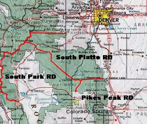
The Pike National Forest encompasses approximately 1.2 million acres spread across Park, Jefferson, Douglas, Teller, and El Paso Counties in central Colorado. Because of its close proximity to both Denver and Colorado Springs, the Pike National Forest is one of the busiest forests in the region, boasting an annual visitation average of nearly 2.5 million people. The South Platte Ranger District is responsible for 450,000 acres of the Pike National Forest, covering the entirety of southern Jefferson County, western Park County, and western Douglas County. The South Platte Ranger District is served by work centers located at the AG Ranch, Buffalo Creek, and Indian Creek. Two other Ranger Districts manage the forest, Pikes Peak to the south, covering the portions of the forest in Teller and El Paso Counties, and the South Park Ranger District, covering the remaining portions of the forest which ring Park County. The Pike National Forest is managed jointly with the San Isabel National Forest and the Cimarron and Comanche National Grasslands. Unlike the unified Arapahoe-Roosevelt, Pawnee radio system to the north, geographic disparities keep the operations of the PSICC radio systems separate, with each management unit operating their own net.
| Frequency | Tone | Description | Notes |
|---|---|---|---|
| 171.1375 | 110.9 PL | Pike Net | Forest-wide output and simplex frequency for Pike National Forest repeater net. Input tones determine selected repeater. |
| 163.7125 | 192.8 PL | Pike Work-1 | Intra-crew tactical for handheld use only. Federal itinerant freq, not exclusively assigned to Pike NF. |
| 168.6125 | Unknown | Pike Work-2 | Intra-crew tactical for handheld use only. Federal itinerant freq, not exclusively assigned to Pike NF. |
| 168.350 | CSQ | "GOV WORK" | Nationwide Federal Government Common/Itinerant. Used by Pike as an intra-crew/tactical. Not exclusively assigned to Pike NF. |
| 163.100 | CSQ | Nationwide Federal Government Common/Itinerant. Used by Pike as an intra-crew/tactical. Not exclusively assigned to Pike NF. | |
| 168.050 | CSQ | Pike TAC-1 | NIFC TAC-1 for initial attack use on wildfires. See NIRSC link below for more info. |
| 168.200 | CSQ | Pike TAC-2 | NIFC TAC-2 for initial attack use on wildfires. See NIRSC link below for more info. |
| 168.600 | CSQ | Pike TAC-3 | NIFC TAC-3 for initial attack use on wildfires. See NIRSC link below for more info. |
| 172.5125 | 110.9 PL | "Devil's Head LEO" | South Platte District Law Enforcement Repeater. Very informal use as a car-to-car/tac by Pike NF LEO's. |
| 168.025 | CSQ | "Law" Channel | USFS Nationwide LE Common/Simplex. Used sparingly for car-to-car comms by Pike NF LEO's, usually when traveling. |
Air Operations
| Frequency | Tone | Description | Notes |
|---|---|---|---|
| 168.650 | 110.9 PL | National Flight Following ("NTL FLTF") | Generally referred to by aircraft as "National." Previously called "Airnet." |
| 168.625 | 110.9 PL | "AIRGUARD" | National Air Emergency frequency |
| 167.225 | CSQ | CO07 A/G35 | CO Zone 07 Initial Attack Air-to-Ground Frequency 1 (Nat'l Air-Ground System Ch 35) |
| 166.9375 | CSQ | CO07 A/G10 | CO Zone 07 Initial Attack Air-to-Ground Frequency 2 (Nat'l Air-Ground System Ch 10) |
| 121.075 | AM | CO07 A/A 1 | CO Zone 07 Initial Attack Air-to-Air Frequency 1 (Authorized in 2020, may be expired) |
| 119.575 | AM | CO07 A/A 2 | CO Zone 07 Initial Attack Air-to-Air Frequency 2 (Authorized in 2020, may be expired) |
| 126.350 | AM | CO07 A/A 3 | CO Zone 07 Initial Attack Air-to-Air Frequency 3 (Authorized in 2020, may be expired) |
| 120.450 | AM | Jeffco Airtanker Base | New frequency assignment for 2021. |
US Forest Service - Pike National Forest (CO)
National Incident Radio Support Cache
Fort Collins Interagency Dispatch Center
Federal Dispatch Boundary Maps for Colorado
The Fort Collins Interagency Dispatch Center is responsible for providing dispatch and resource tracking for northeastern Colorado. Forests within the district's boundaries include the Arapaho and Roosevelt National Forests and the Pawnee National Grasslands. Fort Collins Dispatch (identified on-air as "Fort Collins"), is staffed from 0800-1800 daily. Forest service personnel and fire suppression crews/resources are generally available for dispatch from 0900-1730, however local variances may exist, and fire conditions can dictate a change in staffing levels and hours throughout the season. During the fire season (from roughly May to September), daily fire management briefings are usually broadcast over the radio between 1000 and 1030 in the mornings and afternoon fire weather forecast discussions are usually broadcast at either 1600 or 1630.
Arapaho National Forest
The Arapaho National Forest comprises 723,744 acres spread primarily across Clear Creek, Gilpin, Grand, and Summit Counties. A small portion of the forest, the Maxwell Falls Recreation Area, intrudes into Jefferson County just south of Evergreen. This portion of the forest is managed by the Clear Creek Ranger District, which operates primarily on the South Net of the combined Arapahoe-Roosevelt, Pawnee (ARP) radio network. This radio network is a product of the combined management of the Arapaho National Forest, the Roosevelt National Forest (in Boulder and Larimer Counties), and the Pawnee National Grasslands (in Weld County). Previously, the radio networks for these forests were divided into two separate systems: the Roosevelt Net (which also served Pawnee) and the Arapaho Net. In 2016, additional improvements to these networks resulted in their consolidation into a single network divided into three geographical areas: North, for Roosevelt and Pawnee operations, South, for Arapaho operations on the Clear Creek Ranger District, and West, for Arapaho operations on the Sulphur Ranger District.
| Frequency | Tone | Description | Notes |
|---|---|---|---|
| 169.975 | CSQ | ARP North Net | Output and simplex frequency for Roosevelt & Pawnee repeater net. Input tones determine selected repeater. |
| 170.475 | CSQ | ARP South Net | Output and simplex frequency for South Arapaho (Clear Creek Dist.) repeater net. Input tones determine selected repeater. |
| 170.550 | CSQ | ARP West Net | Output and simplex frequency for West Arapaho (Sulphur Dist.) repeater net. Input tones determine selected repeater. |
| 168.725 | CSQ | "ARP WORK" | Forest-wide simplex for intra-crew/tactical communications. Specifically assigned to ARP. PL 123.0 reported in use. |
| 163.7125 | CSQ | "WORK 1" | Intra-crew tactical for handheld use only. Federal itinerant freq, not exclusive to ARP. |
| 168.6125 | CSQ | "WORK 2" / TAC-3 | Intra-crew tactical for handheld use only. Used as TAC-3 for Type III incidents. Federal itinerant freq, not exclusive to ARP. |
| 166.5625 | CSQ | "FIRETAC" | Forest-wide Initial Attack Tactical. Specifically assigned to ARP. Old Roosevelt Work Net Channel. |
| 168.675 | CSQ | R-2 TAC-1 | USFS Region 2 Fire Tactical for Type III Incidents. |
| 168.775 | CSQ | R-2 TAC-2 | USFS Region 2 Fire Tactical for Type III Incidents. |
| 169.950 | CSQ | SOA Command Repeater ("SOA RPT") | "Scene-of-Action" temporary/portable command repeater for Type III Incidents in Region 2. |
Air Operations
| Frequency | Tone | Description | Notes |
|---|---|---|---|
| 168.650 | 110.9 PL | National Flight Following ("NTL FLTF") | Generally referred to by aircraft as "National." Previously called "Airnet." |
| 168.625 | 110.9 PL | "AIRGUARD" | National Air Emergency frequency |
| 166.9125 | CSQ | CO06 A/G09 | CO Zone 06 Initial Attack Air-to-Ground Frequency 1 (Nat'l Air-Ground System Ch 09) |
| 169.0875 | CSQ | CO06 A/G58 | CO Zone 06 Initial Attack Air-to-Ground Frequency 2 (Nat'l Air-Ground System Ch 58) |
| 126.025 | AM | CO06 A/A 1 | CO Zone 06 Initial Attack Air-to-Air Frequency 1 (Authorized in 2020, may be expired) |
| 124.375 | AM | CO06 A/A 2 | CO Zone 06 Initial Attack Air-to-Air Frequency 2 (Authorized in 2020, may be expired) |
| 133.750 | AM | CO06 A/A 3 | CO Zone 06 Initial Attack Air-to-Air Frequency 3 (Authorized in 2020, may be expired) |
US Forest Service - Arapaho National Forest (CO)
US Forest Service - Roosevelt National Forest (CO)
National Incident Radio Support Cache