|
|
| (248 intermediate revisions by 6 users not shown) |
| Line 1: |
Line 1: |
| − | == U.S. Forest Service, Pacific Southwest Region (R5) Radio Systems Information ==
| + | {{USFSinCA}} |
| | | | |
| − | '''CHARACTERISTICS OF THE REGION'''
| + | == U.S. Forest Service, Pacific Southwest Region (R5) Description and Radio Systems Information == |
| | | | |
| − | The Pacific Southwest Region covers most of California with the following exceptions: the California portions of the Humboldt-Toiyabe National Forest, on the Carson and Bridgeport Ranger Districts located in the Intermountain Region (R4) at the eastern boundary of California and two small portions of the Rogue River-Siskiyou National Forest in the Pacific Northwest Region (R6) at the northern boundary of California north of the Klamath River. It extends into Nevada in two places, first the Nevada portion of the Inyo National Forest north of Bishop and the eastern portion of the Lake Tahoe Basin on the Lake Tahoe Basin Management Unit west of Carson City and Reno Nevada. It also extends into Oregon in one location west of Interstate 5, southwest of Grants Pass, Oregon.
| + | ==='''DESCRIPTION OF THE REGION'''=== |
| | | | |
| − | The workload of Region 5 is heavy and complex. Its fire management program is well known, with approximately 50% of the U.S. Forest Service budget for fire management being spent in the region and the total budget for wildland fire management by all fire agencies in California is more than the rest of the United States combined. Southern California has the most wildland-urban interface land area of any locality in the U.S. and California has more wildland-urban interface than any other state. The interrelationship and juxtaposition of direct protection areas for the federal, state, county and municipal fire agencies is exceedingly complex in California, not because of land ownership alone, but because of the presence of some of the most volatile vegetation in the world. The climate is a huge factor and the lower elevation of California is characterized as a "Mediterranean Climate," with relatively mild winters and hot, dry and long summers with heavy chaparral, which includes drought resistant, evergreen bush species that contain oil like sap that is explosive. It is prone to "area ignition," where large areas of fuel ignite like a pool of gasoline, | + | The Pacific Southwest Region covers most of California with the following exceptions: the California portions of the Humboldt-Toiyabe National Forest, on the Carson and Bridgeport Ranger Districts located in the Intermountain Region (R4) at the eastern boundary of California and two small portions of the Rogue River-Siskiyou National Forest in the Pacific Northwest Region (R6) at the northern boundary of California north of the Klamath River. A portion of the Klamath National Forest (Region 5) extends into Oregon in one location west of Interstate 5, west of Ashland, Oregon. R5 extends into Nevada in two places, first the Nevada portion of the Inyo National Forest north of Bishop and the eastern portion of the Lake Tahoe Basin on the Lake Tahoe Basin Management Unit west of Carson City and Reno, Nevada. |
| | | | |
| − | California has the highest population for a state in the U.S., estimated to be 38 million people in 2014. More money is spent on tourism in California than any other state. Public land recreation use is very heavy, the most for any state in the western U.S. This results in the most human caused wildland fires for any state. The state has the most homes, over 3.8 million, in wildland-urban interface areas than any other state. From the standpoint of property damage the most destructive in U.S. history occurred in California in 1991, the Oakland Hills fire only burned 1,520 acres, but destroyed 3,354 single-family dwellings and 437 apartment and condominium units. There were 25 people killed and 150 injured. The economic loss has been estimated at $1.5 billion (2.5 billion in 2012 dollars). In terms of economic loss 7 of the top 10 fires in U.S. history have occurred in California. Unfortunately, 31% (330) of the wildland firefighter fatalities (1075) in modern U.S. history (1911 to present) have occurred in California, the most of any state. The state has the most human caused fires of any in the country, averaging close to 7,400 per year.There are 10 Geographical Area Coordination Centers (GACCs) in the U.S. and the workload in California is great enough that two of them exist, Operations Northern California and Operations Southern California.
| + | The Pacific Southwest Region of the US Forest Service manages 20 million acres of National Forest land in California and assists the State and Private forest landowners in California, Hawaii and the U.S. Affiliated Pacific Islands. Eighteen national forests are located in this region, in the North Coast, Cascade, and Sierra Nevada ranges and from Big Sur to the Mexican border in the south Coast range. |
| | | | |
| − | Fire management is not alone in the region's heavy workload., the many other resources and functions of the agency face heavy pressure as well. California is the nation's most populous state and tourism spending is highest of any state. Recreation on National Forest lands is heavy, between 20-25% of the recreation use for the U.S. Forest Service nationwide. This volume of visitor use necessitates a large law enforcement program, with more Forest Service law enforcement officers per National Forest than any region. In addition to fire management, recreation and law enforcement all National Forests also manage timber, grazing, watershed (protection and use), wildlife (includes fisheries), soils, roads and trails, facilities (ranger stations, fire stations, lookouts and communication sites), minerals (exploration and extraction) as well as land use (exchanges, purchases and special uses). These vary by National Forest due to differences in location, topography, vegetation, precipitation, proximity to urban areas, etc. In California management of watersheds, roads and trails, facilities, minerals and land use management have the highest or close to the highest workload of any Forest Service region.
| |
| | | | |
| − | Surface water run-off in California averages 71 million acre-feet per year. Annual water use is about 37 million acre-feet, of which 80 percent is used to irrigate crops. National forests supply 50 percent of the water in California and form the watershed of most major aqueducts and more than 2,400 reservoirs throughout the state. Managing watershed to insure high quality water is a major focus of the U.S. Forest Service and saves billions of dollars in potential construction and maintenance costs for water treatment plants.
| + | [[File:R5_National_Forest_Map.JPG]] |
| | | | |
| − | '''RADIO SYSTEMS'''
| |
| | | | |
| − | This complexity, size and pressure on all the management functions on the National Forests in Region 5 have resulted in the most complex radio systems in the agency. Region 5 uses the most radio frequencies of any Forest Service region. Each National Forest has a "forest net" and an "administrative net," both utilizing repeaters. The forest net is usually the main communication channel for a National Forest, although on some forests fire and law enforcement are on forest net and all other functions use the admin net. Some forests have a separate "fire net." Most forests have a "service net," which is used for communications between the incident command post and forest dispatcher with most of that being logistical in nature. Cell phones have replaced this net where coverage is available, but service net is still used in cell phone dead zones. The service nets are also available as a command for initial attack for large incidents or for portions of National Forests during multiple fire starts on a forest. Two National Forests, the Klamath and Shasta-Trinity, have management unit or ranger district nets. Some forests link repeaters and remote bases with UHF radio (406-420 MHz) only, microwave only and some use a combination of both. Region 5, like most regions, has a dedicated project net (168.6625 MHz), which is one simplex channel for the entire region. This frequency can be used for both fire and non-fire day to day uses. The region is also building a state wide Forest Service law enforcement repeater network as well, that at this time will be a single frequency pair. Some forests already have multiple repeaters on this net and more will be built to provide nearly the same coverage that the forest and admin nets provide now. The buildout of this system could take decades given the budget climate of the federal government.
| |
| | | | |
| − | '''FREQUENCY USE''' | + | ====''Fire Management''==== |
| | | | |
| − | The region also has three unique tactical frequencies. These have been used as supplements on extended attack and large, national, incidents for over 25 years and NIFC Tacs 1-3, especially Tac 2 have been used for initial attack for as long they have existed. The federal wildland fire and land management agencies (National Park Service, U.S. Forest Service, Bureau of Land Management and the U.S. Fish and Wildlife Service) are beginning to phase out the use of the NIFC tacticals for initial attack. The BLM and U.S. Forest Service are getting frequency allocations so that each Forest Service region and each BLM State Office have a least three unique tactical frequencies separate from the 6 NIFC tacticals. The future use of the NIFC frequencies will be reserved for use on "National Fires." only. These are fires where a National Type I or Type II incident management team is in command. Less complex and smaller incidents are managed by Type III, IV, and V command organizations and use locally available communications systems. Type III teams can request use of NIFC frequencies and equipment if needed. In Region 5 the complexity and number of simultaneously occurring large incidents in proximity to each other creates a high potential of interference on tactical frequencies. The 6 NIFC and 3 regional tacticals are sometimes insufficient to provide clear and effective communications for all incidents. Unlike other regions that now have regional tactical frequencies the predominate use of R5's tacticals has been to supplement the NIFC system on large incidents. Although a few forests have been using them as additional tacticals in the last 5-10 years, the demand for these continues to be for large "national incidents." At some point in the future additional tactical frequency assignments may be in the picture for R5. | + | The workload of Region 5 is heavy and complex. Its fire management program is well known, with approximately 50% of the U.S. Forest Service budget for fire management being spent in the region. The total budget for wildland fire management by all fire agencies in California is more than the rest of the United States combined. Southern California has the most wildland-urban interface land area of any locality in the U.S. and California has more wildland-urban interface than any other state. The interrelationship and juxtaposition of direct protection areas for the federal, state, county and municipal fire agencies is exceedingly complex in California, not because of land ownership patterns alone, but because of the presence of some of the most volatile vegetation in the world. National Forests contain 6 million of the total 9 million acres of highly volatile brushland in California. It is found mainly in the foothill country where urban expansion is increasing and many developments lack adequate protection against wildfire. Large areas of the state are covered with heavy chaparral, which includes drought resistant, evergreen bush species that contain an oil like sap that is explosive. It is prone to "area ignition," where large areas of fuel ignite like a pool of gasoline. The climate is a huge factor and the lower elevations of California are characterized as a "Mediterranean Climate," with relatively mild winters with hot, dry and long summers. |
| | | | |
| − | NIFC has a goal to provide 2 air to ground frequencies for each of the 105 interagency dispatch centers in the country and in the west has met this goal everywhere except California.. California has been assigned 7 air to ground frequencies to provide 2 for each of 4 zones configured from north to south. These frequencies are for use by all of the federal land management agencies in those zones. These 7 frequencies have been assigned from the list of 73 national air to ground frequencies. All other Geographical Area Coordination Centers use the 5 original air to air FM tactics. In California each National Forest has been assigned 2 unique air tactics frequencies. It is not confirmed, but it is believed that these frequencies can be used by the National Park Service, Bureau of Land Management and U.S. Fish and Wildlife Service as well.
| + | Forest conditions, especially in southern California and the Sierra Nevada, are of particular concern in Region 5. Dense and overgrown areas combined with the influx of people into California’s wildlands have created the potential for disastrous wildfires. Emphasis is being placed on actively managing forests by reducing dangerous accumulations of hazardous fuels to protect people, watersheds, and habitat |
| | | | |
| − | Intra-crew communications in the Pacific Southwest Region take place on the region's project net or on one of the 4 frequencies on the National Intra-crew Communications Plan. The Primary, Secondary and Tertiary crew net frequencies are restricted to incident scenes and National Crew net can be used on the crews home unit. Intra-crew communications must be logistical and not tactical in nature. The 6 NIFC and 3 regional tactical frequencies may not be used for intra-crew communications.
| + | California is the most populous U.S state, estimated to be 38 million people in 2014. More money is spent on tourism in California than any other state. Public land recreation use is very heavy, the most for any state in the western U.S. The state has the most human caused fires of any in the country, averaging close to 7,400 per year. The state has the most homes, over 3.8 million, in wildland-urban interface areas than any other state. From the standpoint of property damage the most destructive fire in U.S. history occurred in California in 1991. The Oakland Hills fire only burned 1,520 acres, but destroyed 3,354 single-family dwellings and 437 apartment and condominium buildings. Casualties included 25 fatalities and 150 injuries. The economic loss has been estimated at $1.5 billion (2.5 billion in 2012 dollars). In terms of economic loss, 7 of the top 10 fires in U.S. history have occurred in California. Unfortunately, 31% (330) of the wildland firefighter fatalities (1075) in modern U.S. history (1911 to present) have occurred in California, the most of any state. There are 10 Geographical Area Coordination Centers (GACCs) in the U.S. and the workload in California is great enough that two of them exist in the state, Operations Northern California and Operations Southern California. |
| | | | |
| − | '''RADIO OPERATION''' | + | ====''Recreation''==== |
| | | | |
| − | The brand of handheld radio used by the U.S. Forest Service (and most wildland fire agencies as well) is Bendix King. These model of BK radios most commonly used have a capacity of 16 groups of 16 channels each. "Command" models with greater capacity are available as well. These radios allow the users to select a CTCSS tone independently for each channel by selecting a number on the radio's keypad. In Region 5, for the purposes of brevity and efficient use of repeater nets the name of the repeater is not voiced, rather the CTCSS tone number is announced (e.g., "Tone 9" instead of "Pine Mountain"). Cal Fire uses the same procedure. Other federal agencies in the state and other areas of the country use the name of the repeater in most cases, although the announcement of the tone only is beginning to catch on in other areas. | + | Fire management is not alone in the region's heavy workload. The other functions of the agency face heavy pressure as well. California is the nation's most populous state and outdoor, public land based, recreation is heavy. Of the Forest Service's 9 regions, 25% of the recreation on National Forest land in the U.S. occurs in R5. National Forests are the home to about half of the public wildland recreation in the state. National Parks and other federal, state, county and private lands provide the remainder. This volume of visitor use necessitates a large law enforcement program, with more Forest Service law enforcement officers per National Forest than any region. In addition to fire management, recreation and law enforcement, National Forests manage timber, grazing, watershed (protection and use), wildlife (includes fisheries), soils, roads and trails, facilities (ranger stations, fire stations, lookouts and communication sites), minerals (exploration and extraction) as well as land use (exchanges, purchases and special uses). The workload and complexity of managing these varies by National Forest due to differences in location, topography, vegetation, precipitation, proximity to urban areas, etc. In California management of watersheds, roads and trails, facilities and land use management have the highest or close to the highest workload of any Forest Service region. |
| | | | |
| − | '''UNIT IDENTIFIERS (aka "Call Signs")''' | + | ====''Watershed''==== |
| | | | |
| − | Unit identifiers in R5 use two systems, ''the function name, district number, position number.'' system (e.g "Recreation 21" and "Wildlife 32"); and the district number, ''function number and position number'' - system (e.g. "261" and "631"). Function numbers vary from forest to forest. A directive was issued for all forest to use the first system, but some forests did not follow this and are using the second. Fire management on all National Forests use the first with Chief, Division, Battalion, Superintendent, Captain, Engineer, Fuels, Engine, Patrol, Water Tender (large water trucks) Prevention, Dozer, Crew, Boat (patrol boat, Lead (plane - 5 plus pilot number), Air Attack (plus National Forest number), Recon (air patrol plane - each forest issued a series of numbers), Tanker (aircraft dumps retardant), Jumper (5 plus number assigned to aircraft) and Helicopter (500 series numbered north to south). Dispatch centers identify by the National Forest name (e.g. "Plumas") when the center is not co-located with Cal Fire, with the exception of the Sierra National Forest. Those co-located with Cal Fire identify with the city the center is located in (e.g. "Redding"). Call signs are the FCC license format (even though the federal government is not issued licenses by the FCC, example "KMB670" for the Inyo National Forest communications center.
| + | Watershed management on National Forest land is extraordinarily important to the economy of the state and to food supply in the U.S. and abroad. California produces more than 400 crops. Of those, the following are commercially produced only in California: almonds, artichokes, dates, figs, raisins, kiwifruit, olives, clingstone peaches, pistachios, dried plums, pomegranates, sweet rice, ladino clover seed, and walnuts. California grows nearly half of the nation’s fruits, vegetables and nuts. California is the nation’s top agricultural state and has been for more than 50 years. Agriculture |
| | + | generates approximately $37.5 billion a year, more than any other state. Surface water run-off in California averages 71 million acre-feet per year. Annual water use is about 37 million acre-feet, of which 80 percent is used to irrigate crops. National forests supply 50 percent of the water in California, include the watersheds of most major aqueducts and more than 2,400 of the reservoirs throughout the state. Managing watershed to insure high quality water is a major focus of the U.S. Forest Service and saves billions of dollars in potential construction and maintenance costs for water treatment plants. Contributing half of the water for agricultural production in California is a major benefit of watershed management on National Forest land. |
| | | | |
| − | '''RADIO PROCEDURES''' | + | ====''Other Resource Management Programs''==== |
| | | | |
| − | All functions use "clear text" and not the 10 codes ("10-4") except law enforcement officers who use the ten code, eleven code and the California Penal and Vehicle codes. This allows them to interface with state/local officers.
| + | Special Uses: the large population and National Forests in proximity of urban areas creates a heavy demand for a variety of uses of these federal lands. These are the uses that don't fit into the major uses of National Forest land, those being timber, range, watershed, recreation and wildlife. Often these diverse needs require specific approval. Special uses are diverse and are too numerous to list here. Examples are water storage, water transmission, powerlines, outfitting and guiding, recreation; special events such as foot and bicycle races, large gatherings of people such as weddings, social gatherings or reunions, religious groups, or large youth encampments, such as Boy and Girl Scouts; organizational camps, ski areas, telecommunications (including electronic sites), research including permanent facilities such as the Barcroft Lab in the White Mountains on the Inyo National Forest, photography, video productions, the filming of major movies, gathering forest products such as mistletoe and pine cones (large quantities not for personal use) and granting road and utility rights-of-ways. |
| | | | |
| − | U.S. Forest Service voice procedure is to speak the unit being called first, followed by the unit that is calling. the net name or channel is then given and finally the repeater tone being used if applicable. The unit called will then answer the call with its identifier only. When the conversation ends each unit signs off with their unit identifier. Example: "Wildlife 2. Recreation 21 (usually abbreviated as "Rec 21), North, Tone 3," "Wildlife 2" "be advised I heard a spotted owl call near Inyo Craters last night" "Copy, I will send Wildlife 23 and 24 there tonight," "Copy, Rec 21," "Thanks Wildlife 2." The channel is not considered clear for someone else to use until both units clear by announcing their unit identifier. Dispatcher centers will announce the time and use the assigned call sign to clear, example "1536, KMB660."
| + | Lands & Real Estate: with the high demand for recreation, existence of some special areas in private ownership within National Forest boundaries and other resources on National Forest land, the region has a very active lands & real estate program. This program is tasked with the following: purchasing land to protect critical resource areas and provide increased public recreation opportunities, exchanging and conveying lands to achieve a desired national forest landownership pattern that supports forest land and resource goals and objectives, conveying administrative sites to allow the agency to realign and enhance its asset portfolio, surveying national forest boundaries to identify and protect private and public lands, determining the market value of lands purchased, exchanged, or conveyed, accepting donations of land to protect archeological or historical sites; maintaining records of national forest land areas, land transactions, land status, permitted uses, and easements; and securing public road and trail access to existing national forest system lands. |
| | | | |
| − | This background information should allow the reader to understand the systems of each National Forest as listed below.
| + | Wildlife & Plants: more than 600 of the 800 species of fish and wildlife in California inhabit the national forests, making the Forest Service the single largest habitat manager in the state. National forests are also home to nearly 4,000 of the 6,500 native plants in California. National Forest land comprises the bulk of wildlife habitat in many states, especially for large mammals and threatened and endangered species. A high population has led to the loss of habitat in much of the state, putting additional pressure on the habitat of public land. The California Department of Fish and Wildlife has jurisdiction of the animal and the hunting or fishing of it. The U.S. Forest Service has jurisdiction of the habitat or homes of the animal. This requires close cooperation between these agencies. |
| | | | |
| − | == '''Angeles National Forest (ANF - Forest #01) KME 2-2''' ==
| + | Range: the United States has about 770 million acres of rangelands. Private individuals own more than half of the Nation's rangelands. The federal government manages 43 percent of the rangelands. State and local governments manage the remainder. The Forest Service administers approximately 193 million acres of National Forest Systems lands. About half of this acreage, 96 million acres, is rangelands. The Forest Service has undergone many changes in its management of rangelands. In the early 1800s, free forage on unclaimed public domain lands allowed the building of cattle and sheep empires. The ranges soon became over-grazed, overstocked, and overcrowded. Congress stepped in the early 1900s and designated the Forest Service as the pioneer grazing control agency. By 1906 to 1907, the Forest Service had established its system of range regulation. This includes permits, limits on herd size, grazing seasons, allotments, and rental fees. Heavy recreation use results in conflicts between grazing permittees and visitors, an issue that is not as prominent in other regions. |
| | | | |
| | + | Forest (AKA vegetation or timber) Management: the overriding objective of the Forest Service's forest management program is to ensure that the National Forests are managed in an ecologically sustainable manner. The National Forests were originally envisioned as working forests with multiple objectives: to improve and protect the forest, to secure favorable watershed conditions, and to furnish a continuous supply of timber for the use of citizens of the United States. Forest management objectives have since expanded and evolved to include ecological restoration and protection, research and product development, fire hazard reduction, and the maintenance of healthy forests. Guided by law, regulation, and agency policy, Forest Service forest managers use timber sales, as well as other vegetation management techniques such as prescribed fire, to achieve these objectives. These activities have captured substantial public attention, and in some cases, become hotly debated issues. There is a great deal of pressure on this management function as recreation, wildlife, open space and scenic resources are especially valuable in California. |
| | | | |
| − | The Angeles National Forest is located in the San Gabriel Mountains of Los Angeles County, southern California, United States. It was established on July 1, 1908, incorporating the portions of San Bernardino National Forest and parts of the former Santa Barbara and San Gabriel National Forests. It covers 655,387 acres and is located just north of the densely inhabited metropolitan area of Los Angeles.
| + | ==='''RADIO SYSTEMS'''=== |
| | | | |
| − | The Angeles National Forest manages the habitats, flora and fauna ecosystems, and watersheds of the largest open space in Los Angeles County. Some of the rivers with watersheds within its boundaries provide valuable non-groundwater recharge water for Southern California. The existing protected and restored native vegetation absorb and slow surface runoff of rainwater to minimize severe floods and landslides in adjacent communities. The land within the Forest is diverse, both in appearance and terrain. Elevations range from 1,200 to 10,064 feet. Many people do not realize the ruggedness of the San Gabriel Mountains and its dangers due to its proximity to the huge southern California metro area. The residents of Los Angeles County are located within a two hour drive of the forest and the 16 million residents of the five county southern California metro area are within a half day drive of the Angeles. This is an extraordinarily difficult forest to manage. It is divided into the Los Angeles River (District 1), the San Gabriel River (District 2), and the Santa Clara/Mojave Rivers (District 3) Ranger District, with the Forest Supervisor's Office in Arcadia. | + | This complexity, size and pressure on all the management functions on the National Forests in Region 5 have resulted in complex radio systems. Each National Forest has a "forest net" and an "administrative net," both utilizing repeaters. The forest net is usually the main communication channel for a National Forest, although on some forests fire and law enforcement use forest net and all other functions use the admin net. Some forests have a separate "fire net." Most forests have a "service net," which is used for communications between the incident command post and forest dispatcher with most of that being logistical in nature. Cell phones have replaced this net where coverage is available, but service net is still used in cell phone dead zones. The service nets are also available as a command for initial attack of large incidents or for portions of National Forests during multiple fire starts on a forest. Two National Forests, the Klamath and Shasta-Trinity, have management unit or ranger district nets. Some forests link repeaters and remote bases with UHF radio (406-420 MHz) only or microwave only and some use a combination of both. Region 5, like most regions, has a dedicated project net (168.6625 MHz), which is one simplex channel for the entire region. This frequency can be used for both fire and non-fire day to day uses. |
| | | | |
| − | === RADIO SYSTEM ===
| + | The region is gradually building a statewide law enforcement net with all repeaters using the same frequency. Many repeaters are to be shifted to digital use only in 2022-2023. The eventual buildout will include digital operation with full time encryption. The Region is considering building a 24 hour, statewide coverage area, full time law enforcement dispatch center with all repeaters connected to this center. This would relieve the local dispatch centers of all law enforcement dispatching and would comply with the California Dept. of Justice mandate to remove all radio traffic with Personal Identifying Information (PII) from public access via scanners. Many forests lack even one law enforcement net repeater, some have several, but no forest has as much law enforcement net coverage as forest and admin nets. Due to dismal budget forecasts this network will continue to grow very slowly. Details about this net are not discussed anywhere on these U.S. Forest Service Region 5 wiki pages. |
| | | | |
| − | Most radios on the forest have 9 frequencies in common: ANF Channels 1 and 2 (Forest Net), ANF Channels 3 and 4 (Admin Net), two National Air to Ground frequencies and NIFC tactical channels 1 through 3. Each ranger district, and crews within each ranger district, may have different channel lineups, but they will usually have these nine in common. The variations between ranger districts and crews involve frequencies belonging to other agencies such as Los Angeles County Fire, San Bernardino County Fire, Cal Fire, and the Bureau of Land Management, as well as frequencies of adjacent National Forests. The agencies and areas that each ranger district interact with for mutual aid are different for each district.
| + | ==='''FREQUENCY USE'''=== |
| | | | |
| − | ANF Channels 1 and 2 are called "Forest Net" and are used primarily for fire and emergency traffic. ANF Channels 3 and 4 are called "Admin Net." Channels 1 and 3 are simplex frequencies and channels 2 and 4 are repeated.
| + | The region has been assigned 3 unique tactical frequencies. These have been used as supplements on extended attack and large, national incidents since they were assigned to the region and NIFC Tacs 1-3, especially Tac 2, have been used for initial attack for as long they have existed. The federal wildland fire and land management agencies (National Park Service, U.S. Forest Service, Bureau of Land Management and the U.S. Fish and Wildlife Service) are beginning to phase out the use of the NIFC tacticals for initial attack. Region 5 does not appear to have started this effort yet. The BLM and U.S. Forest Service are getting frequency allocations so that each Forest Service region and each BLM State Office have a least three unique tactical frequencies in addition to the 6 NIFC tacticals. The future use of the NIFC frequencies will be reserved for use on "National Fires" only. These are fires where a national Type I or Type II incident management team is in command. Less complex and smaller incidents are managed by Type III, IV, and V command organizations and use locally available communications systems. Type III teams can request use of NIFC frequencies and equipment if needed. In Region 5 the complexity and number of simultaneously occurring large incidents in proximity to each other creates a high potential of interference on tactical frequencies. The 6 NIFC and 3 regional tacticals are sometimes insufficient to provide clear and effective communications for all incidents. Unlike other regions that now have regional tactical frequencies, the predominate use of R5's tacticals has been to supplement the NIFC system on large incidents. With the advent of high channel capacity radios in the last 10-15 years a few forests now use them as additional tacticals, but the demand for these continues to be for large "national incidents." At some point in the future additional tactical frequency assignments may be in the picture for R5. |
| | | | |
| − | When users transmit on channels 1 and 3 using tone 8 (103.5 Hz) their transmission can be received by dispatch on the forest's 9 microwave linked remote bases. These remote bases are linked to dispatch located at Fox Field near Lancaster and the Forest Supervisor's Office in Arcadia. Most of these remote bases are co-located with repeaters and some are not. When someone communicates to dispatch on these channels it is not picked up by a repeater and receiving them requires being close enough to receive simplex traffic. On the other hand, if users transmit on channels 2 and 4 , the tone in use must match a repeater within range or their transmission will not be heard.
| + | NIFC has a goal to provide 2 air to ground frequencies for each of the 105 interagency dispatch centers in the country and in the west has met this goal everywhere except California. California has been assigned 7 air to ground frequencies to provide 2 for each of 4 zones configured from north to south. Each of these zones contain several federal interagency dispatch centers. These frequencies are for use by all of the federal land management agencies in those zones. These 7 frequencies have been assigned from the list of 73 national air to ground frequencies. |
| | | | |
| − | The 9 remote bases are located at: Fox Field (dispatch office), Arcadia (Forest Supervisor's Office), Frazier Peak, Warm Springs, Magic Mountain, Mt. Lukens, Blue Ridge, Johnstone Peak and Santiago Peak. Those remote bases that are not co-located with a repeater are: Fox Field, Arcadia, Warm Springs and Blue Ridge.
| + | For air to air tactics Region 5 is the only region using FM frequencies in the two GACC's covering the state. All other Geographical Area Coordination Centers use VHF-AM "Victor" frequencies for this function. In California each National Forest has been assigned 2 unique air-air FM tactics frequencies. These frequencies can be used by the National Park Service, Bureau of Land Management and U.S. Fish and Wildlife Service as well. |
| | | | |
| | + | Intra-crew communications in the Pacific Southwest Region take place on the region's project net or on one of the 4 frequencies on the National Intra-crew Communications Plan. The Primary, Secondary and Tertiary crew net frequencies are restricted to use at incident scenes and National Crew net can be used on the crews home unit and while traveling. Intra-crew communications must be logistical and not tactical in nature. The 6 NIFC and 3 regional tactical frequencies may not be used for intra-crew communications. The State of California's Emergency Service Radio System (CESRS) frequency of 153.7550 (simplex) has been designated as the travel net. |
| | | | |
| − | '''Repeaters''' | + | ==='''STANDARD TONES'''=== |
| | | | |
| − | The Angeles National Forest (ANF) radio system is comprised of 13 repeater sites situated on various mountain peaks in and around the forest which are linked to the dispatch center at Fox Field near Lancaster. Each repeater site functions as both a repeater and as a receiving antenna for dispatch. | + | The Region uses standard tones shared among all natural resource agencies in the state. This interagency effort resulted in all tone selection switches on all radios having the same number and frequency statewide. This is but one example of the efforts to standardize as much as possible through the FIRESCOPE (FIre RESources in California Organized for Potential Emergencies) program. These 16 tones has been accepted by the National Interagency Fire Center for nationwide use. Gradually all the federal agencies and some states, especially in the west, are adopting these as standards. In that way everybody's tone 1 will be 110.9 (analog) and 455 (digital), everyone's tone 9 is 100.0 (analog) and 3E8 (digital) and so on. Disparate tones between agencies was cited as one issue of many in the Granite Mountain Hotshot burn over that resulted in 19 fatalities. |
| | | | |
| − | The input or repeater selection tone is not transmitted on the repeater output frequency, rather all repeaters transmit Tone 8 (103.5) on the output.
| + | CTCSS NAC |
| | + | 1 110.9 455 |
| | + | 2 123.0 4CE |
| | + | 3 131.8 526 |
| | + | 4 136.5 555 |
| | + | 5 146.2 5B6 |
| | + | 6 156.7 61F |
| | + | 7 167.9 68F |
| | + | 8 103.5 40B |
| | + | 9 100.0 3E8 |
| | + | 10 107.2 430 |
| | + | 11 114.8 47C |
| | + | 12 127.3 4F9 |
| | + | 13 141.3 585 |
| | + | 14 151.4 5EA |
| | + | 15 162.2 656 |
| | + | 16 192.8 788 |
| | | | |
| − | '''Other'''
| |
| | | | |
| − | The unit identifiers follow the function name, district, and position number system. The Angeles Interagency Dispatch Center provides dispatching for the National Park Service - Santa Monica Mountains National Recreation Area. It is a 24 hour operation. Its identifier is "Angeles."
| + | ==='''RADIO OPERATION'''=== |
| | | | |
| | + | The brand of handheld radio used the most by the U.S. Forest Service (and most wildland fire agencies as well) is Bendix King. The model of BK radios most commonly used have a capacity of 16 groups of 16 channels each. "Command" models with greater capacity are available as well. These radios allow the user to select a CTCSS tone independently for each channel by selecting a number on the radio's keypad. In Region 5, for the purposes of brevity and efficient use of repeater nets the name of the repeater is not voiced, rather the CTCSS tone number is announced (e.g., "Tone 9" instead of "Pine Mountain"). Cal Fire uses the same procedure. Other federal agencies in the state and other areas of the country use the name of the repeater in most cases, although the announcement of the tone only is beginning to catch on in other areas. |
| | | | |
| − | '''Channel Plan''' | + | ==='''UNIT IDENTIFIERS (aka "Call Signs")'''=== |
| | | | |
| − | {| border="4" cellpadding="4" cellspacing="0" style="margin: 1em 1em 1em 0; background: #f9f9f9; border: 2px #777777 solid; border-collapse: collapse;" class="wikitable sortable"
| + | Unit identifiers in R5 use two systems, the''' function name''', district number, position number, system (e.g "Recreation 21" and "Wildlife 32"); and the district number, '''function number''' and position number - system (e.g. "261" and "631"). Function numbers vary from forest to forest. A directive was issued for all forests to use the first system, but some forests did not follow this direction and are using the second system. Fire management on all National Forests use the first system with Chief, Division, Battalion, Superintendent, Captain, Engineer, Fuels, Engine, Patrol, Water Tender (large water trucks) Prevention, Dozer, Crew, Boat (patrol boat), Lead (plane - 5 plus pilot number), Air Attack (plus National Forest number), Recon (air patrol plane - each forest issued a series of numbers), Tanker (aircraft that dump retardant), Jumper (5 plus number assigned to aircraft) and Helicopter (500 series numbered north to south). Dispatch centers identify by the National Forest name (e.g. "Plumas") when the center is not co-located with Cal Fire, with the exception of the Sierra National Forest. Those co-located with Cal Fire identify with the city the center is located in (e.g. "Redding"). Call signs are the FCC license format (even though the federal government is not issued licenses by the FCC), example: "KMB670" for the Inyo National Forest communications center. |
| − | |+ style="font-size: larger" | '''Angeles National Forest Channel Lineup'''
| |
| − | |'''Channel '''||'''Tone(s) '''||'''Rx '''||'''Tx '''||'''Alpha Tag '''||'''Description '''
| |
| − | |-
| |
| − | |1||8||172.3750||172.3750||ANF 1 Frst Dir||Forest Net Direct
| |
| − | |-
| |
| − | |2||1-14||172.3750||169.9500||ANF 2 Frst Rpt||Forest Net Repeat
| |
| − | |-
| |
| − | |3||8||164.9375||164.9375||ANF 3 Adm Dir||Admin Direct
| |
| − | |-
| |
| − | |4||1-14||164.9375||170.0750||ANF 4 Adm Rpt||Admin Repeat
| |
| − | |-
| |
| − | |5||||169.1125||169.1125||ANF 5 A/G 59||Southern California Primary Air to Ground National AG 59
| |
| − | |-
| |
| − | |6||||168.4875||168.4875||ANF 6 A/G 53||Southern California Secondary Air to Ground National AG 53
| |
| − | |-
| |
| − | |7||||168.0500||168.0500||ANF 7 N Tac 1||NIFC Tac 1
| |
| − | |-
| |
| − | |8||||168.2000||168.2000||ANF 8 N Tac 2||NIFC Tac 2
| |
| − | |-
| |
| − | |9||||168.6000||168.6000||ANF 9 N Tac 3||NIFC Tac 3
| |
| − | |-
| |
| − | |}
| |
| | | | |
| | + | ==='''RADIO PROCEDURES'''=== |
| | | | |
| − | '''Tones'''
| + | All functions use "clear text" and not the 10 codes ("10-4") except law enforcement officers who use the ten code, eleven code and the California Penal and Vehicle codes. This allows them to interface with state/local officers. |
| | | | |
| − | {| border="4" cellpadding="4" cellspacing="0" style="margin: 1em 1em 1em 0; background: #f9f9f9; border: 2px #777777 solid; border-collapse: collapse; float;"
| + | U.S. Forest Service voice procedure is to pronounce the unit being called first, followed by the unit that is calling. The net name or channel is then given and finally the repeater tone being used if applicable. The unit called will then answer the call with its identifier only. When the conversation ends each unit signs off with their unit identifier. Example: '''"Wildlife 2, Recreation 21''' (usually abbreviated as Rec 21), '''North, Tone 3"''' - ''"Wildlife 2"'' - '''"be advised I heard a spotted owl call near Inyo Craters last night"''' -'' "Copy, I will send Wildlife 23 and 24 there tonight"'' - '''"Rec 21"''', ''"Wildlife 2."'' The channel is not considered clear for someone else to use until both units clear by announcing their unit identifier. Dispatcher centers will announce the time and use the assigned call sign to clear, example "1536, KMB 6-6-0." |
| − | |+ style="font-size: larger; font-weight: bold;" |ANF Repeaters
| |
| − | !Tone
| |
| − | !Location
| |
| − | !CTCSS Tone
| |
| − | |-
| |
| − | |1
| |
| − | |Mt. Waterman
| |
| − | |110.9
| |
| − | |-
| |
| − | |2
| |
| − | |Santiago Peak
| |
| − | |123.0
| |
| − | |-
| |
| − | |3
| |
| − | |Mt. Hawkins
| |
| − | |131.8
| |
| − | |-
| |
| − | |4
| |
| − | |Frost Peak
| |
| − | |136.5
| |
| − | |-
| |
| − | |5
| |
| − | |Not Assigned
| |
| − | |146.2
| |
| − | |-
| |
| − | |6
| |
| − | |Oat Mountain
| |
| − | |156.7
| |
| − | |-
| |
| − | |7
| |
| − | |Josephine Peak
| |
| − | |167.9
| |
| − | |-
| |
| − | |8
| |
| − | |Frazier Mountain
| |
| − | |103.5
| |
| − | |-
| |
| − | |9
| |
| − | |Pine Mountain
| |
| − | |100.0
| |
| − | |-
| |
| − | |10
| |
| − | |Burnt Peak
| |
| − | |107.2
| |
| − | |-
| |
| − | |11
| |
| − | |Magic Mountain
| |
| − | |114.8
| |
| − | |-
| |
| − | |12
| |
| − | |Mt. Lukens
| |
| − | |127.3
| |
| − | |-
| |
| − | |13
| |
| − | |Johnstone Peak
| |
| − | |141.3
| |
| − | |-
| |
| − | |14
| |
| − | |Grass Mountain
| |
| − | |151.4
| |
| − | |}
| |
| − | | |
| − | == '''Cleveland National Forest (CNF - Forest #02) KME 2-3''' ==
| |
| − | | |
| − | | |
| − | The Cleveland National Forest is the southern-most National Forest in California. Consisting of 460,000 acres, the forest offers a wide variety of terrains and recreational opportunities. On July 1st, 1908 President Theodore Roosevelt signed a declaration that created this National Forest. Now, more than 100 years later, the Cleveland National Forest provides habitat for native wildlife, as well as a natural refuge and playground for many of the 3 million plus residents in the greater San Diego area. This forest consists of mostly of chaparral, with a few riparian areas. A warm dry Mediterranean climate prevails over the Forest. A major issue on the forest is illegal immigration in the form of abandoned campfires, trash and user built trails. The forest is divided into the Descanso (District 2), Palomar (District 3) and Trabuco (District 4) Ranger Districts with the Forest Supervisor's Office in San Diego.
| |
| − | | |
| − | | |
| − | '''RADIO SYSTEM'''
| |
| − | | |
| − | '''Repeaters'''
| |
| − | | |
| − | The input or repeater selection tone is not transmitted on the repeater output frequency, rather all repeaters transmit Tone 8 (103.5) on the output. The forest does not have direct or simplex channels for its 3 repeater nets.
| |
| − | | |
| − | '''Other'''
| |
| − | | |
| − | The unit identifiers follow the function name, district, position number system. Employees assigned to the Forest Supervisor's Office have identifiers beginning with the number 1. The Cleveland National Forest Emergency Communications Center (ECC) is co-located with Cal Fire's Monte Vista Interagency Communications Center (MVICC). The ECC also dispatches for the San Diego National Wildlife Refuge Complex, the Sonny Bono Salton Sea National Wildlife Refuge and the Sycuan Indian Reservation. It is a 24 hour operation. The ECC's call sign is "Monte Vista." | |
| − | | |
| − | '''Channel Plan'''
| |
| − | | |
| − | {| border="4" cellpadding="4" cellspacing="0" style="margin: 1em 1em 1em 0; background: #f9f9f9; border: 2px #777777 solid; border-collapse: collapse;" class="wikitable sortable"
| |
| − | |+ style="font-size: larger" | '''Cleveland National Forest Channel Lineup'''
| |
| − | |'''Channel '''||'''Tone(s) '''||'''Rx '''||'''Tx '''||'''Alpha Tag '''||'''Description '''
| |
| − | |-
| |
| − | |1||1-12||168.7500||171.4250||CNF 1 Forest||Forest Repeater Net
| |
| − | |-
| |
| − | |2||All excp. 1,6,8||168.1500||169.7250||CNF 2 Admin||Admin Repeater Net
| |
| − | |-
| |
| − | |3||2,5,10||164.1250||164.8250||CNF 3 Service||USFS Southern CA Service Repeater Net
| |
| − | |-
| |
| − | |4||||168.6625||168.6625||CNF 4 Prjct||Region 5 Project Net (Note: R5 2014 listing did not show a channel 4, this channel is assumed from past years)
| |
| − | |-
| |
| − | |5||||168.2000||168.2000||CNF 5 NIFC T2||NIFC Tac 2
| |
| − | |-
| |
| − | |6||||166.5500||166.5500||CNF 6 R5 T4||R5 Tac 4 Palomar Ranger District Initial Attack
| |
| − | |-
| |
| − | |7||||167.1125||167.1125||CNF 7 R5 T5||R5 Tac 5 Trabuco Ranger District Initial Attack
| |
| − | |-
| |
| − | |8||||168.2375||168.2375||CNF 8 R5 T6||R5 Tac 6 Descanso Ranger District Initial Attack
| |
| − | |-
| |
| − | |9||||151.1900||151.1900||CNF 9 CF Loc||Cal Fire MVU Local Direct (Note: Tone 3 - 131.8 Rx Side)
| |
| − | |-
| |
| − | |10||||151.3550||159.3000||CNF F10 CF C1||Cal Fire Command 1 (Note: Tone 8 - 103.5 Rx Side)
| |
| − | |-
| |
| − | |11||||151.2650||159.3300||CNF 11 CF C2||Cal Fire Command 2 (Note: Tone 8 - 103.5 Rx Side)
| |
| − | |-
| |
| − | |12||||151.3400||159.3450||CNF 12 CF C3||Cal Fire Command 3 (Note: Tone 8 - 103.5 Rx Side)
| |
| − | |-
| |
| − | |13||||151.2500||151.2500||CNF 13 CF T5||Cal Fire Tac 5 (Note: Tone 16 - 192.8 Rx Side)
| |
| − | |-
| |
| − | |14||||151.4600||151.4600||CNF 14 CF T12||Cal Fire Tac 12 (Note: Tone 16 - 192.8 Rx Side)
| |
| − | |-
| |
| − | |15||||151.4750||151.4750||CNF 15 CF T13||Cal Fire Tac 13 Tone 16 Rx Side (Note: Tone 16 - 192.8 Rx Side)
| |
| − | |-
| |
| − | |16||||169.1125||169.1125||A/G 59 CA4 (P)||National Air-Ground 59 CA Zone 4 Primary
| |
| − | |-
| |
| − | |}
| |
| − | | |
| − | | |
| − | | |
| − | '''Tones'''
| |
| − | | |
| − | {| border="4" cellpadding="4" cellspacing="0" style="margin: 1em 1em 1em 0; background: #f9f9f9; border: 2px #777777 solid; border-collapse: collapse; float;"
| |
| − | |+ style="font-size: larger; font-weight: bold;" |CNF Repeaters
| |
| − | !Tone
| |
| − | !Location
| |
| − | !CTCSS Tone
| |
| − | |-
| |
| − | |1
| |
| − | |Sierra
| |
| − | |110.9
| |
| − | |-
| |
| − | |2
| |
| − | |Santiago Peak
| |
| − | |123.0
| |
| − | |-
| |
| − | |3
| |
| − | |Elsinore
| |
| − | |131.8
| |
| − | |-
| |
| − | |4
| |
| − | |High Point
| |
| − | |136.5
| |
| − | |-
| |
| − | |5
| |
| − | |Cuyumaca
| |
| − | |146.2
| |
| − | |-
| |
| − | |6
| |
| − | |Ortega
| |
| − | |156.7
| |
| − | |-
| |
| − | |7
| |
| − | |Los Pinos
| |
| − | |167.9
| |
| − | |-
| |
| − | |8
| |
| − | |Boucher
| |
| − | |103.5
| |
| − | |-
| |
| − | |9
| |
| − | |Lyons Peak
| |
| − | |100.0
| |
| − | |-
| |
| − | |10
| |
| − | |Portable Repeater
| |
| − | |107.2
| |
| − | |-
| |
| − | |11
| |
| − | |Black Mtn.
| |
| − | |114.8
| |
| − | |-
| |
| − | |12
| |
| − | |Sitton Peak
| |
| − | |127.3
| |
| − | |-
| |
| − | |}
| |
| − | | |
| − | == '''Eldorado National Forest (ENF - Forest #03) KMB 6-6-0''' ==
| |
| − | | |
| − | | |
| − | Established in 1910, the Eldorado National Forest encompasses 596,724 acres and is located on the west slope of the central Sierra Nevada. It ranges in elevation from 1,000 feet in the foothills to more than 10,000 feet above sea level along the Sierra crest. A complicated ownership pattern exists. The parcels of other ownership (private or other Agency land) are mostly isolated and surrounded on all sides by National Forest land. An opposite pattern occurs outside of the main forest boundary where several small scattered pieces of National Forest lands are separated from the main body and surrounded by lands of other ownership (private and other government agencies). The area within the boundary of the forest is 786,994 acres of which 190,270 acres is private or in other government agency ownership. The remaining 596,724 acres is National Forest land.
| |
| − | | |
| − | The mountainous topography is broken by the steep canyons of the Mokelumne, Cosumnes, American, and Rubicon rivers. Plateaus of generally moderate relief are located between these steep canyons. The principle vegetative types found on the forest are woodland, chaparral, mixed conifer, true fir, and subalpine. A wide variety of hardwoods, brush, grasses, and forbs are mixed in with each of these forest types. Water is a major resource of the Eldorado National Forest. The average acre on the Forest receives about 56 inches of precipitation annually. Average annual runoff is about 29 inches. This is roughly equal to a yield of 2.4 acre-feet of water per acre of land per year; therefore National Forest lands yield an estimated 1,444,000 acre-feet annually An acre foot of water is equivalent to 325,850 gallons of water, the amount consumed in one year by the average household of 4 people.
| |
| − | | |
| − | The forest is located within 3 - 4 hours driving time from the San Francisco Bay Area, a metropolitan complex of 4.5 million people. Sacramento is located within 1 - 1 1/2 hours driving time from the forest with a population of over 1,000,000 people. The forest is divided into the Placerville (District 6), Pacific (District 5), Georgetown (District 3), and Amador (District 1) Ranger Districts with the Forest Supervisor's Office in Placerville.
| |
| − | | |
| − | '''RADIO SYSTEM'''
| |
| − | | |
| − | The Eldorado National Forest does not use channel numbers to describe the frequencies it uses, rather it describes them by name. Channel plans vary based on the ranger district and function to which they are assigned. The names are shown below under "Description" for each channel.
| |
| − | | |
| − | Direct or simplex communications are not conducted on the forest's repeater nets such as Forest Net. Tactical frequencies are used instead. Almost all handheld radios in use by the Forest Service are the Bendix-King. These radios have 16 groups and 16 channels per group. Only one group can be used at a time. By eliminating the simplex operation of the 5 Forest Service repeater nets the forest uses, 5 channels are available for other frequencies.
| |
| − | | |
| − | '''Repeaters'''
| |
| − | | |
| − | The repeater's input tone is transmitted on the output frequency. Remote base stations are located on Bald Mtn., Big Hill and Leek Springs and each also has a repeater installed as well.
| |
| − | | |
| − | '''Other'''
| |
| − | | |
| − | The unit identifier system is unknown. The Eldorado National Forest Dispatch Center is co-located with Cal Fire's Camino Interagency Dispatch Center. It also dispatches for the U.S. Forest Service Lake Tahoe Basin Management Unit. It is a 24 hour operation. The Center's call sign is "Camino."
| |
| − | | |
| − | | |
| − | '''Channel Plan'''
| |
| − | | |
| − | {| border="4" cellpadding="4" cellspacing="0" style="margin: 1em 1em 1em 0; background: #f9f9f9; border: 2px #777777 solid; border-collapse: collapse;" class="wikitable sortable"
| |
| − | |+ style="font-size: larger" | '''Eldorado National Forest Channel Lineup'''
| |
| − | |'''Channel '''||'''Tone(s) '''||'''Rx '''||'''Tx '''||'''Alpha Tag '''||'''Description '''
| |
| − | |-
| |
| − | |-
| |
| − | |***||1-11||171.5250||169.9500||ENF Forest||Forest Net
| |
| − | |-
| |
| − | |***||1-11||172.3250||173.7625||ENF Admin||Admin Net
| |
| − | |-
| |
| − | |***||1-11||164.1250||164.8250||ENF Service||Service Net
| |
| − | |-
| |
| − | |***||1,2,3||172.3750||164.9625||TMU Fire||Lake Tahoe Basin Management Unit Fire Net (Commonly referred to as "Basin Fire")
| |
| − | |-
| |
| − | |***||1,2,3||171.5750||165.4125||TMU Admin||Lake Tahoe Basin Management Unit Admin Net (Commonly referred to as "Basin Admin")
| |
| − | |-
| |
| − | |***||1-8||151.1900||159.2250||AEU Local||Cal Fire Amador-Eldorado Local Net Tone 5 (145.2) Rx Side
| |
| − | |-
| |
| − | |***||1-16||155.9025||159.2275||Eldr Cmd||Eldorado County Command
| |
| − | |-
| |
| − | |***||2,4||153.9350||158.880||Amdr Cmd||Amador County Command (Note: Tone 2 - 123.0 Rx Side)
| |
| − | |-
| |
| − | |***||||168.0500||168.0500||NIFC T1||NIFC Tac 1
| |
| − | |-
| |
| − | |***||||168.2000||168.2000||NIFC T2||NIFC Tac 2
| |
| − | |-
| |
| − | |***||||168.6000||168.6000||NIFC T3||NIFC Tac 3
| |
| − | |-
| |
| − | |***||||166.5500||168.5500||R5 T4||R5 Tac 4
| |
| − | |-
| |
| − | |***||||167.1125||167.1125||R5 T5||R5 Tac 5
| |
| − | |-
| |
| − | |***||||168.2375||168.2375||R5 T6||R5 Tac 6
| |
| − | |-
| |
| − | |***||||168.6625||168.6625||R5 Project||R5 Project Net
| |
| − | |-
| |
| − | |***||||151.1600||151.1600||CF T2||Cal Fire Tac 2 (Note: Tone 16 - 192.8 Rx Side)
| |
| − | |-
| |
| − | |***||||151.3700||151.3700||CF T8||Cal Fire Tac 8 (Note: Tone 16 - 192.8 Rx Side)
| |
| − | |-
| |
| − | |***||||151.3850||151.3850||CF T9||Cal Fire Tac 9 (Note: Tone 16 - 192.8 Rx Side)
| |
| − | |-
| |
| − | |***||||151.2200||151.2200||CF A/G||Cal Fire Air to Ground
| |
| − | |-
| |
| − | |***||||167.5000||167.5000||CA 2 A/G 14 (P)||National Air Ground 14 - CA Zone 2 Primary
| |
| − | |-
| |
| − | |***||||169.1125||169.1125||CA 2 A/G 59 (S)||National Air Ground 59 - CA Zone 2 Secondary
| |
| − | |-
| |
| − | | |
| − | |}
| |
| − | | |
| − | | |
| − | '''Tones'''
| |
| − | | |
| − | {| border="4" cellpadding="4" cellspacing="0" style="margin: 1em 1em 1em 0; background: #f9f9f9; border: 2px #777777 solid; border-collapse: collapse; float;"
| |
| − | |+ style="font-size: larger; font-weight: bold;" |ENF Repeaters
| |
| − | !Tone
| |
| − | !Location
| |
| − | !CTCSS Tone
| |
| − | |-
| |
| − | |1||Alder Ridge||110.9
| |
| − | |-
| |
| − | |2||Leek Springs Hill||123.0
| |
| − | |-
| |
| − | |3||Bald Mtn.||131.8
| |
| − | |-
| |
| − | |4||Big Hill||136.5
| |
| − | |-
| |
| − | |5||Pine Hill||146.2
| |
| − | |-
| |
| − | |6||Echo Summit||156.7
| |
| − | |-
| |
| − | |7||Mt. Reba||167.9
| |
| − | |-
| |
| − | |8||Bunker Hill||103.5
| |
| − | |-
| |
| − | |9||Hawkins Peak||100.0
| |
| − | |-
| |
| − | |10||Walker Ridge||107.2
| |
| − | |-
| |
| − | |11||Sourdough Hill||114.8
| |
| − | | |
| − | |}
| |
| − | | |
| − | ==''' Inyo National Forest (INF - Forest #04) KMB 6-7-0''' ==
| |
| − | | |
| − | | |
| − | Located in California's beautiful Eastern Sierra, the Inyo National Forest offers clean air, crystal blue skies, mountain lakes and streams, challenging trails, high mountain peaks and beautiful views. The Inyo National Forest extends 165 miles near the California and Nevada border. It covers about 2 million acres, mostly on the eastern slope of the Sierra Nevada. Elevations range from 4,000 feet in the Owens Valley to 14,505 feet at Mt. Whitney, the highest peak in the contiguous United States. The forest is home to many natural wonders including Mt. Whitney, Mono Lake, the Mammoth Lakes Basin, and the Ancient Bristlecone Pine Forest. More than 800,000 acres are in nine Congressionally-designated Wilderness Areas. Among them is the John Muir Wilderness, which receives the most use per acre per year of any wilderness area in the western United States. The Mt. Whitney trail corridor is the most challenging trail to manage in the National Forest System and has the only day use quota and permit requirement on any National Forest. The Inyo consistently ranks in the top 5 National Forests in recreation use and its developed recreation sites (campgrounds, picnic areas, nature trails interpretive and historical sites, visitor centers, etc. receive the most use of any one National Forest, approximately twice that of the number 2 National Forest in this category. The Forest is divided into the Mono Lake (District 1), Mammoth (District 2), White Mountain (District 3) and Mt. Whitney (District 4) Ranger Districts with the Forest Supervisor's Office in Bishop. Employee working in or out of the Supervisor's Office use identifiers that start with the number 5.
| |
| − | | |
| − | | |
| − | '''RADIO SYSTEM''' | |
| − | | |
| − | The Inyo National Forest does not have direct, or simplex channels on its Forest Net frequencies. The Forest is divided into two geographical nets, Forest Net - North and Forest Net - South. The Mono Lake and Mammoth Ranger Districts are on the North Net. The White Mountain Ranger District uses the North Net for those areas north of the bottom of the Sherwin Grade on U.S. 395 (McGee and Rock Creek Canyons and the Casa Diablo areas east of Crowley Lake) and the South Net south of that point (Buttermilk Country, Bishop Creek and Big Pine Creek to Division Creek as well as the White Mountains (Westguard Pass north). The Mt. Whitney District uses the South Net only (from Division Creek south to the Kern Plateau and the Inyo Mountains - south of Westguard Pass). Some areas of Bishop Creek and the north end of the White Mountains are covered by Glass Mountain only (Tone 3) and are exceptions to this North Net/South Net configuration. Silver Peak, northeast of Bishop in the White Mountains is the only electronic site with repeaters on both nets and is the location of the North Net remote base. The North Net remote base is on Silver Peak and the South Net remote base is on Mazourka Peak northeast of Independence. The links for the remote bases utilize UHF only. Channels have not been provided for direct (simplex) communications on the 3 nets.
| |
| − | | |
| − | '''Other'''
| |
| − | | |
| − | The fire organizations of the Inyo National Forest and Bishop Field Office of the BLM's Central California District are integrated, with an Inyo National Forest Fire Management Officer (Chief 1) managing the combined organization. The Assistant Forest Fire Management Officer (Chief 2) is a BLM employee. Both work from the jointly located Forest Supervisor's Office/Field Office in Bishop, California. The Mono Basin Interagency Fire Station located west of Mono Lake, houses Type III engines from each agency and a USFS patrol unit. The Topaz Interagency Fire Station, located on U.S. 395 near the Nevada state line, at the north end of the Bishop Field Office jurisdiction, houses one Type III BLM engine and a Type 4 engine and patrol unit from the Toiyabe National Forest. The BLM units at both stations as well as the Inyo National Forest units on the Mono Lake Ranger District are supervised by a USFS division chief and BLM battalion. This organization uses the two Inyo National Forest nets for its primary nets. The BLM net is used as an alternate dispatch or command net when multiple fire starts/large incidents occur.
| |
| − | | |
| − | The State Responsibility Area (SRA) inside the Inyo National Forest is in the direct protection area of the Inyo National Forest and the SRA outside the National Forest boundaries in Mono County is in the direct protection area of the BLM. In exchange the BLM land in Inyo County is in the direct protection area of Cal Fire's San Bernardino Unit, Owens Valley Division.
| |
| − | | |
| − | The unit identifiers follow the function name, district, position number system. The Owens Valley Interagency Dispatch Center is located in the joint Inyo National Forest-BLM Bishop Field Office facility in Bishop. It also provides dispatch for the BLM Central California District - Bishop Field Office with 1700 series identifiers, 1700 is the field office manager, 1710 is real estate, 1720 is the assistant field officer manager, 1730 is resource management, 1740 is recreation, 1750 is range management, 1760 is minerals management, 1760 is archaeology. Law enforcement officers identify with the field office number, followed by "R" for ranger and then by the officer number. example "17R1." It provides fire function dispatching for two National Park Service units: Devils Postpile National Monument and the Manzanar National Historic Site. Law enforcement dispatching for Devils Postpile is provided by Yosemite National Park using a link to its law enforcement net located on Mammoth Mountain. This center is not a 24 hour operation, but is open 7 days per week, year long. When the Owens Valley Center is shut down the San Bernardino Federal Interagency Communications Center ("San Bernardino") provides dispatching as it is able to control the entire Inyo/BLM radio system. The center's identifier is "Inyo."
| |
| − | | |
| − | | |
| − | '''Channel Lineup'''
| |
| − | | |
| − | {| border="4" cellpadding="4" cellspacing="0" style="margin: 1em 1em 1em 0; background: #f9f9f9; border: 2px #777777 solid; border-collapse: collapse;" class="wikitable sortable"
| |
| − | |+ style="font-size: larger" | '''Inyo National Forest Channel Lineup'''
| |
| − | |'''Channel '''||'''Tone(s) '''||'''Rx '''||'''Tx '''||'''Alpha Tag '''||'''Description '''
| |
| − | |-
| |
| − | |1||1-3, 8-9, 10||168.1250||173.8000||INF1 Frst N||North Forest Repeater Net
| |
| − | |-
| |
| − | |2||||168.2000||168.2000||INF2 NIFC T2||NIFC Tac 2
| |
| − | |-
| |
| − | |3||4-8||168.7250||173.8375||INF3 Frst S||South Forest Repeater Net
| |
| − | |-
| |
| − | |4||3-4, 8||171.5000||172.4000||INF4 Serv||Service Repeater Net
| |
| − | |-
| |
| − | |5||||167.4750||167.4750||INF5 A/G41 CA3 P||National Air to Ground 41 - California Zone 3 Primary
| |
| − | |-
| |
| − | |6||||168.6625||168.6625||INF6 R5 Proj||Region 5 Project/Fire Net
| |
| − | |-
| |
| − | |7||4, 5, 8, 10||169.7125||163.1250||INF7 BLM Bshp FO||BLM Bishop Field Office Net
| |
| − | | |
| − | |}
| |
| − | | |
| − | | |
| − | '''Tones'''
| |
| − | | |
| − | {| border="4" cellpadding="4" cellspacing="0" style="margin: 1em 1em 1em 0; background: #f9f9f9; border: 2px #777777 solid; border-collapse: collapse; float;"
| |
| − | |+ style="font-size: larger; font-weight: bold;" |INF North Forest Net Tones
| |
| − | !Tone
| |
| − | !Location
| |
| − | !CTCSS Tone
| |
| − | |-
| |
| − | |1||Mt. Warren||110.9
| |
| − | |-
| |
| − | |2||Mammoth Mtn.||123.0
| |
| − | |-
| |
| − | |3||Glass Mtn.||131.8
| |
| − | |-
| |
| − | |8||Silver Peak||103.5
| |
| − | |-
| |
| − | |9||June Mtn.||100.0
| |
| − | |-
| |
| − | |10||Sweetwater*||107.2
| |
| − | | |
| − | |}
| |
| − | | |
| − | *Located on the Toiyabe NF near the U.S. 395/California State Route 108 junction. It provides radio coverage for the northern portion of the Bishop Field Office jurisdiction.
| |
| − | | |
| − | | |
| − | | |
| − | {| border="4" cellpadding="4" cellspacing="0" style="margin: 1em 1em 1em 0; background: #f9f9f9; border: 2px #777777 solid; border-collapse: collapse; float;"
| |
| − | |+ style="font-size: larger; font-weight: bold;" |INF South Forest Net Tones
| |
| − | !Tone
| |
| − | !Location
| |
| − | !CTCSS Tone
| |
| − | |-
| |
| − | |4||Mazourka Peak||136.5
| |
| − | |-
| |
| − | |5||Cerro Gordo Peak||146.2
| |
| − | |-
| |
| − | |6||Olancha Peak||156.7
| |
| − | |-
| |
| − | |7||Piper Peak||167.9
| |
| − | |-
| |
| − | |8||Silver Peak||103.5
| |
| − | |-
| |
| − | | |
| − | |}
| |
| − | | |
| − | | |
| − | {| border="4" cellpadding="4" cellspacing="0" style="margin: 1em 1em 1em 0; background: #f9f9f9; border: 2px #777777 solid; border-collapse: collapse; float;"
| |
| − | |+ style="font-size: larger; font-weight: bold;" |INF Service Net Tones
| |
| − | !Tone
| |
| − | !Location
| |
| − | !CTCSS Tone
| |
| − | |-
| |
| − | |3||Glass Mtn.||131.8
| |
| − | |-
| |
| − | |4||Mazourka Peak||136.5
| |
| − | |-
| |
| − | |8||Silver Peak||103.5
| |
| − | |-
| |
| − | | |
| − | |}
| |
| − | | |
| − | | |
| − | {| border="4" cellpadding="4" cellspacing="0" style="margin: 1em 1em 1em 0; background: #f9f9f9; border: 2px #777777 solid; border-collapse: collapse; float;"
| |
| − | |+ style="font-size: larger; font-weight: bold;" |BLM Bishop Field Office Net Tones
| |
| − | !Tone
| |
| − | !Location
| |
| − | !CTCSS Tone
| |
| − | |-
| |
| − | |4||Potato Peak||136.5
| |
| − | |-
| |
| − | |5||Cerro Gordo Peak||146.2
| |
| − | |-
| |
| − | |8||Silver Peak||103.5
| |
| − | |-
| |
| − | |10||Sweetwater||107.2
| |
| − | |-
| |
| − | | |
| − | |}
| |
| − | | |
| − | == '''Klamath National Forest (KNF - Forest #05) KMB 6-8-0''' ==
| |
| − | | |
| − | The Klamath National Forest encompasses nearly 1.7 million acres of land straddling the California and Oregon border with the majority in California and a small portion in Oregon. The Forest is divided into two sections separated by the Shasta Valley and the I-5 corridor. In the mountains to the west, the terrain is steep and rugged and is arguably the most rugged in the Pacific Southwest Region. The east-side has the relatively gentler, rolling terrain of volcanic origin. Here the Goosenest Ranger District also administers the Butte Valley National Grassland, the only National Grassland in Region 5. With elevations ranging from 450 to 8,900 feet above sea level, the Klamath National Forest is one of America’s most biologically diverse regions. It is situated in a transitional region between the hotter and drier areas to the south and the colder, wetter climate to the north.
| |
| − | | |
| − | The forest includes 5 Congressionally designated wilderness areas, Marble Mountain, Russian, Trinity Alps, Red Buttes and Siskiyou. In the lower elevations, you'll find park-like stands of Ponderosa Pines, while in the higher elevations, the Douglas fir, sub-alpine fir and mixed conifer stands beg to be explored. There are 200 miles of river system for rafting and 152 miles of wild and scenic rivers on the forest. The Forest also helps to meet local and national needs for timber, gold, and other natural resources. The forest is divided into the Oak Knoll (District 1), Happy Camp (District 2), Salmon River (District 4), Scott River (District 5) and Goosenest (District 7) Ranger Districts, with the Forest Supervisor's Office in Yreka.
| |
| − | | |
| − | '''RADIO SYSTEM'''
| |
| − | | |
| − | The Klamath National Forest is unique in that it has a separate repeater net for each of the 5 ranger districts on the forest. The Black Net covers the Oak Knoll Ranger District, the Orange Net is provided for the Happy Camp Ranger District, the Salmon Net is used on the Salmon River Ranger District,, the Sage Net is assigned to Goosenest Ranger District and finally the River Net is for the Scott River Ranger District. A simplex channel is included for each net. The R5 project/fire net is not used on this forest due to conflicts with frequency use in the Pacific Northwest Region (R6 - Oregon and Washington).
| |
| − | | |
| − | '''Other'''
| |
| − | | |
| − | The unit identifier system is unknown. The Yreka Interagency Dispatch Center provides dispatching services for the Klamath National Forest is co-located with Cal Fire's Siskiyou Unit dispatch center located in the California Siskiyou Unit headquarters. It is a 24 hour operation. The center's identifier is "Yreka".
| |
| − | | |
| − | | |
| − | {| border="4" cellpadding="4" cellspacing="0" style="margin: 1em 1em 1em 0; background: #f9f9f9; border: 2px #777777 solid; border-collapse: collapse;" class="wikitable sortable"
| |
| − | |+ style="font-size: larger" | '''Klamath National Forest Channel Lineup'''
| |
| − | |'''Channel '''||'''Tone(s) '''||'''Rx '''||'''Tx '''||'''Alpha Tag '''||'''Description '''
| |
| − | |-
| |
| − | |1||7||164.175||164.175||KNF1 Frst Dir||Forest Net Direct
| |
| − | |-
| |
| − | |2||1-12||164.175||164.975||KNF2 Frst Rpt||Forest Repeater Net
| |
| − | |-
| |
| − | |3||||168.2000||168.2000||KNF3 NIFC T2||NIFC Tac 2
| |
| − | |-
| |
| − | |4||||167.6000||167.6000||KNF4 A/G43 CA1 P||National Air-Ground 43 CA Zone 1 Primary
| |
| − | |-
| |
| − | |5||||166.8750||166.8750||KNF5 A/G08 CA1 S||National Air-Ground 08 CA Zone 1 Secondary
| |
| − | |-
| |
| − | |6||7||168.1750||168.1750||KNF6 BlkNet Dir||Black Net Direct - Oak Knoll RD
| |
| − | |-
| |
| − | |7||1,2,10||168.1750||171.5250||KNF7 BlkNet Rpt||Black Net Repeater - Oak Knoll RD
| |
| − | |-
| |
| − | |8||7||168.7750||168.7750||KNF8 OrngNet Dir||Orange Net Direct - Happy Camp RD
| |
| − | |-
| |
| − | |9||2,4,11||168.7750||170.5750||KNF9 OrngNet Rpt||Orange Net Repeater - Happy Camp RD
| |
| − | |-
| |
| − | |10||7||171.5000||171.5000||KNF10 SlmNet Dir||Salmon Net Direct - Salmon River RD
| |
| − | |-
| |
| − | |11||5,6||171.5000||172.4000||KNF11 SlmNet Rpt||Salmon Net Repeater - Salmon River RD
| |
| − | |-
| |
| − | |12||7||172.3250||172.3250||KNF12 SageNet Dir||Sage Net Direct - Goosenest RD
| |
| − | |-
| |
| − | |13||8,9||172.3250||173.3625||KNF13 SageNet Rpt||Sage Net Repeater - Goosenest RD
| |
| − | |-
| |
| − | |14||7||172.2500||172.2500||KNF14 RvrNet Dir||River Net Direct - Scott River RD
| |
| − | |-
| |
| − | |15||2,7,10||172.250||171.5500||KNF15 RvrNet Rpt||River Net Repeater - Scott River RD
| |
| − | | |
| − | |}
| |
| − | | |
| − | {| border="4" cellpadding="4" cellspacing="0" style="margin: 1em 1em 1em 0; background: #f9f9f9; border: 2px #777777 solid; border-collapse: collapse; float;"
| |
| − | |+ style="font-size: larger; font-weight: bold;" |KNF Repeaters
| |
| − | !Tone
| |
| − | !Location
| |
| − | !CTCSS Tone
| |
| − | |-
| |
| − | |1||Oak Knoll||110.9
| |
| − | |-
| |
| − | |2||Lake Mtn.||123.0
| |
| − | |-
| |
| − | |3||Baldy Lookout||131.8
| |
| − | |-
| |
| − | |4||Ukonom||136.5
| |
| − | |-
| |
| − | |5||Orleans||146.2
| |
| − | |-
| |
| − | |6||Orleans||156.7
| |
| − | |-
| |
| − | |7||Bolivar||167.9
| |
| − | |-
| |
| − | |8||Ball Mtn.||103.8
| |
| − | |-
| |
| − | |9||Orr Mtn.||100.0
| |
| − | |-
| |
| − | |10||Collins Baldy||107.2
| |
| − | |-
| |
| − | |11||Slater||114.8
| |
| − | |-
| |
| − | |12||Paradise Craggy||127.3
| |
| − | | |
| − | |}
| |
| − | | |
| − | == '''Lake Tahoe Basin Management Unit (TMU - Forest #19) KMB 6-6-4''' ==
| |
| − | | |
| − | In 1973, this most unique area of America's National Forest System was established. The establishment of the LTBMU was not really the creation of a "new" National Forest, but rather a re-organization of National Forest Lands that had already existed in the Tahoe Basin since 1899. In the last year of the 19th century, President McKinley created the "Lake Tahoe Forest Reserve" to conserve the remaining forests of the basin following the decades of logging for the Comstock mining boom. National Forests were beginning to be established over the years since 1891, and the Lake Tahoe Forest Reserve would officially enter the National Forest System when the U.S. Forest Service was established in 1905. Creation of the Lake Tahoe Forest Reserve was the first official step in a process of conservation at the Tahoe Basin that is now over a century in development. As the years rolled on, the reserve lands of the basin were divided between three large and separate National Forests that surrounded the basin on three sides. These three National Forests were divided between two Forest Services regions, one based in San Francisco (R5) and one based in Ogden Utah (R4). To the east was the Toiyabe, to the south and west was the Eldorado, and to the north the Tahoe National Forest. Each of these separately managed forests had land reaching into the basin, yet most all of the shoreline land was privately held.
| |
| − | | |
| − | By the 1960s development around Lake Tahoe was in high gear, while early attempts at regional planning were being forged. By the early years of the 1970s, it became clear to Forest Service managers that the divided forest management of the basin hindered a unified approach to public land management. The Forest Service and the National Forests they managed were changing. Science and ecosystem-management were becoming more important tools for the Rangers and Foresters. Urbanization and development were clashing with a growing environmental awareness of the public. The National Forest land of the basin needed its own unique "management unit." Two regions and three National Forests managed by three different Ranger Districts fragmented the management of National Forest lands in the Basin. In April of 1973, the National Forest lands of the basin were consolidated into the new Lake Tahoe Basin Management Unit (LTBMU). This new and unusual sort of forest area would be small, just 154,000 acres, but the issues and public use of these lands is large. As of 2014 over 78% of the area around the lake is public land managed by the Forest Service. A core job for this unit would is comprehensive watershed protection and restoration, as part of an ecosystem approach to management. The forests, the wildlife, the soil, as well as the recreational values and uses would be managed as a dynamic system. As the largest land manager of the basin, the Forest Service has, and will continue to play a key role in managing, conserving and improving the lands that contribute so much to the quality of Lake Tahoe, its special communities, lifestyle and experiences.
| |
| − | | |
| − | There are no ranger districts dividing this "forest," the LTBMU is headed by a Forest Supervisor, with the Forest Supervisor's Office in South Lake Tahoe. Several bills to establish the Lake Tahoe National Forest have been introduced in the U.S. Congress using the LTBMU boundary, however none have passed so far.
| |
| − | | |
| − | The input tone of each repeater is transmitted on the output frequency.
| |
| − | | |
| − | There are 3 fire stations on the LTBMU, Meyers, William Kent and Spooner Summit. As there are not any ranger districts on this "forest" every identifier, for an unknown reason, begins with the number 4. The LTBMU is dispatched by the Cal Fire - Eldorado NF co-located communications center in Camino, just east of Placerville. The center's identifier is "Camino."
| |
| − | | |
| − | | |
| − | {| border="4" cellpadding="4" cellspacing="0" style="margin: 1em 1em 1em 0; background: #f9f9f9; border: 2px #777777 solid; border-collapse: collapse;" class="wikitable sortable"
| |
| − | |+ style="font-size: larger" | '''Lake Tahoe Basin Management Unit Channel Lineup'''
| |
| − | |'''Channel '''||'''Tone(s) '''||'''Rx '''||'''Tx '''||'''Alpha Tag '''||'''Description '''
| |
| − | |-
| |
| − | |1||||172.3750||172.3750||TMU1 Fire Dir||Basin Fire Net Direct
| |
| − | |-
| |
| − | |2||1-3||172.3750||164.9625||TMU2 Fire Rpt||Basin Fire Net Repeater
| |
| − | |-
| |
| − | |3||||171.5750||171.5750||TMU3 Adm Dir||Basin Admin Net Direct
| |
| − | |-
| |
| − | |4||1-3||171.5750||165.4125||TMU4 Adm Rpt||Basin Admin Net Repeater
| |
| − | |-
| |
| − | |5||||168.6625||168.6625||TMU5 R5 Proj||R5 Project Net
| |
| − | |-
| |
| − | |6||||168.2000||168.2000||TMU6 NIFC T2||NIFC Tac 2
| |
| − | |-
| |
| − | |7||6||154.2650||154.2650||TMU7 V Fire 22||V Fire 22 (Note: Tone 6 - 156.7 Tx & Rx)
| |
| − | |-
| |
| − | |8||6||154.2950||154.2950||TMU8 V Fire 23||V Fire 23 (Note: Tone 6 - 156.7 Tx & Rx)
| |
| − | |-
| |
| − | |9||6||154.3025||154.3025||TMU9 V Fire 26||V Fire 26 (Note: Tone 6 - 156.7 Tx & Rx)
| |
| − | |-
| |
| − | |10||9||153.9500||154.4450||TMU10 SLT FD||South Lake Tahoe FD (Use Tone 9 - 100.0)
| |
| − | |-
| |
| − | |11||4,9||154.3400||153.8900||TMU11 Lk Vlly Cmd||Lake Valley FD Command (Use Tone 4 - 136.5 or Tone 9 - 100.0)
| |
| − | |-
| |
| − | |12||8,9,11,13||154.1300||159.495||TMU12 CF NEU East||Cal Fire Nevada-Yuba-Placer East (Use Tone 3 - 131.8 Rx Side)
| |
| − | |-
| |
| − | |13||||154.2350||154.2350||TMU13 N Lk Tahoe FPD||North Lake Tahoe FPD - Incline
| |
| − | |-
| |
| − | |14||7||155.0250||158.7750||TMU14 TahDoug FD||Tahoe Douglas FD (Use Tone 7 - 167.9)
| |
| − | |-
| |
| − | |15||1-11||171.5250||169.9500||TMU15 ENF ForNetRpt||Eldorado NF Forest Net Repeater*
| |
| − | |-
| |
| − | |16||||162.5500||||TMU16 NWS WX||National Weather Service
| |
| − | |-
| |
| − | |17||||167.5000||167.5000||TMU17 A/G 14 CA2 P||National Air Ground 14 - CA 2 Primary
| |
| − | |-
| |
| − | |18||||169.1125||169.1125||TMU18 A/G 59 CA2 S||National Air Ground 59 - CA 2 Secondary
| |
| − | |-
| |
| − | | |
| − | |}
| |
| − | | |
| − | * See the Eldorado NF listing for repeater tones.
| |
| − | | |
| − | | |
| − | {| border="4" cellpadding="4" cellspacing="0" style="margin: 1em 1em 1em 0; background: #f9f9f9; border: 2px #777777 solid; border-collapse: collapse; float;"
| |
| − | |+ style="font-size: larger; font-weight: bold;" |TMU Repeaters
| |
| − | !Tone
| |
| − | !Location
| |
| − | !CTCSS Tone
| |
| − | |-
| |
| − | |1||Snow Valley||110.9
| |
| − | |-
| |
| − | |2||East Peak||123.0
| |
| − | |-
| |
| − | |3||Scout Peak||131.8
| |
| − | |-
| |
| − | | |
| − | |}
| |
| − | | |
| − | | |
| − | {| border="4" cellpadding="4" cellspacing="0" style="margin: 1em 1em 1em 0; background: #f9f9f9; border: 2px #777777 solid; border-collapse: collapse; float;"
| |
| − | |+ style="font-size: larger; font-weight: bold;" |Cal Fire NEU East Repeaters
| |
| − | !Tone
| |
| − | !Location
| |
| − | !CTCSS Tone
| |
| − | |-
| |
| − | |8||Mt. Rose||103.5
| |
| − | |-
| |
| − | |9||Snow Valley||100.0
| |
| − | |-
| |
| − | |11||Mt. Pluto||114.8
| |
| − | |-
| |
| − | |13||Northstar||141.3
| |
| − | |-
| |
| − | | |
| − | |}
| |
| − | | |
| − | == Lassen National Forest (LNF - Forest #06) KMB 6-9-0 ==
| |
| − | | |
| − | The forest was formed in 1905 when it was named one of the National Forest Reserves, which evolved into the National Forest system. It is named after pioneer Peter Lassen, who mined, ranched and promoted the area to emigrant parties in the 1850s. The Lassen National Forest is a total of 1.2 million acres or 1,875 square miles. The Forest lies at the heart of one of the most fascinating areas of California, called the Crossroads. Here the granite of the Sierra Nevada, the lava of the Cascades and the Modoc Plateau, and the sagebrush of the Great Basin meet and blend. It is an area of great variety, greeting visitors and residents alike with a wide array of recreational opportunities and adventures. Fishing, hunting, camping, hiking, bicycling, boating, snowmobiling, cross-country skiing, and just exploring and learning about nature are among the many popular pastimes.
| |
| − | | |
| − | Within the Lassen National Forest you can explore a lava tube or the land of Ishi, the last survivor of the Yahi Yana Native American tribe; watch pronghorn antelope glide across sage flats or an osprey snatch fish from lake waters; drive four-wheel trails into high granite country appointed with sapphire lakes or discover spring wildflowers on foot. The Forest is divided into the Almanor (District 1), Hat Creek (District 3) and Eagle Lake (District 8) Ranger Districts, with the Forest Supervisor's Office in Susanville.
| |
| − | | |
| − | '''RADIO SYSTEM'''
| |
| − | | |
| − | '''Repeaters'''
| |
| − | | |
| − | The Lassen National Forest has a Forest Net with 8 repeaters and an Admin Net with 4 repeaters. Channels allowing direct (simplex) communications on each net. There are channels for the fire net of the BLM Northern California District and the local net for the Lassen-Modoc Unit of Cal Fire. The first 11 channels listed are common to all the radios of the Forest, regardless of function or location.
| |
| − | | |
| − | '''Other'''
| |
| − | | |
| − | The unit identifier system for non-fire personnel used on the Lassen National Forest is unknown. The Susanville Interagency Fire Center provides dispatching for the Lassen National Forest, the Northern California District of the BLM, the Lassen-Modoc-Plumas Unit of Cal Fire, and the fire function of Lassen National Park. Law enforcement services for Lassen National Park is provided by the dispatch center at Yosemite National Park. The unit identifier for this center is "Susanville."
| |
| − | | |
| − | | |
| − | '''Channel Plan'''
| |
| − | | |
| − | | |
| − | {| border="4" cellpadding="4" cellspacing="0" style="margin: 1em 1em 1em 0; background: #f9f9f9; border: 2px #777777 solid; border-collapse: collapse;" class="wikitable sortable"
| |
| − | |+ style="font-size: larger" | '''Lassen National Forest Channel Lineup'''
| |
| − | |'''Channel '''||'''Tone(s) '''||'''Rx '''||'''Tx '''||'''Alpha Tag '''||'''Description '''
| |
| − | |-
| |
| − | |1||||172.2250||172.2250||LNF1 Frst Dir||Forest Net Direct
| |
| − | |-
| |
| − | |2||1-8||172.2250||171.4750||LNF2 Frst Rpt||Forest Net Repeater
| |
| − | |-
| |
| − | |3||7||169.9500||169.9500||LNF3 Admin Dir||Admin Net Direct
| |
| − | |-
| |
| − | |4||2-5||169.9500||164.9125||LNF4 Admin Rpt||Admin Net Repeater
| |
| − | |-
| |
| − | |5||4||171.6250||171.6250||LNF5 BLM NOD Fire||BLM Northern California District Fire Net Direct
| |
| − | |-
| |
| − | |6||||168.6625||168.6625||LNF6 R5 ProjNet||R5 Project Net
| |
| − | |-
| |
| − | |7||||168.2000||168.2000||LNF7 NIFC T2||NIFC Tac 2
| |
| − | |-
| |
| − | |8||||167.6000||167.6000||LNF8 A/G 43 CA1 P||National Air to Ground 43 CA1 Zone 1
| |
| − | |-
| |
| − | |9||||151.2200||151.2200||LNF9 CF A/G||Cal Fire Air to Ground
| |
| − | |-
| |
| − | |10||||151.2500||151.2500||LNF10 CF LMU LocDir||Cal Fire Lake-Modoc-Plumas Unit, Local Net Direct
| |
| − | |-
| |
| − | |11||1-7||151.2500||159.4050||LNF11 CF LMU LocRpt||Cal Fire Lake-Modoc-Plumas Unit, Local Net Repeater
| |
| − | | |
| − | |}
| |
| − | | |
| − | '''Tones'''
| |
| − | | |
| − | | |
| − | {| border="4" cellpadding="4" cellspacing="0" style="margin: 1em 1em 1em 0; background: #f9f9f9; border: 2px #777777 solid; border-collapse: collapse; float;"
| |
| − | |+ style="font-size: larger; font-weight: bold;" |LNF Repeaters
| |
| − | !Tone
| |
| − | !Location
| |
| − | !CTCSS Tone
| |
| − | |-
| |
| − | |1||Dyer Mtn.||110.9
| |
| − | |-
| |
| − | |2||Widow Mtn||123.0
| |
| − | |-
| |
| − | |3||West Prospect||131.8
| |
| − | |-
| |
| − | |4||Antelope Mtn.||136.5
| |
| − | |-
| |
| − | |5||Turner Mtn.||146.2
| |
| − | |-
| |
| − | |6||Bald Mtn.||156.7
| |
| − | |-
| |
| − | |7||Little Antelope||167.9
| |
| − | |-
| |
| − | |8||Lassen Peak||103.5
| |
| − | | |
| − | |}
| |
| − | | |
| − | | |
| − | The Forest Net (Channel 2) works on all of these repeaters. The Fire Net (Channel 4) is installed at 4 of these repeater sites as listed in the channel line up table above.
| |
| − | | |
| − | | |
| − | Cal Fire Tones
| |
| − | | |
| − | {| border="4" cellpadding="4" cellspacing="0" style="margin: 1em 1em 1em 0; background: #f9f9f9; border: 2px #777777 solid; border-collapse: collapse; float;"
| |
| − | |+ style="font-size: larger; font-weight: bold;" |LMU Repeaters
| |
| − | !Tone
| |
| − | !Location
| |
| − | !CTCSS Tone
| |
| − | |-
| |
| − | |1||Beckworth||110.9
| |
| − | |-
| |
| − | |2||Dyer Mtn.||123.0
| |
| − | |-
| |
| − | |3||Likely||131.8
| |
| − | |-
| |
| − | |4||Fredonyer||136.5
| |
| − | |-
| |
| − | |5||Widow Mtn.||146.2
| |
| − | |-
| |
| − | |6||Happy Camp||156.7
| |
| − | |-
| |
| − | |7||Roop||167.9
| |
| − | |-
| |
| − | | |
| − | |}
| |
| − | | |
| − | == '''Los Padres National Forest (LPF - Forest #07) KME 2-1''' ==
| |
| − | | |
| − | The Los Padres ("the Fathers") National Forest encompasses approximately 1.762,400 acres of central California's scenic Coast and Transverse Ranges. The forest stretches across almost 220 miles from north to south and is divided between two noncontiguous areas. The northern portion, on the Monterey Ranger District, includes the beautiful Big Sur Coast and scenic interior areas. It contains the Ventana Wilderness, a home to the California Condor. The southern portion of the forest contains several mountain ranges including the Santa Lucia Mountains, La Panza Range, Caliente Range (a small part), Sierra Madre Mountains, San Rafael Mountains, Santa Ynez Mountains, and Topatopa Mountains; the highest parts of the forest are not within named mountain ranges, but are adjacent to the western San Emigdio Mountains and include Mount Pinos, Cerro Noroeste, and Reyes Peak. The forest is also adjacent to the Angeles National Forest and is nearby Carrizo Plain National Monument, on the western edge of the San Joaquin Valley and managed by the Bureau of Land Management. The Los Padres holds the distinction of being the only National Forest whose boundary reaches an ocean. Many rivers in southern and central California have their points of origin within the Los Padres National Forest, including the Carmel, Salinas, Cuyama, Sisquoc, Santa Ynez, Sespe, Ventura, and Piru. These rivers supply a substantial portion of the water needs of several downstream communities. There are 10 wilderness areas on the Los Padres covering 48% of the forest. The Los Padres serves an enormous population base including the San Francisco Bay Area, the greater Los Angeles Metropolitan area, the southern San Joaquin Valley and the many communities along the south and central coast. The Forest provides the scenic backdrop for many communities and plays a significant role in the quality of life in this area. | |
| − | | |
| − | The Los Padres National Forest is a key area that is essential in the recovery efforts for the endangered California condor. The Hopper Mountain National Wildlife Refuge, a 2,471-acre refuge was established in 1974, is surrounded by the Los Padres. The Forest manages two condor sanctuaries, the 1200-acre Sisquoc Condor Sanctuary in the San Rafael Wilderness and the 53,000-acre Sespe Condor Sanctuary, north of the Hopper Mountain refuge..To protect the condor these sanctuaries are closed to the public
| |
| − | | |
| − | There is a considerable risk of wildfire in Los Padres National Forest resulting from a combination of weather, vegetation, terrain and human use. Intense wildfires, fed by accumulation of dead vegetation, cause substantial resource damage and are difficult and expensive to suppress. Wildfire burned over 2.3 million acres in Los Padres National Forest since 1912, for a historic average of 25,000 acres per year. Most wildfires in the forest are human-caused, the balance are lightning-caused. The average annual wildfire occurrence has increased steadily over the last 60 years. This increase is attributed to urban encroachment, expanded recreational use of the forest, and old-age chaparral. Chaparral accounts for over 95 percent of the acres burned annually by wildfire.
| |
| − | | |
| − | The forest is divided into five ranger districts, Monterey (District 1), Santa Lucia Ranger (District 3), Santa Barbara (District 4), Ojai (District 5) and Mount Pinos (District 7) Ranger Districts, with the Forest Supervisor's Office in Goleta. Employees working in and from the Supervisor's Office use identifiers starting with the number.
| |
| − | | |
| − | '''RADIO SYSTEM'''
| |
| − | | |
| − | The Los Padres National Forest has two repeater nets, Forest Net and Admin. For tactical communication two frequencies are utilized that are not assigned for tactical purposes anywhere else, . The two were frequencies originally assigned to the Los Padres for an admin net. The Forest gained two tactical frequencies, but was left without an admin net. The Forest is using its assigned Service Net frequency pair as an Admin net. The Los Padres has provided channels to enable direct or simplex communications on each repeater net. There are 16 repeaters on the Los Padres, numerous due to the distances involved and ruggedness of the terrain. One of the repeaters is located offshore on Santa Cruz island, the only repeater of this type in the Forest Service. There is one remote base, on Santa Ynez peak. The two Los Padres tactical channels, Channel 3 (170.475 MHz) and Channel 4 (172.350 MHz) can be configured for use in a portable command repeater with (Tone 15 - 162.2). When units arrive on the scene of an incident they are instructed to switch to Channel 3. If simultaneous incidents occur in proximity of each other the Communications Center will assign tactical frequencies to each incident, which may involve use of Channel 4.
| |
| − | | |
| − | '''Other'''
| |
| − | | |
| − | The Los Padres Communications Center provides All-Risk Dispatching services to the Los Padres National Forest, the Hopper Mountain and Bitter Creek National Wildlife Refuges, the Santa Ynez Band of Chumash Mission Indians, and initial attack and expanded dispatch services for "fire related" incidents occurring on Channel Islands National Park (San Miguel, Santa Rosa, Santa Cruz, Anacapa, San Nicholas, and Santa Barbara Islands), Bureau of Reclamation managed reservoirs Lake Casitas and Lake Cachuma, Vandenberg Air Force Base and Fort Hunter Ligget Army Training Base. This communications center is located in Santa Maria. Its identifier is "Los Padres."
| |
| − | | |
| − | | |
| − | '''Channel Plan'''
| |
| − | | |
| − | {| border="4" cellpadding="4" cellspacing="0" style="margin: 1em 1em 1em 0; background: #f9f9f9; border: 2px #777777 solid; border-collapse: collapse;" class="wikitable sortable"
| |
| − | |+ style="font-size: larger" | '''Los Padres National Forest Channel Lineup'''
| |
| − | |'''Channel '''||'''Tone(s) '''||'''Rx '''||'''Tx '''||'''Alpha Tag '''||'''Description '''
| |
| − | |-
| |
| − | |1||||170.4625||170.4625||LPF1 FrstDir||Los Padres N.F. - Forest Net Direct
| |
| − | |-
| |
| − | |2||1-15||170.4625||164.9125||LPF2 FrstRpt||Los Padres N.F. - Forest Net Repeater
| |
| − | |-
| |
| − | |3||||170.4750||170.4750||LPF3 T3||Los Padres N.F. - Tac 3
| |
| − | |-
| |
| − | |4||||172.3500||172.3500||LPF4 T4||Los Padres N.'F. - Tac 4
| |
| − | |-
| |
| − | |5||||168.2000||168.2000||LPF5 NIFC T2||NIFC Tac 2
| |
| − | |-
| |
| − | |6||||167.4750||167.4750||LPF6 A/G 41 CA03 P||National Air-Ground 41 - CA03 Zone Primary
| |
| − | |-
| |
| − | |7||||171.5500||171.5500||LPF7 ServDir||Los Padres NF - Admin Net Direct
| |
| − | |-
| |
| − | |8||All but 7||171.5500||164.1500||LPF8 ServRpt||Los Padres NF - Admin Net Repeater
| |
| − | |-
| |
| − | | |
| − | |}
| |
| − | | |
| − | | |
| − | '''Tones'''
| |
| − | | |
| − | {| border="4" cellpadding="4" cellspacing="0" style="margin: 1em 1em 1em 0; background: #f9f9f9; border: 2px #777777 solid; border-collapse: collapse; float;"
| |
| − | |+ style="font-size: larger; font-weight: bold;" |LPF Repeaters
| |
| − | !Tone
| |
| − | !Location
| |
| − | !CTCSS Tone
| |
| − | |-
| |
| − | |1||Frazier||110.9
| |
| − | |-
| |
| − | |2||Sisar Peak||123.0
| |
| − | |-
| |
| − | |3||La Cumbre||131.8
| |
| − | |-
| |
| − | |4||Alder Peak||136.5 Note: replaces Calandra (Williams Hill) in 2014
| |
| − | |-
| |
| − | |5||Black Mtn.||146.2
| |
| − | |-
| |
| − | |6||Torrey Hill||156.7
| |
| − | |-
| |
| − | |7||Mt. Pinos||167.9 Note: replaces Mt. Abel (Cerro Noroeste) in 2014
| |
| − | |-
| |
| − | |8||Cone Peak||103.5
| |
| − | |-
| |
| − | |8||Santa Ynez Peak||103.5 (1)
| |
| − | |-
| |
| − | |9||Tassajera Peak||100.0
| |
| − | |-
| |
| − | |10||Chews Ridge||107.2
| |
| − | |-
| |
| − | |11||Plowshare Peak||114.8
| |
| − | |-
| |
| − | |12||Tepusquet Peak||127.3
| |
| − | |-
| |
| − | |13||Anderson Peak||141.3
| |
| − | |-
| |
| − | |14||Figueroa Mtn.||151.4
| |
| − | |-
| |
| − | |15||Piedras Blancas||162.2 Note: will be placed in service in 2014
| |
| − | |-
| |
| − | |16||Santa Cruz Island||192.8 Note: will be placed in service in 2014
| |
| − | | |
| − | |}
| |
| − | | |
| − | (1) This is a remote base and not a repeater. Use Channels 1 (Forest Net) or 7 (Admin Net), both simplex, and this tone to contact dispatch.
| |
| − | | |
| − | == Mendocino National Forest (MNF - Forest #08) KMB 7-1-0 ==
| |
| − | | |
| − | The 913,306 acre Mendocino National Forest straddles the eastern spur of the Coastal Mountain Range in northwestern California, just a three hour drive north of San Francisco and Sacramento. It is 65 miles long, 35 miles across and is 913,306 acres in size. First set aside as a "forest reserve" by President Roosevelt on February 6,1907, it was originally named the Stony Creek Forest Reserve and later the California National Forest on July 1, 1908. This designation proved to be confusing with relation to the state itself, and President Herbert Hoover renamed it the Mendocino National Forest on July 12, 1932. This National Forest takes its name from Mendocino County which was named for Cape Mendocino in Humboldt County. In 1542 explorer Roderiques de Cabrillo named the cape in honor of Don Antonio de Mendoza, first viceroy of New Spain.
| |
| − | | |
| − | The Mendocino National Forest is the only one of California's 18 National Forests not crossed by a paved road or highway. Elevations in the Forest range from 750 feet in the Grindstone Creek Canyon in the Sacramento Valley foothills on the Forest's eastern edge to the 8092 feet of South Yolla Bolly Mountain in the northern part of the Forest. The average elevation is about 4000 feet.
| |
| − | | |
| − | There are two units managed by the Forest which are not located within the Mendocino boundary. The Chico Genetic Resource and Conservation Center is located on 209 acres, in Chico, CA. Development started in 1904 when the site was assigned to the Agricultural Research Service for the purpose of plant breeding research and plant introduction from all over the world. The facility was originally named the Plant Introduction Station. Two of the station's early accomplishments included introducing the pistachio in 1917 and the kiwi in 1934. The "mother" and "father" kiwi are still at the Center and are the oldest producing kiwi in the country. The Forest Service acquired the station in 1974. The Center's program gradually changed to developing and producing genetically improved plant material for the reforestation program of the Pacific Southwest Region. In 1992, the Center's name changed to Genetic Resource and Conservation Center which reflects the broader scope and role of genetics in the management of forest ecosystems. The propagation function has evolved including over 130 species of trees, shrubs, grasses, and other native species which are of great importance for the productivity, health, diversity and sustainable use of our forest ecosystems.
| |
| − | | |
| − | The Lake Red Bluff Recreation Area is located along sparkling Sacramento River, which bisects 488 acres of riparian forest, flowering grasslands, wetlands, and oak woodlands providing very diverse Naturewatch experiences, which can include gazing at animals from a viewing site, searching for spring wildflowers, observing the changing seasons, or immersing oneself in the clear waters of a national forest stream, among other activities. Engaging in NatureWatching activities leads to greater personal connection to the environment and the natural resources we all share. Birds literally flock to this variety of habitats over the course of the year, with over 125 species observed to date. It was originally one of many Bureau of Reclamation recreation areas on the Sacramento River in the area between Shasta Lake and the city of Sacramento. It was transferred to the Mendocino National Forest in the late 1980s.
| |
| − | | |
| − | The Mendocino National Forest is divided into the Grindstone (District 3), the Upper Lake (District 4) and the Covelo (District 5) ranger districts, with the Forest Supervisor's Office in Willows. The Grindstone Ranger District shares the Willows facility with the Forest Supervisor's Office.
| |
| − | | |
| − | '''RADIO SYSTEM'''
| |
| − | | |
| − | The forest has three repeater nets, Forest Net, Fire Net and Service Net. There are 8 repeater sites. All the nets have a channel for direct communication. The Forest Net has repeaters at all of the sites, the Fire Net has repeaters on all but one of the sties and the Service Net has repeaters at 6 of the sites. At one time the Service Net was used by the engineering and maintenance organization. They had to move off of this net when a fire necessitated its use. The radios of all the management functions share the first 9 channels.
| |
| − | | |
| − | '''Other'''
| |
| − | | |
| − | The Forest uses the function number identifier system. Identifiers of employees assigned to the Supervisor's Office begin with the number 1. The Mendocino Interagency Dispatch Center is located in the Forest Supervisor's Office. It dispatches for the Mendocino and the Sacramento River National Wildlife Refuge Complex. The Refuge Complex uses unit identifiers in the 8400 number series. The center serves as a channel or ordering point for logistics coordination with the Operations Northern California Geographical Area Coordination Center. It serves in this capacity for the Forest and Refuge Complex and for the following units it does not provide radio dispatch for: Point Reyes National Seashore, Golden Gate National Recreation Area, Hawaii Volcanoes National Park and the Round Valley Indian Reservation. The center uses the identifier of "Mendocino.".
| |
| − | | |
| − | | |
| − | '''Channel Plan'''
| |
| − | | |
| − | {| border="4" cellpadding="4" cellspacing="0" style="margin: 1em 1em 1em 0; background: #f9f9f9; border: 2px #777777 solid; border-collapse: collapse;" class="wikitable sortable"
| |
| − | |+ style="font-size: larger" | '''Mendocino National Forest Channel Lineup'''
| |
| − | |'''Channel '''||'''Tone(s) '''||'''Rx '''||'''Tx '''||'''Alpha Tag '''||'''Description '''
| |
| − | |-
| |
| − | |||||169.1750||169.1750||MNF1 Frst Dir||Forest Net Direct
| |
| − | |-
| |
| − | |2||1-7,9||169.175||169.9750||MNF2 Frst Rpt||Forest Net Repeater
| |
| − | |-
| |
| − | |3||||171.5500||171.5500||MNF3 Fire Dir||Fire Net Direct
| |
| − | |-
| |
| − | |4||1,2,5-7,9||171.5500||164.5000||MNF4 Fire Rpt||Fire Net Repeater
| |
| − | |-
| |
| − | |5||||171.7000||171.7000||MNF5 Serv Dir||Service Net Direct
| |
| − | |-
| |
| − | |6||1,2,4-6,9||171.7000||172.4000||MNF6 Serv Rpt||Service Net Repeater
| |
| − | |-
| |
| − | |7||||168.2000||168.2000||MNF7 NIFC T2||NIFC Tac 2
| |
| − | |-
| |
| − | |8||||168.0500||168.0500||MNF8 NIFC T1||NIFC Tac 1
| |
| − | |-
| |
| − | |9||||168.6000||168.6000||MNF9 NIFC T3||NIFC Tac 3
| |
| − | | |
| − | |}
| |
| − | | |
| − | '''Repeater Tones'''
| |
| − | | |
| − | | |
| − | {| border="4" cellpadding="4" cellspacing="0" style="margin: 1em 1em 1em 0; background: #f9f9f9; border: 2px #777777 solid; border-collapse: collapse; float;"
| |
| − | |+ style="font-size: larger; font-weight: bold;" |MNF Repeaters
| |
| − | !Tone
| |
| − | !Location
| |
| − | !CTCSS Tone
| |
| − | |-
| |
| − | |1||St. John Mt. (E)||110.9
| |
| − | |-
| |
| − | |2||Anthony Peak (W)||123.0
| |
| − | |-
| |
| − | |3||Round Mtn. (E)||131.8
| |
| − | |-
| |
| − | |4||Sanhedrin Mt. (W)||136.5
| |
| − | |-
| |
| − | |5||Tomhead (E)||146.2
| |
| − | |-
| |
| − | |6||Goat Mtn. (E)||156.7
| |
| − | |-
| |
| − | |7||Mt. Konocti (W)||167.9
| |
| − | |-
| |
| − | |8||Not Assigned||103.5
| |
| − | |-
| |
| − | |9||Alder Springs (E)||100.0
| |
| − | |-
| |
| − | | |
| − | |}
| |
| − | | |
| − | The forest lists those repeaters to be used depending on what side of the mountain range crest the radio user is on.
| |
| − | | |
| − | == Modoc National Forest (MDF - Forest #09) KMB 700 ==
| |
| − | | |
| − | “The Smiles of Gods” is what the Native Americans, who first settled this land, called it. The forest is named for the county in which the greater part of the forest is situated. The county, in turn, is named after the Native American tribe, the Modocs. The history of the Modoc National Forest begins with the setting aside of the forest reserves by President Theodore Roosevelt in 1904 at the request of the local ranchers. The forest covers 1,654,392 acres and is located on the on the huge Modoc Plateau where vegetation tends to be sparse. Recreation use is low as compared to the other 17 National Forests in California with approximately 175,000 visits. There are single developed recreation sites on National Forest land in California that have more visits.
| |
| − | | |
| − | Separated from the more heavily populated and intensively used areas of the Sacramento Valley by the main Sierra Nevada mountain ranges, the Modoc lies in the extreme northeast corner of California. The topography is diverse, ranging from the forested Warner Mountain range in the east, to the high plateaus dominated by sage steppe and ancient lava flows around Alturas, and culminating at the Medicine Highlands (the largest shield volcano in North America) in the west. The high desert climate in the valley areas consists of four distinct seasons and an average precipitation of 13 inches, a large part of which comes in the form of snow during the winter months of December to March. Elevation levels in the Modoc range from 9,906 feet at Eagle Peak in the South Warner Wilderness, to 4,000 feet in the valleys.
| |
| − | | |
| − | The Modoc National Forest is divided into the Warner Mtn. (District 3), Big Valley (District 4), Devil's Garden (District 5) and Doublehead Ranger Districts, with the Forest Supervisor's Office in Alturas. The Devil's Garden Ranger District is located in the Forest Supervisor's Office.
| |
| − | | |
| − | '''RADIO SYSTEM'''
| |
| − | | |
| − | The Forest has a Forest Net, Admin. Net and a Service Net with only 6 repeater sites, the fewest of any National Forest in Region 5. The Modoc's gentle terrain is such that higher points, a few of which have electronic sites on them and those sites can "see" a great deal of land. At least some of the sites are linked by microwave, but not much is known by hobbyists about the location of remote base stations and other design features of the system.
| |
| − | | |
| − | '''Other'''
| |
| − | | |
| − | The Modoc National Forest averages 103 wildland fires per year. The Klamath Basin and Modoc National Wildlife Refuges average 8.6 fires per year. The Lava Beds National Monument averages 3.8 fires per year.
| |
| − | | |
| − | It is not known what system the Forest uses for non-fire or the number used for employees of the Forest Supervisor's Office. The Modoc Interagency Communications Center coordinates and dispatches resources to respond to wildland fires and all risk incidents within the Modoc National Forest, Lava Beds National Monument and the Klamath Basin and Modoc National Wildlife Refuges. Ranger District identifiers use the numbers 3, 4, 5 and 6. Lava Beds National Monument use the number 7 and the U.S. Fish and Wildlife Service uses the number 8. It is unknown what number the identifiers of non-fire employees of the Supervisor's Office are based on.
| |
| − | | |
| − | It is believed that the identifier of the Communications Center is "Modoc." If not, it would identify as "Alturas."
| |
| − | | |
| − | | |
| − | '''Channel Plan'''
| |
| − | | |
| − | | |
| − | | |
| − | {| border="4" cellpadding="4" cellspacing="0" style="margin: 1em 1em 1em 0; background: #f9f9f9; border: 2px #777777 solid; border-collapse: collapse;" class="wikitable sortable"
| |
| − | |+ style="font-size: larger" | '''Modoc National Forest Channel Lineup'''
| |
| − | |'''Channel '''||'''Tone(s) '''||'''Rx '''||'''Tx '''||'''Alpha Tag '''||'''Description '''
| |
| − | |-
| |
| − | |1||1||168.7500||168.7500||MDF1 FrstNet Dir||Modoc NF Forest Net Direct
| |
| − | |-
| |
| − | |2||1-8||168.7500||170.1750||MDF2 FrstNet Rpt||Modoc NF Forest Net Repeater
| |
| − | |-
| |
| − | |3||1||173.7875||173.7875||MDF3 Adm Dir||Modoc NF Admin Net Direct
| |
| − | |-
| |
| − | |4||1-8||173.7875||162.4875||MDF4 Adm Rpt||Modoc NF Admin Net Repeater
| |
| − | |-
| |
| − | |5||1-8||164.1000||164.8000||MDF5 Serv Rpt||Modoc NF Service Net Repeater
| |
| − | |-
| |
| − | |6||||168.0500||168.0500||MDF6 NIFC T1||NIFC Tac 1
| |
| − | |-
| |
| − | |7||||168.2000||168.2000||MDF7 NIFC T2||NIFC Tac 2
| |
| − | |-
| |
| − | |8||||168.6000||168.6000||MDF8 NIFC T3||NIFC Tac 3
| |
| − | |-
| |
| − | |9||||167.6000||167.6000||MDF9 AG43 P||National Air to Ground 43 CA Zone 01 Primary\
| |
| − | |-
| |
| − | |10||||168.6625||168.6625||MDF10 R5 Proj||Region 5 Project/Fire Net
| |
| − | |-
| |
| − | |11||4||171.6250||171.6250||MDF11 NODFireD||BLM Northern California District Fire Net Direct
| |
| − | |-
| |
| − | |12||1-8||171.6250||164.2500||MDF12 NODFireR||BLM Northern California District Fire Net Repeater
| |
| − | |-
| |
| − | |13||||151.2500||151.2500||MDF13 LMU Dir||Cal Fire Lassen-Modoc-Plumas Local Direct
| |
| − | |-
| |
| − | |14||xx||151.2500||159.405||MDF14 LMU Rpt||Cal Fire Lassen-Modoc-Plumas Local Repeater
| |
| − | | |
| − | |}
| |
| − | | |
| − | On Channels 1 & 3 Tone 1 (110.9) must be used to contact dispatch or a Ranger District office.
| |
| − | | |
| − | | |
| − | '''Tones'''
| |
| − | | |
| − | {| border="4" cellpadding="4" cellspacing="0" style="margin: 1em 1em 1em 0; background: #f9f9f9; border: 2px #777777 solid; border-collapse: collapse; float;"
| |
| − | |+ style="font-size: larger; font-weight: bold;" |MDF Repeaters
| |
| − | !Tone
| |
| − | !Location
| |
| − | !CTCSS Tone
| |
| − | |-
| |
| − | |1||Channels 1&3||110.9
| |
| − | |-
| |
| − | |2||Sugar Hill||123.0
| |
| − | |-
| |
| − | |3||Likely Mtn.||131.8
| |
| − | |-
| |
| − | |4||49 Mtn.||136.5
| |
| − | |-
| |
| − | |5||Grouse Mtn.||146.2
| |
| − | |-
| |
| − | |6||Fire Repeater||156.7
| |
| − | |-
| |
| − | |7||Red Shale Butte||167.9
| |
| − | |-
| |
| − | |8||Widow Mtn.||103.5
| |
| − | | |
| − | |}
| |
| − | | |
| − | == Plumas National Forest (PNF - Forest #11) KMD 7-8-0 ==
| |
| − | | |
| − | The Plumas National Forest occupies 1,146,000 acres of scenic mountain lands in the northern Sierra Nevada. Management of the Plumas National Forest has been the responsibility of the Forest Service, U.S. Department of Agriculture, since the Forest was established by President Theodore Roosevelt in 1905. Situated in the Sierra Nevada, just south of the Cascade Range, the Plumas is versatile in its land features, uncrowded, and enhanced by a pleasant climate. Outdoor enthusiasts are attracted year round to its many streams and lakes, beautiful deep canyons, rich mountain valleys, meadows, and lofty peaks. Beginning in the foothill country near Lake Oroville, the Plumas extends through heavily timbered slopes and into the rugged high country near U.S. Highway 395. State Highway 70 between Oroville and U.S. Highway 395 provide year round access, and State Highway 89 provides convenient connections through Tahoe.
| |
| − | | |
| − | The Plumas National Forest is divided into the Beckworth (District 1), Mt. Hough ("Huff") (District 2) and Feather River (District 3) Ranger Districts with the Forest Supervisor's Office in Quincy.
| |
| − | | |
| − | | |
| − | '''RADIO SYSTEM'''
| |
| − | | |
| − | The Forest has a Forest Net, an Admin Net, and a Service Net. It is possible to use a direct (simplex) channel on the Service Net, but not on the other two repeater networks. The Plumas used to link their repeaters with microwave and perhaps it is still in place, however,contacting the Ranger District offices and the dispatcher was possible on the simplex channel of each net. The user selected the simplex net and the tone for the repeater site they were in range of allowing direct communications with all the offices and the Emergency Communications Center. The radios could also switch to the repeater channel and use the same tone to key up the repeater. Direct or simplex calling of the dispatcher and ranger stations is no longer available.
| |
| − | | |
| − | '''Other'''
| |
| − | | |
| − | The unit identifier system for non-fire personnel on the Plumas is the function name, district number, position number system. The Plumas National Forest Emergency Communications Center provides service to the Plumas NF only. It is only one of two such federal centers in California that do not provide service to other federal agencies or co-located with a Cal Fire ECC. The other dispatch center similar is the Stanislaus National Forest Dispatch Center. The identifier used by the center is "Plumas."
| |
| − | | |
| − | | |
| − | '''Channel Plan'''
| |
| − | | |
| − | {| border="4" cellpadding="4" cellspacing="0" style="margin: 1em 1em 1em 0; background: #f9f9f9; border: 2px #777777 solid; border-collapse: collapse;" class="wikitable sortable"
| |
| − | |+ style="font-size: larger" | '''Plumas National Forest Channel Lineup'''
| |
| − | |'''Channel '''||'''Tone(s) '''||'''Rx '''||'''Tx '''||'''Alpha Tag '''||'''Description '''
| |
| − | |-
| |
| − | |1||1-14||170.5500||169.9000||PNF1 FrstRep||Plumas NF Forest Net Repeater
| |
| − | |-
| |
| − | |2||1-14||171.4250||172.3500||PNF2 AdmRpt||Plumas NF Admin Net Repeater
| |
| − | |-
| |
| − | |3||1-14||164.1250||164.8250||PNF3 Serv Rpt||Plumas NF Service Net Repeater
| |
| − | |-
| |
| − | |4||||164.1250||164.1250||PNF4 Serv Dir||Plumas NF Service Net Direct
| |
| − | |-
| |
| − | |5||||168.2000||168.2000||PNF5 NIFC T2||NIFC Tac 2
| |
| − | |-
| |
| − | |6||||167.5000||167.5000||PNF6 A/G14 CA2 P||National Air-Ground 14 CA2 Zone Primary
| |
| − | |-
| |
| − | |7||||168.0500||168.0500||PNF7 NIFC T1||NIFC Tac 1
| |
| − | |-
| |
| − | |8||||168.6000||168.6000||PNF8 NIFC T2||NIFC Tac 3
| |
| − | |-
| |
| − | |9||||168.6625||168.6625||PNF9 R5 Proj||Region 5 Project
| |
| − | | |
| − | |}
| |
| − | | |
| − | | |
| − | '''Repeaters'''
| |
| − | | |
| − | {| border="4" cellpadding="4" cellspacing="0" style="margin: 1em 1em 1em 0; background: #f9f9f9; border: 2px #777777 solid; border-collapse: collapse; float;"
| |
| − | |+ style="font-size: larger; font-weight: bold;" |Plumas NF Repeaters
| |
| − | !Tone
| |
| − | !Location
| |
| − | !CTCSS Tone
| |
| − | |-
| |
| − | |1||Black Mtn.||110.9
| |
| − | |-
| |
| − | |2||Sage Mtn.||123.0
| |
| − | |-
| |
| − | |3||Thompson Peak||131.8
| |
| − | |-
| |
| − | |4||Mills Peak||136.5
| |
| − | |-
| |
| − | |5||Kettle Rock||146.2
| |
| − | |-
| |
| − | |6||Mt. Hough||156.7
| |
| − | |-
| |
| − | |7||Dixie Mtn.||167.9
| |
| − | |-
| |
| − | |8||Claremont||103.5
| |
| − | |-
| |
| − | |9||Bloomer||100.0
| |
| − | |-
| |
| − | |10||Big Bar||107.2
| |
| − | |-
| |
| − | |11||Sunset||114.8
| |
| − | |-
| |
| − | |12||Pike Country||127.3
| |
| − | |-
| |
| − | |13||Lexington||141.3
| |
| − | |-
| |
| − | |14||Red Hill||151.4
| |
| − | | |
| − | |}
| |
| − | | |
| − | == San Bernardino National Forest (BDF - Forest #12) KME 2-0==
| |
| − | | |
| − | | |
| − | {| border="4" cellpadding="4" cellspacing="0" style="margin: 1em 1em 1em 0; background: #f9f9f9; border: 2px #777777 solid; border-collapse: collapse;" class="wikitable sortable"
| |
| − | |+ style="font-size: larger" | '''San Bernardino National Forest Channel Lineup'''
| |
| − | |'''Channel '''||'''Tone(s) '''||'''Rx '''||'''Tx '''||'''Alpha Tag '''||'''Description '''
| |
| − | |-
| |
| − | |}
| |
| − | | |
| − | | |
| − | {| border="4" cellpadding="4" cellspacing="0" style="margin: 1em 1em 1em 0; background: #f9f9f9; border: 2px #777777 solid; border-collapse: collapse; float;"
| |
| − | |+ style="font-size: larger; font-weight: bold;" |BDF Repeaters
| |
| − | !Tone
| |
| − | !Location
| |
| − | !CTCSS Tone
| |
| − | |-
| |
| − | |}
| |
| − | | |
| − | == Sequoia National Forest (SQF - Forest #13) KMB 7-4-0 ==
| |
| − | === Radio System ===
| |
| − | | |
| − | | |
| − | ===Channels===
| |
| − | | |
| − | {| border="4" cellpadding="4" cellspacing="0" style="margin: 1em 1em 1em 0; background: #f9f9f9; border: 2px #777777 solid; border-collapse: collapse;" class="wikitable sortable"
| |
| − | |+ style="font-size: larger" | '''Sequoia National Forest Channel Lineup'''
| |
| − | |'''Channel '''||'''Tone(s) '''||'''Rx '''||'''Tx '''||'''Alpha Tag '''||'''Description '''
| |
| − | |-
| |
| − | |-
| |
| − | |1||8||168.6750||168.6750||SQF F1||Emergency Net Direct
| |
| − | |-
| |
| − | |2||1-14||167.67500||170.5750||SQF F2||Emergency Repeater Net
| |
| − | |-
| |
| − | |3||8||168.7750||168.7750||SQF F3||Fire Net Direct
| |
| − | |-
| |
| − | |4||1-14||168.7750||170.6000||SQF F4||Fire Repeater Net
| |
| − | |-
| |
| − | |5||8||168.1750||168.1750||SQF F5||Admin Net Direct
| |
| − | |-
| |
| − | |6||||169.7250||169.7250||SQF F6||BLM Central CA DIstrict Admin Net Direct
| |
| − | |-
| |
| − | |7||4,5,8||169.7250||165.450||SQF F7||BLM Central CA District Admin Repeater
| |
| − | |-
| |
| − | |8||||169.7750||169.7750||SQF F8||BLM Central CA District Fire Net Direct
| |
| − | |-
| |
| − | |9||2-8||169.7750||163.0250||SQF F9||BLM Central CA District Fire Repeater Net
| |
| − | |-
| |
| − | |}
| |
| − | | |
| − | === Tones ===
| |
| − | | |
| − | | |
| − | {| border="4" cellpadding="4" cellspacing="0" style="margin: 1em 1em 1em 0; background: #f9f9f9; border: 2px #777777 solid; border-collapse: collapse; float;"
| |
| − | |+ style="font-size: larger; font-weight: bold;" |CNF Repeaters
| |
| − | !Tone
| |
| − | !Location
| |
| − | !CTCSS Tone
| |
| − | |-
| |
| − | |1
| |
| − | |Delilah Lookout
| |
| − | |110.9
| |
| − | |-
| |
| − | |2
| |
| − | |Buckrock Lookout
| |
| − | |123.0
| |
| − | |-
| |
| − | |3
| |
| − | |Mule Peak Lookout
| |
| − | |131.8
| |
| − | |-
| |
| − | |4
| |
| − | |Baker Point
| |
| − | |136.5
| |
| − | |-
| |
| − | |5
| |
| − | |Oakflat
| |
| − | |146.2
| |
| − | |-
| |
| − | |6
| |
| − | |Piute BM
| |
| − | |156.7
| |
| − | |-
| |
| − | |7
| |
| − | |Chimney Peak
| |
| − | |167.9
| |
| − | |-
| |
| − | |8
| |
| − | |Jordan Peak Lookout
| |
| − | |103.5
| |
| − | |-
| |
| − | |9
| |
| − | |Sherman Peak
| |
| − | |100.0
| |
| − | |-
| |
| − | |10
| |
| − | |Tobias Peak
| |
| − | |107.2
| |
| − | |-
| |
| − | |11
| |
| − | |Breckenridge
| |
| − | |114.8
| |
| − | |-
| |
| − | |12
| |
| − | |Parkridge
| |
| − | |127.3
| |
| − | |-
| |
| − | |13
| |
| − | |Converse
| |
| − | |141.3
| |
| − | |-
| |
| − | |14
| |
| − | |Olancha
| |
| − | |151.4
| |
| − | |}
| |
| − | | |
| − | == Shasta-Trinity National Forests (SHF - Forest #14) KME 2-5==
| |
| − | | |
| − | | |
| − | {| border="4" cellpadding="4" cellspacing="0" style="margin: 1em 1em 1em 0; background: #f9f9f9; border: 2px #777777 solid; border-collapse: collapse;" class="wikitable sortable"
| |
| − | |+ style="font-size: larger" | '''Shasta-Trinity National Forests Channel Lineup'''
| |
| − | |'''Channel '''||'''Tone(s) '''||'''Rx '''||'''Tx '''||'''Alpha Tag '''||'''Description '''
| |
| − | |-
| |
| − | |}
| |
| − | | |
| − | | |
| − | {| border="4" cellpadding="4" cellspacing="0" style="margin: 1em 1em 1em 0; background: #f9f9f9; border: 2px #777777 solid; border-collapse: collapse; float;"
| |
| − | |+ style="font-size: larger; font-weight: bold;" |SHF Repeaters
| |
| − | !Tone
| |
| − | !Location
| |
| − | !CTCSS Tone
| |
| − | |-
| |
| − | |}
| |
| − | | |
| − | == Sierra National Forest (SNF - Forest #15) KME 2-6 ==
| |
| − | | |
| − | | |
| − | {| border="4" cellpadding="4" cellspacing="0" style="margin: 1em 1em 1em 0; background: #f9f9f9; border: 2px #777777 solid; border-collapse: collapse;" class="wikitable sortable"
| |
| − | |+ style="font-size: larger" | '''Sierra National Forest Channel Lineup'''
| |
| − | |'''Channel '''||'''Tone(s) '''||'''Rx '''||'''Tx '''||'''Alpha Tag '''||'''Description '''
| |
| − | |-
| |
| − | |}
| |
| − | | |
| − | | |
| − | {| border="4" cellpadding="4" cellspacing="0" style="margin: 1em 1em 1em 0; background: #f9f9f9; border: 2px #777777 solid; border-collapse: collapse; float;"
| |
| − | |+ style="font-size: larger; font-weight: bold;" |SNF Repeaters
| |
| − | !Tone
| |
| − | !Location
| |
| − | !CTCSS Tone
| |
| − | |-
| |
| − | |}
| |
| − | | |
| − | == Six Rivers National Forest (SRF - Forest #10) KMB 7-5-5 ==
| |
| − | | |
| − | | |
| − | {| border="4" cellpadding="4" cellspacing="0" style="margin: 1em 1em 1em 0; background: #f9f9f9; border: 2px #777777 solid; border-collapse: collapse;" class="wikitable sortable"
| |
| − | |+ style="font-size: larger" | '''Six Rivers National Forest Channel Lineup'''
| |
| − | |'''Channel '''||'''Tone(s) '''||'''Rx '''||'''Tx '''||'''Alpha Tag '''||'''Description '''
| |
| − | |-
| |
| − | |}
| |
| − | | |
| − | | |
| − | {| border="4" cellpadding="4" cellspacing="0" style="margin: 1em 1em 1em 0; background: #f9f9f9; border: 2px #777777 solid; border-collapse: collapse; float;"
| |
| − | |+ style="font-size: larger; font-weight: bold;" |SRF Repeaters
| |
| − | !Tone
| |
| − | !Location
| |
| − | !CTCSS Tone
| |
| − | |-
| |
| − | |}
| |
| − | | |
| − | == Stanislaus National Forest (STF - Forest #16) KME 2-4 ==
| |
| − | | |
| − | | |
| − | {| border="4" cellpadding="4" cellspacing="0" style="margin: 1em 1em 1em 0; background: #f9f9f9; border: 2px #777777 solid; border-collapse: collapse;" class="wikitable sortable"
| |
| − | |+ style="font-size: larger" | '''Stanislaus National Forest Channel Lineup'''
| |
| − | |'''Channel '''||'''Tone(s) '''||'''Rx '''||'''Tx '''||'''Alpha Tag '''||'''Description '''
| |
| − | |-
| |
| − | |}
| |
| − | | |
| − | | |
| − | {| border="4" cellpadding="4" cellspacing="0" style="margin: 1em 1em 1em 0; background: #f9f9f9; border: 2px #777777 solid; border-collapse: collapse; float;"
| |
| − | |+ style="font-size: larger; font-weight: bold;" |STF Repeaters
| |
| − | !Tone
| |
| − | !Location
| |
| − | !CTCSS Tone
| |
| − | |-
| |
| − | |}
| |
| − | | |
| − | == Tahoe National Forest (TNF - Forest #17) KMB 7-6-0 ==
| |
| − | | |
| − | | |
| − | {| border="4" cellpadding="4" cellspacing="0" style="margin: 1em 1em 1em 0; background: #f9f9f9; border: 2px #777777 solid; border-collapse: collapse;" class="wikitable sortable"
| |
| − | |+ style="font-size: larger" | '''Tahoe National Forest Channel Lineup'''
| |
| − | |'''Channel '''||'''Tone(s) '''||'''Rx '''||'''Tx '''||'''Alpha Tag '''||'''Description '''
| |
| − | |-
| |
| − | |}
| |
| − | | |
| − | | |
| − | {| border="4" cellpadding="4" cellspacing="0" style="margin: 1em 1em 1em 0; background: #f9f9f9; border: 2px #777777 solid; border-collapse: collapse; float;"
| |
| − | |+ style="font-size: larger; font-weight: bold;" |TNF Repeaters
| |
| − | !Tone
| |
| − | !Location
| |
| − | !CTCSS Tone
| |
| − | |-
| |
| − | |}
| |
| − | | |
| − | ==Wiki Links==
| |
| − | *[[US Forest Service - Lake Tahoe Basin Mgmt Unit (CA/NV)]]
| |
| − | *[[US Forest Service - Lassen National Forest (CA)]]
| |
| | | | |
| | + | This background information should allow the reader to understand the systems of each National Forest as listed below. |
| | | | |
| | + | ===Related Links=== |
| | + | *[[National Incident Radio Support Cache]] - These frequencies are used for large incidents, usually when a Type I or Type II Incident Management Team is assigned. This cache is used for fires, floods, tornadoes, hurricanes, visits of high ranking officials, such the U.S. President and the presidents of other countries, large law enforcement incidents, special events and other incidents where the federal government is utilizing the Incident Command System. |
| | | | |
| | | | |
| | | | |
| | | | |
| − | Return to DB page: [http://www.radioreference.com/apps/db/?aid=4301 United States Forest Service (CA)]<br/> | + | Return to DB page: {{DB|a|4301|United States Forest Service (CA)}}<br/> |
| − | Return to Wiki page: [[California (US)]], [[US Forest Service]]<br/>
| + | {{USFSinCA}} |
| | | | |
| − | [[Category:California]] | + | [[Category:California Recreation or Attractions]] |
| − | [[Category:US Forest Service]]
| + | [[Category:California Recreation or Attractions Frequencies]] |
| − | [[Category:California Frequencies]] | + | [[Category:US Forest Service in California]] |
| − | [[Category:US Forest Service Frequencies]] | + | [[Category:US Forest Service Frequencies in California]] |
| − | [[Category:US Federal Government]] | |
| − | [[Category:US Federal Government Frequencies]]
| |
| − | [[Category:Recreation or Attractions]]
| |
| − | [[Category:Recreation or Attractions Frequencies]]
| |
U.S. Forest Service, Pacific Southwest Region (R5) Description and Radio Systems Information
DESCRIPTION OF THE REGION
The Pacific Southwest Region covers most of California with the following exceptions: the California portions of the Humboldt-Toiyabe National Forest, on the Carson and Bridgeport Ranger Districts located in the Intermountain Region (R4) at the eastern boundary of California and two small portions of the Rogue River-Siskiyou National Forest in the Pacific Northwest Region (R6) at the northern boundary of California north of the Klamath River. A portion of the Klamath National Forest (Region 5) extends into Oregon in one location west of Interstate 5, west of Ashland, Oregon. R5 extends into Nevada in two places, first the Nevada portion of the Inyo National Forest north of Bishop and the eastern portion of the Lake Tahoe Basin on the Lake Tahoe Basin Management Unit west of Carson City and Reno, Nevada.
The Pacific Southwest Region of the US Forest Service manages 20 million acres of National Forest land in California and assists the State and Private forest landowners in California, Hawaii and the U.S. Affiliated Pacific Islands. Eighteen national forests are located in this region, in the North Coast, Cascade, and Sierra Nevada ranges and from Big Sur to the Mexican border in the south Coast range.
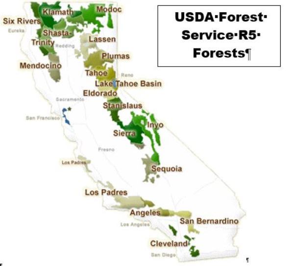
Fire Management
The workload of Region 5 is heavy and complex. Its fire management program is well known, with approximately 50% of the U.S. Forest Service budget for fire management being spent in the region. The total budget for wildland fire management by all fire agencies in California is more than the rest of the United States combined. Southern California has the most wildland-urban interface land area of any locality in the U.S. and California has more wildland-urban interface than any other state. The interrelationship and juxtaposition of direct protection areas for the federal, state, county and municipal fire agencies is exceedingly complex in California, not because of land ownership patterns alone, but because of the presence of some of the most volatile vegetation in the world. National Forests contain 6 million of the total 9 million acres of highly volatile brushland in California. It is found mainly in the foothill country where urban expansion is increasing and many developments lack adequate protection against wildfire. Large areas of the state are covered with heavy chaparral, which includes drought resistant, evergreen bush species that contain an oil like sap that is explosive. It is prone to "area ignition," where large areas of fuel ignite like a pool of gasoline. The climate is a huge factor and the lower elevations of California are characterized as a "Mediterranean Climate," with relatively mild winters with hot, dry and long summers.
Forest conditions, especially in southern California and the Sierra Nevada, are of particular concern in Region 5. Dense and overgrown areas combined with the influx of people into California’s wildlands have created the potential for disastrous wildfires. Emphasis is being placed on actively managing forests by reducing dangerous accumulations of hazardous fuels to protect people, watersheds, and habitat
California is the most populous U.S state, estimated to be 38 million people in 2014. More money is spent on tourism in California than any other state. Public land recreation use is very heavy, the most for any state in the western U.S. The state has the most human caused fires of any in the country, averaging close to 7,400 per year. The state has the most homes, over 3.8 million, in wildland-urban interface areas than any other state. From the standpoint of property damage the most destructive fire in U.S. history occurred in California in 1991. The Oakland Hills fire only burned 1,520 acres, but destroyed 3,354 single-family dwellings and 437 apartment and condominium buildings. Casualties included 25 fatalities and 150 injuries. The economic loss has been estimated at $1.5 billion (2.5 billion in 2012 dollars). In terms of economic loss, 7 of the top 10 fires in U.S. history have occurred in California. Unfortunately, 31% (330) of the wildland firefighter fatalities (1075) in modern U.S. history (1911 to present) have occurred in California, the most of any state. There are 10 Geographical Area Coordination Centers (GACCs) in the U.S. and the workload in California is great enough that two of them exist in the state, Operations Northern California and Operations Southern California.
Recreation
Fire management is not alone in the region's heavy workload. The other functions of the agency face heavy pressure as well. California is the nation's most populous state and outdoor, public land based, recreation is heavy. Of the Forest Service's 9 regions, 25% of the recreation on National Forest land in the U.S. occurs in R5. National Forests are the home to about half of the public wildland recreation in the state. National Parks and other federal, state, county and private lands provide the remainder. This volume of visitor use necessitates a large law enforcement program, with more Forest Service law enforcement officers per National Forest than any region. In addition to fire management, recreation and law enforcement, National Forests manage timber, grazing, watershed (protection and use), wildlife (includes fisheries), soils, roads and trails, facilities (ranger stations, fire stations, lookouts and communication sites), minerals (exploration and extraction) as well as land use (exchanges, purchases and special uses). The workload and complexity of managing these varies by National Forest due to differences in location, topography, vegetation, precipitation, proximity to urban areas, etc. In California management of watersheds, roads and trails, facilities and land use management have the highest or close to the highest workload of any Forest Service region.
Watershed
Watershed management on National Forest land is extraordinarily important to the economy of the state and to food supply in the U.S. and abroad. California produces more than 400 crops. Of those, the following are commercially produced only in California: almonds, artichokes, dates, figs, raisins, kiwifruit, olives, clingstone peaches, pistachios, dried plums, pomegranates, sweet rice, ladino clover seed, and walnuts. California grows nearly half of the nation’s fruits, vegetables and nuts. California is the nation’s top agricultural state and has been for more than 50 years. Agriculture
generates approximately $37.5 billion a year, more than any other state. Surface water run-off in California averages 71 million acre-feet per year. Annual water use is about 37 million acre-feet, of which 80 percent is used to irrigate crops. National forests supply 50 percent of the water in California, include the watersheds of most major aqueducts and more than 2,400 of the reservoirs throughout the state. Managing watershed to insure high quality water is a major focus of the U.S. Forest Service and saves billions of dollars in potential construction and maintenance costs for water treatment plants. Contributing half of the water for agricultural production in California is a major benefit of watershed management on National Forest land.
Other Resource Management Programs
Special Uses: the large population and National Forests in proximity of urban areas creates a heavy demand for a variety of uses of these federal lands. These are the uses that don't fit into the major uses of National Forest land, those being timber, range, watershed, recreation and wildlife. Often these diverse needs require specific approval. Special uses are diverse and are too numerous to list here. Examples are water storage, water transmission, powerlines, outfitting and guiding, recreation; special events such as foot and bicycle races, large gatherings of people such as weddings, social gatherings or reunions, religious groups, or large youth encampments, such as Boy and Girl Scouts; organizational camps, ski areas, telecommunications (including electronic sites), research including permanent facilities such as the Barcroft Lab in the White Mountains on the Inyo National Forest, photography, video productions, the filming of major movies, gathering forest products such as mistletoe and pine cones (large quantities not for personal use) and granting road and utility rights-of-ways.
Lands & Real Estate: with the high demand for recreation, existence of some special areas in private ownership within National Forest boundaries and other resources on National Forest land, the region has a very active lands & real estate program. This program is tasked with the following: purchasing land to protect critical resource areas and provide increased public recreation opportunities, exchanging and conveying lands to achieve a desired national forest landownership pattern that supports forest land and resource goals and objectives, conveying administrative sites to allow the agency to realign and enhance its asset portfolio, surveying national forest boundaries to identify and protect private and public lands, determining the market value of lands purchased, exchanged, or conveyed, accepting donations of land to protect archeological or historical sites; maintaining records of national forest land areas, land transactions, land status, permitted uses, and easements; and securing public road and trail access to existing national forest system lands.
Wildlife & Plants: more than 600 of the 800 species of fish and wildlife in California inhabit the national forests, making the Forest Service the single largest habitat manager in the state. National forests are also home to nearly 4,000 of the 6,500 native plants in California. National Forest land comprises the bulk of wildlife habitat in many states, especially for large mammals and threatened and endangered species. A high population has led to the loss of habitat in much of the state, putting additional pressure on the habitat of public land. The California Department of Fish and Wildlife has jurisdiction of the animal and the hunting or fishing of it. The U.S. Forest Service has jurisdiction of the habitat or homes of the animal. This requires close cooperation between these agencies.
Range: the United States has about 770 million acres of rangelands. Private individuals own more than half of the Nation's rangelands. The federal government manages 43 percent of the rangelands. State and local governments manage the remainder. The Forest Service administers approximately 193 million acres of National Forest Systems lands. About half of this acreage, 96 million acres, is rangelands. The Forest Service has undergone many changes in its management of rangelands. In the early 1800s, free forage on unclaimed public domain lands allowed the building of cattle and sheep empires. The ranges soon became over-grazed, overstocked, and overcrowded. Congress stepped in the early 1900s and designated the Forest Service as the pioneer grazing control agency. By 1906 to 1907, the Forest Service had established its system of range regulation. This includes permits, limits on herd size, grazing seasons, allotments, and rental fees. Heavy recreation use results in conflicts between grazing permittees and visitors, an issue that is not as prominent in other regions.
Forest (AKA vegetation or timber) Management: the overriding objective of the Forest Service's forest management program is to ensure that the National Forests are managed in an ecologically sustainable manner. The National Forests were originally envisioned as working forests with multiple objectives: to improve and protect the forest, to secure favorable watershed conditions, and to furnish a continuous supply of timber for the use of citizens of the United States. Forest management objectives have since expanded and evolved to include ecological restoration and protection, research and product development, fire hazard reduction, and the maintenance of healthy forests. Guided by law, regulation, and agency policy, Forest Service forest managers use timber sales, as well as other vegetation management techniques such as prescribed fire, to achieve these objectives. These activities have captured substantial public attention, and in some cases, become hotly debated issues. There is a great deal of pressure on this management function as recreation, wildlife, open space and scenic resources are especially valuable in California.
RADIO SYSTEMS
This complexity, size and pressure on all the management functions on the National Forests in Region 5 have resulted in complex radio systems. Each National Forest has a "forest net" and an "administrative net," both utilizing repeaters. The forest net is usually the main communication channel for a National Forest, although on some forests fire and law enforcement use forest net and all other functions use the admin net. Some forests have a separate "fire net." Most forests have a "service net," which is used for communications between the incident command post and forest dispatcher with most of that being logistical in nature. Cell phones have replaced this net where coverage is available, but service net is still used in cell phone dead zones. The service nets are also available as a command for initial attack of large incidents or for portions of National Forests during multiple fire starts on a forest. Two National Forests, the Klamath and Shasta-Trinity, have management unit or ranger district nets. Some forests link repeaters and remote bases with UHF radio (406-420 MHz) only or microwave only and some use a combination of both. Region 5, like most regions, has a dedicated project net (168.6625 MHz), which is one simplex channel for the entire region. This frequency can be used for both fire and non-fire day to day uses.
The region is gradually building a statewide law enforcement net with all repeaters using the same frequency. Many repeaters are to be shifted to digital use only in 2022-2023. The eventual buildout will include digital operation with full time encryption. The Region is considering building a 24 hour, statewide coverage area, full time law enforcement dispatch center with all repeaters connected to this center. This would relieve the local dispatch centers of all law enforcement dispatching and would comply with the California Dept. of Justice mandate to remove all radio traffic with Personal Identifying Information (PII) from public access via scanners. Many forests lack even one law enforcement net repeater, some have several, but no forest has as much law enforcement net coverage as forest and admin nets. Due to dismal budget forecasts this network will continue to grow very slowly. Details about this net are not discussed anywhere on these U.S. Forest Service Region 5 wiki pages.
FREQUENCY USE
The region has been assigned 3 unique tactical frequencies. These have been used as supplements on extended attack and large, national incidents since they were assigned to the region and NIFC Tacs 1-3, especially Tac 2, have been used for initial attack for as long they have existed. The federal wildland fire and land management agencies (National Park Service, U.S. Forest Service, Bureau of Land Management and the U.S. Fish and Wildlife Service) are beginning to phase out the use of the NIFC tacticals for initial attack. Region 5 does not appear to have started this effort yet. The BLM and U.S. Forest Service are getting frequency allocations so that each Forest Service region and each BLM State Office have a least three unique tactical frequencies in addition to the 6 NIFC tacticals. The future use of the NIFC frequencies will be reserved for use on "National Fires" only. These are fires where a national Type I or Type II incident management team is in command. Less complex and smaller incidents are managed by Type III, IV, and V command organizations and use locally available communications systems. Type III teams can request use of NIFC frequencies and equipment if needed. In Region 5 the complexity and number of simultaneously occurring large incidents in proximity to each other creates a high potential of interference on tactical frequencies. The 6 NIFC and 3 regional tacticals are sometimes insufficient to provide clear and effective communications for all incidents. Unlike other regions that now have regional tactical frequencies, the predominate use of R5's tacticals has been to supplement the NIFC system on large incidents. With the advent of high channel capacity radios in the last 10-15 years a few forests now use them as additional tacticals, but the demand for these continues to be for large "national incidents." At some point in the future additional tactical frequency assignments may be in the picture for R5.
NIFC has a goal to provide 2 air to ground frequencies for each of the 105 interagency dispatch centers in the country and in the west has met this goal everywhere except California. California has been assigned 7 air to ground frequencies to provide 2 for each of 4 zones configured from north to south. Each of these zones contain several federal interagency dispatch centers. These frequencies are for use by all of the federal land management agencies in those zones. These 7 frequencies have been assigned from the list of 73 national air to ground frequencies.
For air to air tactics Region 5 is the only region using FM frequencies in the two GACC's covering the state. All other Geographical Area Coordination Centers use VHF-AM "Victor" frequencies for this function. In California each National Forest has been assigned 2 unique air-air FM tactics frequencies. These frequencies can be used by the National Park Service, Bureau of Land Management and U.S. Fish and Wildlife Service as well.
Intra-crew communications in the Pacific Southwest Region take place on the region's project net or on one of the 4 frequencies on the National Intra-crew Communications Plan. The Primary, Secondary and Tertiary crew net frequencies are restricted to use at incident scenes and National Crew net can be used on the crews home unit and while traveling. Intra-crew communications must be logistical and not tactical in nature. The 6 NIFC and 3 regional tactical frequencies may not be used for intra-crew communications. The State of California's Emergency Service Radio System (CESRS) frequency of 153.7550 (simplex) has been designated as the travel net.
STANDARD TONES
The Region uses standard tones shared among all natural resource agencies in the state. This interagency effort resulted in all tone selection switches on all radios having the same number and frequency statewide. This is but one example of the efforts to standardize as much as possible through the FIRESCOPE (FIre RESources in California Organized for Potential Emergencies) program. These 16 tones has been accepted by the National Interagency Fire Center for nationwide use. Gradually all the federal agencies and some states, especially in the west, are adopting these as standards. In that way everybody's tone 1 will be 110.9 (analog) and 455 (digital), everyone's tone 9 is 100.0 (analog) and 3E8 (digital) and so on. Disparate tones between agencies was cited as one issue of many in the Granite Mountain Hotshot burn over that resulted in 19 fatalities.
      CTCSS      NAC
1     110.9      455
2     123.0      4CE
3     131.8      526
4     136.5      555
5     146.2      5B6
6     156.7      61F
7     167.9      68F
8     103.5      40B
9     100.0      3E8
10    107.2      430
11    114.8      47C
12    127.3      4F9
13    141.3      585
14    151.4      5EA
15    162.2      656
16    192.8      788
RADIO OPERATION
The brand of handheld radio used the most by the U.S. Forest Service (and most wildland fire agencies as well) is Bendix King. The model of BK radios most commonly used have a capacity of 16 groups of 16 channels each. "Command" models with greater capacity are available as well. These radios allow the user to select a CTCSS tone independently for each channel by selecting a number on the radio's keypad. In Region 5, for the purposes of brevity and efficient use of repeater nets the name of the repeater is not voiced, rather the CTCSS tone number is announced (e.g., "Tone 9" instead of "Pine Mountain"). Cal Fire uses the same procedure. Other federal agencies in the state and other areas of the country use the name of the repeater in most cases, although the announcement of the tone only is beginning to catch on in other areas.
UNIT IDENTIFIERS (aka "Call Signs")
Unit identifiers in R5 use two systems, the function name, district number, position number, system (e.g "Recreation 21" and "Wildlife 32"); and the district number, function number and position number - system (e.g. "261" and "631"). Function numbers vary from forest to forest. A directive was issued for all forests to use the first system, but some forests did not follow this direction and are using the second system. Fire management on all National Forests use the first system with Chief, Division, Battalion, Superintendent, Captain, Engineer, Fuels, Engine, Patrol, Water Tender (large water trucks) Prevention, Dozer, Crew, Boat (patrol boat), Lead (plane - 5 plus pilot number), Air Attack (plus National Forest number), Recon (air patrol plane - each forest issued a series of numbers), Tanker (aircraft that dump retardant), Jumper (5 plus number assigned to aircraft) and Helicopter (500 series numbered north to south). Dispatch centers identify by the National Forest name (e.g. "Plumas") when the center is not co-located with Cal Fire, with the exception of the Sierra National Forest. Those co-located with Cal Fire identify with the city the center is located in (e.g. "Redding"). Call signs are the FCC license format (even though the federal government is not issued licenses by the FCC), example: "KMB670" for the Inyo National Forest communications center.
RADIO PROCEDURES
All functions use "clear text" and not the 10 codes ("10-4") except law enforcement officers who use the ten code, eleven code and the California Penal and Vehicle codes. This allows them to interface with state/local officers.
U.S. Forest Service voice procedure is to pronounce the unit being called first, followed by the unit that is calling. The net name or channel is then given and finally the repeater tone being used if applicable. The unit called will then answer the call with its identifier only. When the conversation ends each unit signs off with their unit identifier. Example: "Wildlife 2, Recreation 21 (usually abbreviated as Rec 21), North, Tone 3" - "Wildlife 2" - "be advised I heard a spotted owl call near Inyo Craters last night" - "Copy, I will send Wildlife 23 and 24 there tonight" - "Rec 21", "Wildlife 2." The channel is not considered clear for someone else to use until both units clear by announcing their unit identifier. Dispatcher centers will announce the time and use the assigned call sign to clear, example "1536, KMB 6-6-0."
This background information should allow the reader to understand the systems of each National Forest as listed below.
Related Links
- National Incident Radio Support Cache - These frequencies are used for large incidents, usually when a Type I or Type II Incident Management Team is assigned. This cache is used for fires, floods, tornadoes, hurricanes, visits of high ranking officials, such the U.S. President and the presidents of other countries, large law enforcement incidents, special events and other incidents where the federal government is utilizing the Incident Command System.
Return to DB page: United States Forest Service (CA)
